Adventuring around Washington with a bit of real life.
Journal
Adventuring around Washington with a bit of real life.
Atlantic to the Pacific with stops to visit friends, pick up some goods in Colorado, skiing July and rounding out our lower 48 mission.
Just going for a trail run with some wild horses...you know. Then some great family time in New Jersey.
Heading into the mountains within the Southeast. Cooler air, waterfalls and some good old East Coast downpours.
We head along the coast of Georgia and Florida, then point north to Asheville.
Ending up back on the East Coast for some wedding fun and then down the spine of the Appalachians.
Switching out to #carlife and visiting some great friends in Iowa. We detoured slightly north to check off a few states with a stop in Madison, WI and eventually ending up along the shores of Lake Erie.
The sun continued to shine across Wyoming and into Colorado where we switched out some gear before heading east. The largest change was dropping off Hobbes to give him a rest as we head into the heat of the Plains and East Coast.
Idaho continues to impress with stops in Sun Valley for some hiking, Craters of the Moon for some volcanic scenery and the western flanks of the Teton range.
We head into Eastern Washington, the dry side, after a hike of Mount Si in North Bend. Exploration through rivers, waterfalls and fields of flowers.
5/11-17/17
Current location: Kozy Campground, Jackson Wyoming
We pulled into Mary and Dick’s driveway outside of Portland under bright sunny skies, their fifth day in a row without rain, which hadn’t happened since the beginning of January. Soon after arriving, we went on a walk around the neighborhood and through two parks. The Willamete River was high and running strong, a common thread with all of the rivers we’ve seen in Oregon, after a very rainy winter. Wednesday afternoon was spent catching up with some stories of recent travels. After dinner Aunt Mary and I attended the neighborhood book club, where we drank wine and chatted about books, while Uncle Dick and Eric drank beer and chatted about life’s adventures.

Thursday we headed into Portland in time for the guided tour around the Chinese Garden. I’ve visited a few Chinese Gardens before, but never with a guide. It was very interesting to learn about what it was that I was looking at and gained a greater appreciation of everything from the architecture, to the plants and masonry through out. After tea at the Gardens, we wandered around some of the stores in Portland before going back home.


Friday was wine country day. After taking Rooney for a quick run around the neighborhood, Mary and Dick brought us to Sokol Blasser, their go-to vineyard, for wine tasting. The rains of the past day and a half were intermittent and held off enough for us to have some views from the tasting room. Dinner Friday was a family event, with Kathy, Kendrick and Ben joining us.

It was great to see everyone and we look forward to being on the left coast with family nearby in Seattle and Portland. Our days were filled with stories of adventures, family, laughter and tons of recommendations for Washington and the Pacific Northwest.
After catching up with a friend over lunch in Portland, we decided to take one of our new recommendations and headed to the Columbia River Gorge. We passed several tall waterfalls, stopping at a few to take pictures. Camp was in the hills above the river and the train tracks.


In the morning, we continued along the gorge, stopping at the Bonneville Dam. We wandered through the visitor center and down into the bottom floor where the fish counting takes place. All dams along the Columbia River have fish ladders so the fish can return and swim upstream, around the dam. We saw a few large fish, however we were unsure what kind they were. The fish counters not only count the fish passing through the ladder, they determine what species and what sex they are as they pass the window in a matter of seconds. The view of the fish ladder from above looks like a maze for the fish. Each twist and turn in the ladder allows for the correct amount of water flow so the fish can make it upstream without too much difficulty. We stopped for a lunch beer at Thunder Island Brewing before crossing the Bridge of the Gods into Washington, our 40th state of the trip!


Seals playing/eating in the dam outlet


We have been hosted by some great family and friends and this continued in Seattle. We arrived at the Hudgins’ just after 7. Wren and Leigh are our good friend Alex’s parents, and were also our landlords for the past 6 years while we lived in the house in Golden. Their house would be our home base while we explored the Seattle area over the next few days. We broke up the greater Seattle area into 3 sections: east, west and north, to try and scope out areas we would be interested in moving to at the end of July. Don’t worry, our stay wasn’t filled with all work and no play. We got out for a run in the rain on Cougar Mountain and we were able to meet up with some friends for dinner on our last night in town.


We had a great time catching up with everyone we got to visit while in the Pac Northwest.We look forward to doing more together when we’re there in a few months!
5/7-10/17
Current Location: Snake River at Little Goose Dam, WA
Sunday morning we packed up our RV life of electrical cords and laundry detergent and headed southwest across the bottom of Oregon and briefly into California. We made a stop at a visitor center for Redwoods National Park but decided we’d continue our plan to get to the coast and head north. We met up with the famous Highway 101 who would be our close friend for the next few days. We quickly crossed back into Oregon and met up with the Pacific Ocean and its coastal sea stacks, crashing waves and fresh air. As we had mentioned previously, Oregon has this great habit of providing a brewery right in the middle of the afternoon when we say “huh, I wonder if there is a brewery in this little town.” In this case we were in Brookings and said brewery was literally right next to us at a stop light. We stopped in for a quick sample and chatted with the friendly locals who loved the van and Rooney, the latter of which was happy to lay on the floor of the bar and be petted by every patron and employee.
A short way up the road was Harris Beach State Park where we picked out an empty campsite on the bluffs above the coast. Oregon, we will learn, as a great state park system and all along the 101 there are dozens of small parks, some for a particularly gorgeous part of the coast line and many with small campgrounds. We quickly made our way down one of the numerous trails from the campground down onto the dark sand, rocks and driftwood beach. The tide was out so we explored around for an hour or so before heading back up to the van and dinner. Given that we are now in mid-May and directly on the west coast, the sun sets pretty darn late so we made our way back to the beach for sunset, including a nice rum & fruit drink perched on a large rock as the tide creeped closer and closer as the sun sank lower and lower. The timing was perfect and we hopped off the rock just as the first few waves started to surround it for the rest of the night.


The campground was pretty large but the section we stayed in was full of tall trees and it was well divided between sites. We were surprised by the number of people because it was a weeknight but this was a theme on the 101 as the tourism here was more constant than the weekend warriors we had seen elsewhere. The night was quiet with the dull roar of the waves in the background.

We were really excited that our planned route up the Oregon coast on the 101 was designed to be slow with no significant driving on any given day. This allowed us to stop and numerous pull offs and take in the coast line. The next morning we did just that. We pulled the roof down and started our drive north and no more than 30 minutes did we come across a lengthy part of the road hugging right along the beaches and cliffs of the ocean. At a big pull out we pulled over to take in the view. We both decided we were pretty hungry so we decided to make sausage and egg breakfast sandwiches. Nothing like spending an hour and a half break after half an hour of driving.


Back and the road we meandered in the best sense of the word up the coast. Most of the 101 in Oregon hugs pretty closely to the ocean and the views come in and out as you climb up a small hill behind a point sticking out into the ocean and drop back down with lengthy views of beach or rocky outcroppings. We eventually pulled into Coos Bay in early afternoon. We were intent on finding a fish market to change up our dinner routine. We waited for a train to make its way through town and crossed the tracks directly onto the docks of Coos Bay where a tiny floating market/fish and chips shop was located. We couldn’t turn down some fresh fried fish so we split an order and got some Pacific Cod to go.

We stopped at the ranger station for the Oregon Dunes National Recreation area to pick their brain about campgrounds in the area. We settled on a spot away from some of the off highway vehicle areas (buggies and atv’s) that was not too far away. We found a campground that was only about 1/4 full and only about 1/2 mile from the beach. While I started our fish soup Lara did a nice workout at our campsite. We made our fish soup with whatever random items we had in the van and it turned out delicious. The key factor was the small left over pizza sauce that gave the broth some great flavor. Pound of fish, couple of sausages and boom, fish soup.


Just before sunset we walked the road down to the beach, walking by the namesake dunes that extended for dozens of miles in a north-south orientation all along the coast. Some of the dunes are hundreds of feet and a mix of grasses and pristine sand. Given the weeknight and pretty quiet campgrounds we had a massive expanse of beach to ourselves to watch the sunset, let Rooney romp through the waves and frolic. We never saw a single other soul on our walk to, up/down and back from the beach, which was a couple hours at least. Rooney spent his time being confused by the protected Snowy Plovers, small dune-dwelling birds that fly in large packs low to the wave level, just off shore. As we played and walked through the edges of the surf they’d swoop towards us in a full group, sometimes splitting in half as a few dozen full-speed birds cut on both sides of the three of us. Sunset did not disappoint either. We were treated to another quiet night with the far-off white noise of the ocean doing its thing while the rest of us slept.


Again without any major travel the next day we got a relaxed start and headed back out to the 101. Our first stop was at the Heceta Head Lighthouse, one of only a few operating lighthouses left along the Oregon coast. A group of volunteers gave short tours of the lighthouse at the top of the 1/2 mile walk from the beach to the cliffs where the lighthouse and the old home still stood that housed the light keepers and their families. We heard about how the building of the lighthouse itself and, originally, two homes was all done through shipments from the sea as there was no access at that point along the coast. The lens was particularly interesting with hundreds of perfectly designed and installed glass all mean to reflect and enhance the light. A great roadside stop. Plus a nice place to pop the roof for an hour to make lunch next to the driftwood and stone beach.


Another excellent stop on this day was Thor’s Well, a spot of particular rugged coastline with small inlets breaking up the rocky and jagged rock. In one spot there is a blowhole that shoots water and spray dozens of feet into the air with the right swell and tide. Thankfully it was cranking away while we were there and we stared intently at the incoming waves as they crashed over the edge of the coast.


Onward, we continued up along the 101 and at one point crossing a major inlet on one of the dozen or so major bridges looked down to see Rogue Brewery, a nationally known brewery that we kind of forgot was along the Oregon Coast. About face. We stopped in for a quick sample and continued north to our destination of Cape Lookout State Park. The length of the days have really helped out and only having about 3 hours total to drive each day meant we could take a leisurely morning pace, make some planned and unexpected stops, show up at a campground to pick out a side in mid afternoon and partake in the local coastal/beach sunset options.
On this day we showed up, picked out a campsite only 100 yards or so from the beach and grabbed a backpack to go for a wander over the dune and rocks onto the expanse of a low tide beach. Once we got there we decided maybe a run was in order. The sand was perfectly packed and the tide exposed 100-200 yards of expansive beach that very few people explored beyond a quarter mile or so from the campground.
We laced up and headed north which turned out was a spit of land about 6 miles or so long, which meant there was no other access to the north. After only a mile or so we were completely isolated with the sea birds, a pair of bald eagles watching us from the trees along the dunes and just miles of packed glistening sand. The run was probably a top-10 run of my life, with reflective wet sand after a wave receded, low tide exposing short sections of well tumbled rocks, bald eagles and an absolutely gorgeous sunset. I’ll let pictures do much of the talking here.


Can you spot the two bald eagles?


Before bed we stretched on the beach, snacked on some dinner and sat on the dunes watching the full moon glide in and out of the clouds that were building. We went to bed with an even closer roar of the waves in our ears. Those clouds meant the end of our stretch of perfect weather but we were ready to head inland to visit with some family and explore a bit of Portland.


5/4-5/6/17
Current Location: Kozy Campground Jackson, Wyoming

Rooney could get used to getting gas in Oregon because the attendants all have treats!

We pointed ourselves slightly north to take the scenic route to Eugene and allowed ourselves to see some of the many waterfalls Oregon has to offer. Sahalie Falls cascaded crystal clear water into the river below that was struggling to keep the high waters in its banks. The three of us walked along the river for about a half mile or so stopping to appreciate the power of the water along the way. The temperature near the falls and the river was a good 5-10 degrees cooler than up at the parking lot. We all enjoyed the cooler air, and quickly noticed how much warmer it was as we climbed back to the van, swatting the newly hatched bugs from entering the van and joining our road trip.


Our plan to camp at Silver Falls State Park was put on hold when we drove around Detroit Lake and decided to stay and camp there. After stopping in the National Forest ranger station to try and pry information out of the ranger that only the locals are privy to, we were able to find a spot that overlooked Detroit Lake. Free and with a great view, not too bad! The lake was at full capacity, with water level touching the boughs of the pines lining the lake. We sat and watched boats, fishermen and the birds, including some resident osprey who’s nest was almost directly above us, for what was probably hours. As the sun set, clouds were building and it looked as though the threat of storms was going to become reality. Lightning lit the sky over the ridge lines and we watched the weather radar to see the trajectory of the cells moving towards us. This was our first thunderstorm of the trip and we were excited to watch it weathering around us. Rooney however, curled between us on the bed with his back turned to the windows. We fell asleep to the sound of big rain drops hitting the roof and thunder rolling off in the distance.


The drive to Silver Falls took us over mountain passes still covered in snow, through the back roads between rolling tree farms and in and out of rain showers. The rain was falling steadily as we pulled into the parking lot, so we donned our full rain gear and headed out along the Trail of 10 Falls. The park was built by the CCC, like many of our great state parks and staples of any good road trip throughout the country. We admired the craftsmanship of the buildings, as well as the trail construction as we wound our way down and behind the first of the falls.


We had flashbacks to Iceland a few years ago and our first experience walking behind waterfalls. After the second waterfall, we decided to turn around and save the rest of the loop for another day since we were soaked through and starting to get cold. Back at the van and changed into dry, warm clothes, we headed to a campground outside Eugene which was a couple hours south as the weather improved.


We quickly took showers and then drove into Eugene to Hayward Field to watch the Oregon Twilight Track Meet. This meet is special in that it has races for area middle and high schools, masters, college and professional runners. We were as excited to be there, in the historic stands of Hayward Field watching a meet, as we’d be to see the biggest concert of the year, actually, more so. As we were walking in, we kind of laughed and admitted to each other we were both quoting lines in our head from the movie Without Limits and the book Once a Runner on the drive. It brought back the “running feel” for both of us. We watched a few middle school races from the stands, and then headed down along the start line as the televised races were about to start. It was cool to see some current Olympians and Oregon alumni post some impressive times for early season. After the meet, we drove the 10 minutes up the hill to Pre’s Rock, the memorial site where Steve Prefontaine was killed in a car accident.


We woke up Saturday morning to the sound of crew teams out on the lake across from our campsite. The morning was spent doing much needed chores; laundry and giving Hobbes a good cleaning. The cool foggy morning gave way to warm sunshine as we ran up Mount Pisgah, what we fondly equated to Green Mountain in Golden. Once we were off the main trail, we had the place to ourselves for a bit. The uphills put a good burn in the legs and the downhills were just plain old fun. Sufficiently tired and hungry, we decided to check out some of the breweries Eugene has to offer. We found a neighborhood that had a few and decided to put together our own little brewery crawl for the afternoon. It felt good to sit in the sunshine and enjoy our beers. We checked the forecast and were excited for some sunshine along the famous Highway 101.


Current location: Little Goose Dam, Snake River, eastern Washington
So we awoke from a quiet night in the woods and had not heard a single vehicle all evening, night or morning. The plan was to head up to Mt. Bachelor for a half day of skiing (they only open for a half day because it gets so warm in the afternoon the snow is kinda crap). All loaded up and…nada. Crank, crank, crank… Hobbes had decided he was not going to start this day. There was plenty of battery and cranking just no firing. After at least a couple dozen tries we decided we’d run the generator for the engine block heater for a while in case it was just too cold, which we quickly realized was definitely not the problem as it only got down to about 45 that night.

We eventually gave in and called AAA, which we realized later our account was about to expire the next day (it’s renewed, don’t you worry!). We waited about an hour and a half and thankfully we were only about 1/2 mile down a very easy dirt road and about 200 yards off that road. The driver didn’t mind at all backing into our forested site and a short while later we were at the Ford dealership in Bend. The service department was pretty swamped and short staffed, as every mechanic in the entire United States says, so they got all our information, chatted for a while about the previous van issues and the Bend area. They helped us gather our things and gave us a ride over to a hotel in town, including Rooney, a fridge’s worth of food, electronics and our clothes. Again, hotel points came in handy.
We always knew that Bend was great for outdoor activities and breweries but we quickly realized how lucky we were to be there while work was being done on the van. There were about 10 breweries within walking distance of the hotel and on Saturday afternoon after a stressful morning we went across the street from the hotel (literally 100 yards) to a brewery. Otherwise we relaxed the rest of the day and partook in things like shower and internet.

Sunday, we awoke and went for a run along the Deschutes River directly below the hotel. It was nice to get some exercise and the weather was perfect for a run along the trails on the edge of the river that cuts right through Bend. With Rooney pretty tired we cleaned up and got to the Deschutes Brewery in time for their last tour of the afternoon. We then crossed the river with plans to go to Crux Fermentation Project but, as will become a theme with Oregon, we stumbled upon a brewery that just happened to be directly where we were. Immersion brewing, then we got to Crux for a beer in their yard/beer garden as the sun started to set beyond Mt. Bachelor and the Three Sisters to the west. On our mile walk back to the hotel we, again, discovered Craft Brewery all of 1/4 mile from Crux and Immersion. Why not stop and grab a bite to eat too!


Monday we knew we’d have to wait and see what the diagnosis of the van was. We still weren’t “on the schedule” but they said they would try to fit us in between other appointments. We took the morning to walk along the river all the way into downtown Bend for lunch. We spent some time internet’ing and updating the blog and videos. The afternoon was spent walking in a slightly different direction to Good Life and 10 Barrel Brewing before a stop for fish tacos and an early evening. We did hear that the van had a camshaft sensor issue and the part would arrive and be installed Tuesday. So, thankfully not some major issue and wouldn’t cause to tell the story of how we broke down in Bend and 40 years later never left (although that was tempting).
Tuesday we got a run in along the river in the morning and went through the logistic exercise of picking up and reloading the van in the afternoon. We still had some other parts of Bend to see so we set up camp in the national forest about 20 minutes outside of town. We fell asleep to what we had now figured out was a completely normal thing in the woods of Oregon: pine cones firing off of trees at great heights, bouncing their way through branches on the way down. For a couple days we had no idea what we were hearing but finally figured it out and were amazed at the frequency of this occurrence. Only one actually hit the roof of the van, which is good because it scared the crap out of me when it did.


The next day we finally got up to Mt. Bachelor. We arrived before first chair under bright, warm sunshine without a cloud in the sky. Mt. Bachelor is a volcano and has the distinct cone shape with ski runs circling the mountain. This late in the season some areas of the mountain were closed but we quickly took lifts to the “summit” and enjoyed the views in all directions of other volcanoes of the Cascades and the land a few thousand feet below us. Off the top the snow was already soupy at about 8:30am. We picked our way through parts of the mountain to both explore but try to follow the coolest snow. Eventually the direct north facing slopes were too wet to even make forward motion so we circled around to the northwest side where we found great snow. Given this was early May and Wednesday, it was little surprise we felt like we were nearly the only people on the mountain. We lapped the NW side of the mountain until about 12 and then called it a day as the lifts closed at 1:30pm anyway. We hung out in the parking lot having lunch and enjoying the sunshine for a while, chatting with other skiers and a couple van people. We made a stop back to Crux for a beer in the afternoon before settling into another site in the national forest outside out town, while Rooney stared intently out at the trees wondering why things kept falling from them.


That evening we realized there was a group of trails directly next to our spot in the woods and on Thursday morning we got up and went on a nice 5 mile run along perfectly flowing single track over cushy pine needles. We loaded up, ready to move on, all while still nervously watching every gauge, listening to every sound and holding our breath on every start of the van. We did have one other issue taken care of before we left but thankfully this was just removing a broken key out of the roof box lock and getting a new one made. In and out, finally!


I just realized my recollection of our time in Bend seems very sterile, very factual. And in fact, that’s probably how we felt about some of it because of dealing with yet another van issue. However, the benefit we had this time was that Bend is a very easy place to spend a few days. We really did enjoy the town, the surrounding activities and the breweries. The river cutting through is beautiful and the people were extremely accommodating and willing to share some secrets of the town with us. The good thing is that we know we will be back to Bend for long weekend trips from the Seattle area and it will be nice to have some familiarity then.
4/26-28/17
Current location: Hudgins residence Issaquah, Washington

The drive out of Lake Tahoe north to Lava Beds National Monument took us back onto less-traveled highways. Our quick detour into Reno via highway 580 meant 2 things, a. we could get gas that was a lot less expensive than in California and b. we got to go through the California agricultural inspection again. We scoped out camp spots as we approached Lava Beds was we drove through the Modoc National Forest.


The campground was fine in the park, but we decided we’d rather not spend the money if we didn’t need to. A quick stop into the visitor center to get our cave permit and a debriefing about white-nose syndrome that is killing bats, and we headed back out to set up camp. We watched the rain come and go for a few hours, clearing enough for a colorful sunset. In the morning we headed into the national monument, donned our bike helmets and headlamps, and climbed down into the lava tubes to explore. Our first stop was into Mushpot, a lit informational lava tube/cave so we could orient ourselves with the formations we’d see through out the park. Golden dome was our second cave. We climbed down a steep ladder, ducking below ‘headache rock’ to enter into the darkness. Darkness quickly set in as we walked about 5 feet from the ladder. Our headlamps lit the walls and ceiling around us, illuminating the shimmering bacteria and water droplets. As we became more comfortable in the darkness, we turned off our lights, only illuminating the ceiling with the flash of the camera, trying to capture the beauty around us.


Our third cave was into Skull Cave, named for the bones of bighorn sheep and antelope that had died in the cave. This cave was the result of 2 layers of lava tube collapsing, becoming 1 very tall cave. The short hike in and down stairs reveals an ice floor that has been forming over the centuries. We rounded out our stay at Lava Beds with a hike up Schonchin Butte to the fire lookout tower. From the top, it was easy to see the different formations created by the volcanic activity in the area; lava tubes, lava flows, cinder cones. With each cave we visit, we are continually impressed with how different each are from one another. Each are interesting and beautiful in their own way.


As we drove through Klamath Falls, we decided to do a quick brewery search. Much to our amusement, we were only a few blocks away, so naturally we had to stop in to sample the local brews. Our campsite research turned up a sweet spot we were excited to check out. Odessa Campground is a free forest service run campground. Tucked in the woods and along a lake, we were happy to officially be in the Pacific Northwest. We watched the sunset from a grassy outcropping along the lake, listening to the several species of birds wish the sun a pleasant evening, while the fish jumped for the bugs taking flight in the fading light.


Without having set plans for the following day, we chatted about what we wanted to do to explore the area. We realized Crater Lake was only a 30 minute ‘detour’ from our greater plan of traveling north.Being that seeing Crater Lake was on our original list of places to see, it was a no brainer of where to explore next. As we started to gain elevation driving into the park, the snow piles quickly grew to over the height of the van. Most roads within the park were under at least 5 feet of snow, and would be quite a while until they were cleared. We parked the van in the designated center lane of the road and gleefully changed into our ski clothes. I’m sure we had some inquisitive looks in our direction as we climbed onto the roof to pull the skis out of the roof box. We climbed the tall snow banks and headed west along the lake, quickly leaving behind other visitors and into the quiet. We had unimpeded views of the lake and the surrounding area under bright blue skies and warm temps. The dark blue waters of the lake contrasted the snow covered slopes of the volcanic caldera. We skinned the edge of the lake for about a mile and a half for some exercise and, on principle, got in about half a dozen turns with a great background. Happy with our outing we changed, had a snack and made our way towards Bend, Oregon. We pulled into Sunriver Brewery for dinner and a beverage before we set up camp in the national forest a few miles away. Camp was among trees marked for logging, but was quiet and along easy dirt roads.


4/24-4/25/17
Current Location: FS Road above Detroit Lake, OR
Monday morning we repacked the van and headed back over the Bay Bridge eastbound and bound for Lake Tahoe. The Sierras had been crushed with snow all winter long, with almost all resorts between 600-700” of snow. This meant plenty of snow to get some late April skiing in. We had hoped to get a day riding lifts but we found out the ski area on our pass, Boreal Mountain, had closed the day before. Oh well, we’ll just nap instead. Which is exactly what we spent Monday doing, errands and a nap. Plus it would give us time to make Rooney his annual birthday hat! Holy crap, he's 7!!

I hate you guys...

Can I just get my treats now?

Yeeessssss! Totally worth it.
As we approached Donner Pass some wet snow flew for a while and Truckee was pretty damp as we ran around checking out the local ski/bike shop and reload on groceries. We pulled into the nearly empty parking lot of Squaw in the middle of the day and much of the resort was closed due to high winds at the upper levels f the mountain. We found a spot in the lot that allows overnight parking and listened to the wind blow and a wet snow intermittently hit the roof for a solid afternoon nap. With the weekend weary slightly averted we went into Tahoe City for a bite to eat and beer near the lake at Tahoe Mountain Brewing. We then retired back to our huge nearly empty lot with only a small handful of other vans and RV’s for the night.

The next morning we took Alex’s advice and found some really great, pretty simple backcountry routes on the west shore of the lake. On our radar was Rubicon Peak. After finding the trailhead through some neighborhood roads that rose above the lake we geared up for the 2,000’ or so of skinning directly to the summit. The lower slopes were well covered and the snow was pretty solid. As the sun came out the snow softened quickly and we even found some recent powder that was quickly turning to mush. The glop monsters arrived after about 45 minutes of direct sun and we applied a healthy amount of wax to our skins while cursing the snow every few minutes. We topped out to views directly down to the dark blue lake. The wind was calm and the sun went in and out of the clouds while we romped around the top. We figured the snow was already pretty soupy so there was no real need to rush.


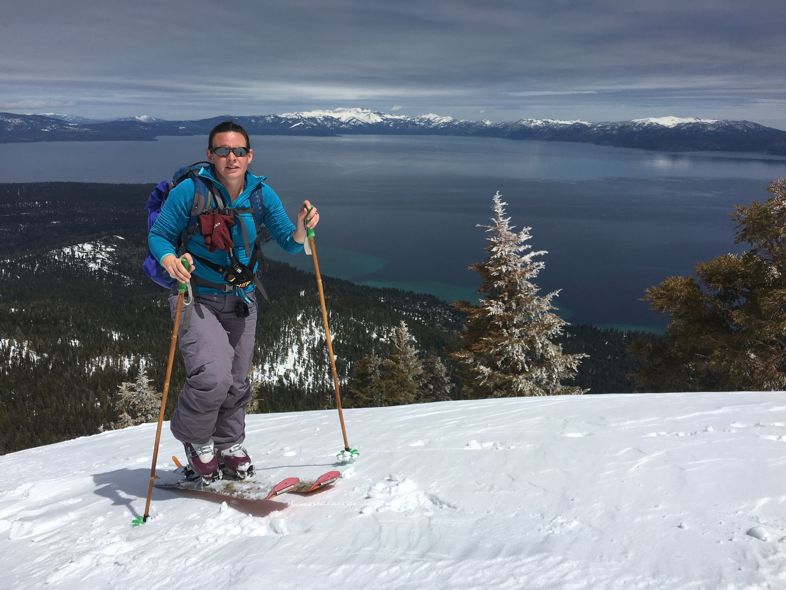


We dropped in off the top to pretty good conditions, heavy but fun. It was great to look across the expanse of Lake Tahoe from 2,600’ above it on a clear day. The skiing was pretty fun for the first half and then got extremely heavy on the lower half. We slopped our way through the mashed potatoes to end a great day of exercise and great views.


With hungry bellies we stopped at the BridgeTender in Tahoe City and wandered the dam that was mightily holding back one hell of a snowmelt as the Truckee River flowed at some 1,600 cubic feet per second as compared to 2016 of 15 cfs. Feast or famine for California and their water.


We made one more stop at FiftyFifty Brewing in Truckee before settling back in our spot at Squaw, this night along the creek on the opposite side of the lot. The evening was spent debating and researching what direction we’d head in the morning. The decision was to point north.


With the tire patched and the engine fixed, we were hesitant to celebrate being back on the road, worried that something else was going to go wrong at any moment. Our drive towards Sequoia National Park took us through about 20+ miles of orange groves. The scent of the trees was unlike either of us had smelled before. We couldn’t help but repeat how good it smelled.

As the road started to kick up in elevation, we stopped to stretch our legs and take in the views at Slick Rock Recreation Area. We arrived at the Sequoia NP entrance station as the sun was setting. Unsure if we would be able to find a campsite so late in the day, we decided to turn around and opt for one in town a few miles down the road. The night was cool and humidity was up, the change in weather felt good, we had been in the desert southwest for about a month and a half, after all. We made a stop at a local Mexican joint for a beer and some dinner.

We were up early with our fellow campers all packing up our respective sites to head into Sequoia. The road from the south through the park climbs about 5,000’ while winding through tight switchbacks. We stopped a few times to get out and take some pictures. The sky was bright blue and we could see from the snowcapped mountains above to the creek bottom below. We easily found a parking spot at the Giant Forest Museum, where we started our hike to Morro Rock. During winter the road is closed to vehicles and is used as a hiking trail. About 100 feet onto the road, we found ourselves alone amongst the famed giant trees. The actual trail for Morro Rock was about a mile down the road. We started up the granite rock with almost no one else around. The higher we climbed up the stairs cut from the granite, the more fog started to build, pouring from one side to the other through notches in the rock. Rumor has it that the views from the top of the hike are spectacular. We were fully socked in and could barely see 10 feet below the summit ridge. The walk downhill was fully engulfed in fog. It was interesting to see how much the weather could build in about a 30 minute time period.


The hike along the road continued to other highlights of the park, including Auto Log and Tunnel Log. People once drove their cars onto Auto Log, and can continue to drive through Tunnel Log, given it’s no taller than about 6 and a half feet tall. We decided to take the scenic route back along Soldiers Trail. The fog moved freely through the trees, clearing and building as the winds shifted. We’d stop and marvel frequently. At certain points, at the base of these huge trees we’d watch the fog engulf the tops some 100-200’ above us. At a random tree of average size we decided to pace out the base. 31 steps it took to circle the base of the tree…and this was just an average tree we saw this day.

My best side!


Back at the van, we continued along Generals Highway to one of the most popular trees, The General Sherman Tree. We prepared ourselves for the 1/2 mile hike that would no doubt be a stark contrast to the few hours we had earlier. The trail was paved and full of people eager to see the largest (by volume) tree in the park. Interestingly, the height and circumference of the trees is not indicative of their age, but rather the optimal growing conditions. Some of the largest trees are actually 500 years or so younger than the oldest trees (2,000-2,500 years old) because of their proximity to moisture and ground conditions.

Home for the night would be in Azelea Campground in Kings Canyon National Park, on the north end of Sequoia NP. In the morning we got up and wandered around Grant Grove before anyone else got there. We have really come to appreciate being in popular national parks with no one else around. Sometimes that is by design, other times it’s luck.


About 3 hours after leaving and a thousands of feet elevation lower than relative seclusion of the mountains, we found ourselves sitting in traffic trying to cross the Bay Bridge with everyone else as they left work on a Friday afternoon. Really, the delay wasn’t too bad. We met Alex at his neighborhood watering hole in the Dogpatch section of San Francisco. The next few days would be spent catching up on recent adventures, reminiscing of past adventures, and planning future adventures. Rooney and Kinley were happy to play, but also happy to lounge about the living room like they used to when they were younger and roommates for a short period of time.


Alex played tour guide for us and showed us some of his favorite Bay Area highlights. We started Saturday off sluggishly after an evening staying up way past our bedtimes and having maybe one two many beverages. We did however get out for a run to the Saturday Farmers Market along Embarcadero. After looking at all of the fresh meats, cheeses and breads, we decided to take the pups out for a picnic and scamper along the beach at Fort Funston on the western/costal side of the city. After we made the dogs behave as we picnic’d at the top of the cliffs overlooking the ocean, they got to enjoy running along the water, meeting other dogs and having a quick game of tag before continuing on.


Happy dog #1

Happy dog #2
After an evening of French food Friday, we partook in Alex’s favorite dive bar/Ethiopian restaurant Saturday. Only in San Francisco do “dive bar” and “Ethiopian restaurant” get combined.
Sunday we explored the Marin Headlands, hiking along the sea cliffs, watching the swells crash against the volcanic rock. After a full day of running and playing the day before, the dogs were happy to sit and watch the waves with us. Not only was this an accidental visit to a National Recreation Area but we also filled one of our pillars of the trip later in the afternoon with a stop at LaGunitas Brewing Company for a beer in the sun. We rounded out our worldly dinner travels with some sushi in his neighborhood.


It was a great weekend catching up with Alex and seeing the sights. We look forward to our next adventures together, near and far!

4/8/17-4/9/17. Current location: Lava Beds National Monument (waaayy behind!)
We headed into Phoenix to visit our friends Chris & Kristina on Friday after leaving the Mojave. The drive south saw the thermometer head north as legs started to stick to the seats and Rooney panted away in the back of the well ventilated van. The weekend was spent catching up with good friends, sitting with our feet in the pool, letting the dogs play and enjoying a beer or two, one uniquely in the local supermarket-bar.
We hiked in the local preserve through the saguaro cactus and took in the views on the edge of suburban Phoenix. The weather was perfect for mornings on the patio and afternoons spent outside grilling. Rooney was thoroughly content playing with his old friend Athena and they quickly tired each other out.


Monday started our rollercoaster of enjoyment (sarcasm at its finest) with the inner workings of a Ford 6.0L diesel engine. Let me first state that without having understanding and hugely generous friends in Chris and Kristina we would have had a much more difficult time and we are so thankful for them putting up with us invading their house nearly everyday for a week straight. We said “goodbye” to them nearly half a dozen times, only to knock on the door with all our crap in tow about a day later. Thank you from the bottom of our hearts!

We have now learned more than most people would care to know about their engine but what started as an oil change and a 3 hour drive west into the eastern edge of southern California turned into a week+ worth of repairs and downtime. We learned about oil temperature compared to coolant temperature, an EGR cooler, the oil cooler, power steering and so much more.

What this looked like on a map was a drunken zig zag of the same few roads that would look like us trying desperately to exit the state of Arizona only to be pulled back towards the beating heart of Phoenix. The said drive to California is where a wrench light came on in the middle of the desert. Thankfully we were near an extremely remote campground and related dirt road leading away from the highway where we found an easy place to set up shop for the night. We researched and read most of the internet related to Ford 6.0L diesels and then drove back to Phoenix for a visit to our friends at the place we got the oil change. They put the van through numerous tests to see if we can get the oil & coolant temperatures to act up again. Which, of course, it did not. No engine lights or codes or issues the entire 3 hour drive back to the mechanic or during their tests on the rollers under a high stress test simulating pulling a 15,000 lb trailer up a mountain at full RPM’s. After a lengthy, very honest and open discussion with these guys they recommend we keep watching it and not to invest the pretty healthy cash into it without it acting up consistently. Good! We felt good about the testing that was done and the decision we all came to.

After another gracious night at our friends house, the next day we headed out again. This time we pointed northeast back towards where we camped in the Mojave, deciding to skip Joshua Tree National Park and still make it to San Francisco by the weekend albeit via a more direct route.

Welp! Wouldn’t you know it? Same situation on Wednesday we had on Monday; 3 hours out of Phoenix, same wrench light. This time we were near a Ford dealer in Kingman, AZ. The day before we were told by the mechanic that a Ford dealer can read the engine codes in more detail than any other mechanic so we stopped in to have them see if the same issue had come up again. This time the tests were clear that the oil and coolant temps were way out of whack. Not good news but at least it was a clear test that certain parts were beginning to clog and fail. We debated heavily for a couple hours to have the Ford dealer fix the problem (much more lengthy and expensive estimate) or drive back to the mechanic we were very comfortable with in Phoenix (trustworthy, local, knowledgable and cheaper estimate). We decided we could get a hotel with points in Kingman and to just have the dealer fix everything over the course of 2-3 days. We were very on the fence about this decision as it was looking like more money and more time but we were there and the dealer seemed pretty knowledgable. However, when the technician brought the van around for us to take our stuff over to the hotel he drove the roof box into a low hanging wall near the service entrance…while we watched…and yelled at him to stop. After a healthy amount of cursing and having to check over the roof box, the cross bars, the supports and the very integral roof we left the dealer with the van pointed back to Phoenix. Thankfully the damage did seem to be just a lot of scratches on the top of the box and a slightly bent crossbar. I told the technician that our $150 worth of testing they had already completed was going to be free and we would no longer be giving them our business while his coworkers and a few other customers gawked at the van half stuck under the ceiling and me crawling around on the roof to see if anything was significantly damaged. Good times!!!

Hey, a-hole, thanks for driving my HOUSE into a wall!!
Ding-dong, back again! Can Rooney come play with Athena again? This time the work took days to finish, completely disassembling the intake manifold and numerous items being replaced. This spanned the end of the work week and into the weekend where our friends were on vacation in California (just where we were supposed to be!). We continued to live the house life, went for a run in the preserve nearby and sampled some local breweries. We worked on some trip videos and generally lounged around the house and patio. When the van was not done by the end of the weekend and our gracious hosts returning we decided we could not continue to take over their house and needed to give it back so we got a hotel room for the last couple nights.


The van was complete and tested by the mechanic and us on Tuesday and in the early afternoon we pointed west once again. Only one minor scare of some transmission fluid being blown off (probably an overfill on their part) and we were finally back on the road. We actually camped in the exact same spot as 8 days earlier miles off of I-10 about 50 miles into California. But alas, the story does not end there. We had been so stressed driving all over Arizona, trying to fix the van, feeling bad about taking over someone else’s house for a week, constantly staring at gauges while driving and so much more. We pulled into this campsite for the night and both looked at each other and sighed a massive sigh of relief. We stepped out into the warm evening and heard an a familiar hissing sound coming from the rear passenger tire. I won’t got into details but it hurt, a lot. We could still not relax and had to go back into salvage mode to change the tire, switch the good tire to the rear (rear-wheel drive van) and put the dingy of a tire on the front wondering if we could even keep up a safe speed on the interstate the next day. We were 6 miles down a fairly easy dirt road but over 50 miles away from the nearest town. Do we go west to the bigger town with more services that happens to be further away or do we go east, backtracking AGAIN, to the closer, smaller town? Can we even keep up 45 mph or so on the 75 mph highway? We slept hard but not without fret that evening.

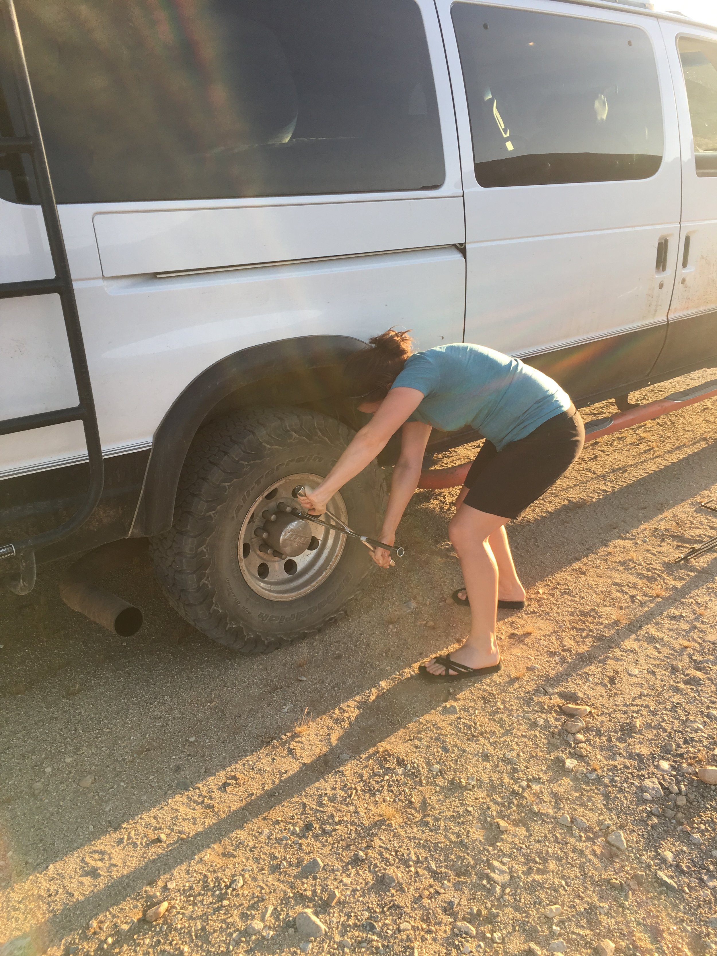
Thankfully the front spare tire held up well on the dirt road and we had about half a mile of pavement before having to decide which on-ramp to get on. We decided 55 mph felt plenty safe so we pointed west and listened to the click-click of the flashers for over an hour. The tire was patched without incident the next morning and we got back on the road hoping and praying that was our last issue for the 6th time in last than two weeks.
Not the most upbeat time on our trip but we learned a lot about the van and we got to see plenty of good friends who were more than welcoming to us, over and over and over again!
We cover the last bit of Utah, a quick stop into Colorado and exploring western New Mexico, northern Arizona and a jaunt into California and the Mojave. Enjoy!
Music: Modest Mouse - Missed the Boat
Entry #32 4/4/17- 4/7/17 Mojave Desert National Preserve
Current Location: Four Points Sheridan Phoenix, AZ (wait for the next post for that little explanation)
The drive out of Flagstaff west to the Mojave Desert was an uncomplicated one; get on I-40 west until we reached the Kelbacker exit into the preserve. We did, however, take a more scenic way through historic Route 66. We had the road to ourselves for much of the drive through hillsides in full bloom as we wound our way up to Sitgreaves Pass. We dropped into Oatman, AZ which was a stark contrast to our quiet drive. It had looked as if time had forgotten the town. What was once saloons, mom & pop shops and other staples of a 1915 mining town, the buildings are now full of trinkets, t-shirts and antiques catering to the tourist crowd. The narrow road through town is shared by vehicles, wandering people and wild burros alike. The latter have learned that food is readily available through hand feeding by the visitors as they lounge in the middle of the road.


We found a great campsite near Granite Pass, tucked in and amongst the rock formations. The heat of the day cooled off, becoming quite pleasant and we ventured out to wander up the formations, looking at all of the various varieties of flowering cactus. The views from only a hundred or so feet above the van allowed us to see the great expanses of the preserve painted in pinks, oranges and yellows of the valley in bloom. The full moon light reflected off of the white granite hills around us, casting shadows.


In the morning we drove to the Kelso Depot Visitors Center. The first version of the Depot was a train station, telegraph office, restaurant and dormitory for railroad men. The old lunch counter compete with wooden stools where travelers of another era satnow holds souvenirs and memorabilia. Trains traveling between Salt Lake and LA continue to pass through the Mojave.
Before the heat of the day kicked in, we drove to the hills in the Mojave in search of the lava tube. Unsure if Rooney could navigate the steep steps into the tube, we were excited and proud when he scurried down, excited for the adventure below. The entrance ceiling of the lava tube was low. The three of us ducked low, careful not to hit our heads. 3 feet from the low ceiling, the lava tube opens up to a 20 foot room, complete with a few skylights. Beams of light shown down and illuminated the center of the tube. Rooney cautiously looked along the walls as we took pictures.


We set up camp near the Kelso Sand Dunes and waited for the day to cool. It seemed as though all birds were waiting for the same before they became active again. An endangered Desert Tortoise wandered through the scrub brush pausing to eat some flowering grasses. Little lizards darted from shade spot to shade spot. Every now and then one would catch Rooney’s eye and he’d lift his head from his shady nap spot, too hot to care to chase after them.


We hiked to the top of the Kelso Sand dunes before sunset. There were a few small groups that decided to do the same, but by no means was it crowded. Near the top, we watched 2 younger guys jumping down the side of the sand dunes. As they landed the sand slid downhill, and the sand “whoomphed”. Although Rooney has been with us as we’ve done the same, he stopped, turned and sprinted downhill in one motion. It’s hard to say how far he would have gone if he weren’t on leash. A few hundred feet from the summit, I was able to slow him enough to try and comfort him. We ventured off the side of the dune to a slope away from the other groups where we could sit and watch the sunset in relative quiet. A train rolled silently through the valley below. The hike back down to camp was much quicker than the way up. The moon rose as we made dinner andwe couldn’t help but wonder where our desert tortoise friend wandered off to.


Our morning hike up Teuton Peak took us from the sand and into rocks and Joshua Trees. We had the trail to ourselves, minus one group we passed about halfway up and the scurrying lizards.


For our last night in the Mojave we opted for a campsite off of Black Canyon Road in a mix of Pinion Juniper Woodland, Joshua Tree Woodland and Blackbrush scrub. The campsite was full of blacktail jackrabbits, cottontail rabbits, song birds, and huge barrel cactus. Rooney loved watching the rabbits and would have very much liked to chase them through the brush if we let him. The trail for the Rings Loop went right behind camp and we saw a few groups pass by through out the afternoon. In the morning we would hike the Rings Loop trail before heading out to Phoenix.


Our stay in the Mojave exceeded all of our expectations of the desert. We were lucky to see the wildflowers in a super bloom. The heat of the day allowed us to catch up on reading and writing during the afternoon, enjoying the cooler evening to wander.
