6/23-6/25/17
Current location: Denny Creek CG, Mount Baker-Snoqualmie NF, WA (what’s another blog entry if it’s not almost a month behind)
Leaving Asheville behind we wanted to get in a bit of a hike in the area so we headed about an hour outside of town to Max Patch. This area is a particularly unique mountain top bare of any trees that make the Appalachian mountains so famous. The area had been cleared for farming and now, after a lengthy dirt road up and down the mountains is a short hike from a parking lot and a famous spot on the Appalachian trail. We wandered along its bare ridge for a while and, after numerous weeks of hot, sticky air, reveled in the 60 degree, 25 mph wind.


Back down the winding, remote dirt road we headed south towards Great Smoky Mountain National Park with a stop at Soco Falls along the way. The falls drop about 50 feet and come from two different creeks. There is a short trail from a pull-off on the side of the road and you can hike down to the base of the falls. We played around with the good camera and some long exposure shots, made easier by the dark forest surrounding the falls. A short way down the road we made an abrupt stop at a farm stand for some fruits, veggies and, because we had no plans for dinner, some local pork products.


We made a stop at the visitor center of Great Smokies and set up camp at the Smokemont campground. It was a decently sized campground and pretty full but overall good space and decently quiet. Towards the middle of the afternoon and some maxing and relaxing, we decided to go for a drive through the park, particularly on the North Carolina side. There is a nice 20 mile, double-track dirt road that leads off the Blue Ridge Parkway down into the creeks and rivers of the park. We gained a couple thousand feet on the Parkway and then descended the desolate double-track, complete with grass growing down the center of the road. The road was beautiful and a joy to drive. Trails spoked off the road at a couple points and I think we only saw one or two cars parked at these trailheads. As we joined up with one of the other, slightly more popular, dirt road we quickly had to hit the brakes. At some point in the very recent past a tree had fallen across the road and wedged itself tightly between two other trees on the opposite side; a one in a million shot. The tree was probably 6” in diameter as it crossed the road and was wedged well enough that a simple overhead lift would not be sufficient. We went back to the car to retrieve what we thought was simple tools for the job and remembered that we had left the folding saw in the van when we transitioned to tent life. We rifled through the rest of our gear and only came up with our two Swiss Army Knives, each with a 3” saw blade. Oh well, here goes nothing.


We spent about 15 minutes sawing the mercifully soft wood and made a lot more progress than we had thought we would. In the meantime another car had come down the road the way we came and gave us a hand swapping saw duties. They went through the similar exercise as we had completed earlier, trying various techniques of lift, pull, analyze and eventually conclude these tiny saws were our way out of the woods this night. Eventually we got about 1/2-2/3 through the tree and decided a healthy lift and drop technique was in order. Thankfully this was successful and we all hauled the rest of the tree out of the road and went on our merry way, laughing, joking and congratulating each other on a job well done. The afternoon turned to evening during our lumberjack session so we made a very quick jaunt up to Mingo Falls on our way back to camp.


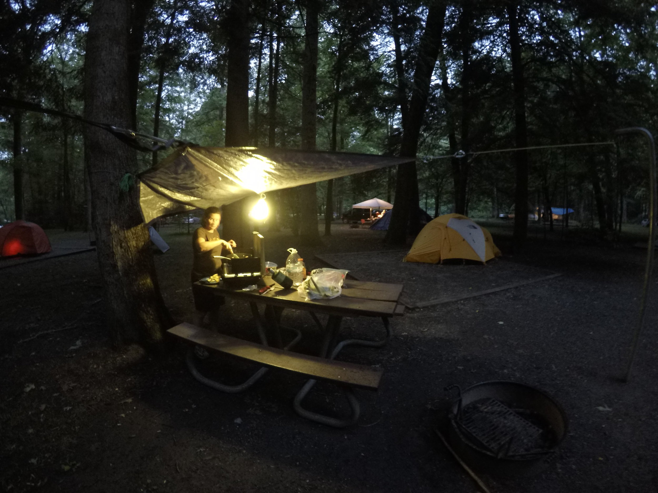
It had gotten pretty late and, unfortunately, also quite stormy by the time we started cooking our dinner at 9pm. We had set up a tarp over the picnic table at our site and huddled under it pan frying potatoes, zucchini, corn and what turned out to be just really legit bacon. An odd dinner, under torrential down pours but tasty nonetheless.

The next morning we feebly attempted to dry out the tent rain fly as we packed up to head up and over the Smokies. On our ascent the clouds were perfectly demonstrating the reason this area got its name. From deep in the valleys the clouds rose as misty creatures, eventually catching some breeze and drying out. The scene was beautiful under morning light and the green backdrop of trees as far as you can see. As we continued upward the clouds closed in and at Clingman’s Dome, the high point of the Smokies and of Tennessee, there were views as far as…your arm. Despite this we made our way up to the spiral walkway to the top of Tennessee and joked with other visitors about how good the view was at the top.


As we descended the west side of the park, the weather started to clear for good. By the time we were down at the Element campground only intermittent clouds dotted the blue above. Along the way we stopped at Laurel Falls for the quick few mile jaunt up to the falls themselves. Here we started to experience what we had read was the “busy side” of the Smokies. I’m still not entirely sure why but the Tennessee side was packed with people, cars and general national park mayhem. The trail to the falls was a constant flow of people and the falls themselves displayed a nearly Darwin-esque genius that is reserved only for the city individuals who think their 75+ year old grandmother should be in the photo with the 3 and 6 year old scrambling up a 20’ slippery waterfall. This level of general self danger was coupled by mess of leaving wrappers and water bottles behind just about anywhere in the area of the falls. Okay, rant over, the falls were still nice…over the screaming kids getting yelled at by their parents.

As we pulled into the campground we spoke with the ranger about our site for the night and, having made an actual reservation a few days earlier, heard that we are pretty good at playing the “map, Google satellite view, campsite selection” game. The ranger’s comment was, “You got F8! Good work.” Apparently this one site is at the end of the entire campground, nearly on its own and has about 100’ of river front. We spent the better part of the early afternoon partaking in our good selection, both through relaxing in the hammock we hung over the edge of the creek and wading in the creek itself under the stone bridge. With clear weather prevailing, the sound of a river running directly next to us and a couple of cold beers chilling in the eddy under the hammock we enjoyed listening to the water and birds and chatting.


Later in the afternoon we had no intention of cooking as we had run out of food and knew a brewery with dinner was calling our name in Gatlinburg just outside the park. To our surprise, the town of Gatlinburg was not a sleepy, mountain town but rather a bustling, almost mini-Vegas with hordes of people wandering the streets, attractions, shows, plastic building fronts. We had dinner at the Smoky Mountain Brewery but did not last much longer when we had a quite, creek side retreat only about 15 minutes away. The evening was spent doing much of the same and enjoying the sound of the river and forest as we fell asleep.


The next morning we got an early start with a crowded day planned. We headed north through the corner of Tennessee to Cumberland Gap National Historic Park. We made quick work of the Tri-State Peak trail in the park with about a 3.5 mile roundtrip. The top of the hike is the point at which Tennessee, Virginia and Kentucky meet. This checked off our 45th state in Kentucky as much of the hike and a good amount of the history was through that state. The area and Cumberland Gap has been used over centuries from Native American tribes to Civil War battlefields and now, recreation. The visitor center on the Kentucky side has a really interesting display on this progression of the use of the gap.

With more of the Appalachians to see we headed east and into Virginia. The roads this way were rural, skinny, two-lane roads rolling up and down hills.
As we rolled through Damascus, Virginia we made an abrupt stop at the Damascus Brewery as it stared us in the face down a similarly quiet highway. The town of Damascus looks like a great outdoor town, with tons of trails in the area and seemingly even more mountain bike shuttle companies. The beer was tasty in the mid afternoon and we continued on up the road to Grayson Highlands State Park. The roads were windy and climbed significantly as we got into the park. We made a lap of the campground and settled on a spot at the edge of an open field, near the front corner of the campground. We had a few spots in between any other group and we enjoyed the breeze from the field. As we set up camp, we were joined by the famous Grayson Highlands wild ponies. A mom and its young foal wandered out of the woods to a campsite down from us and meandered along the roads, seemingly without care or concern for any humans around. It was cool to see them so close and the little pony was pretty cute.


We thoroughly enjoyed ourselves as the air cooled down through and below 60 degrees. Up high in the Virginia mountains we finally had cool, dry air to sleep in for the first time in a while. We threw on probably an extra layer too many but having the slightly heavier fleece on felt good.
