#31 - Intro to Arizona

 4/1-4/3/17

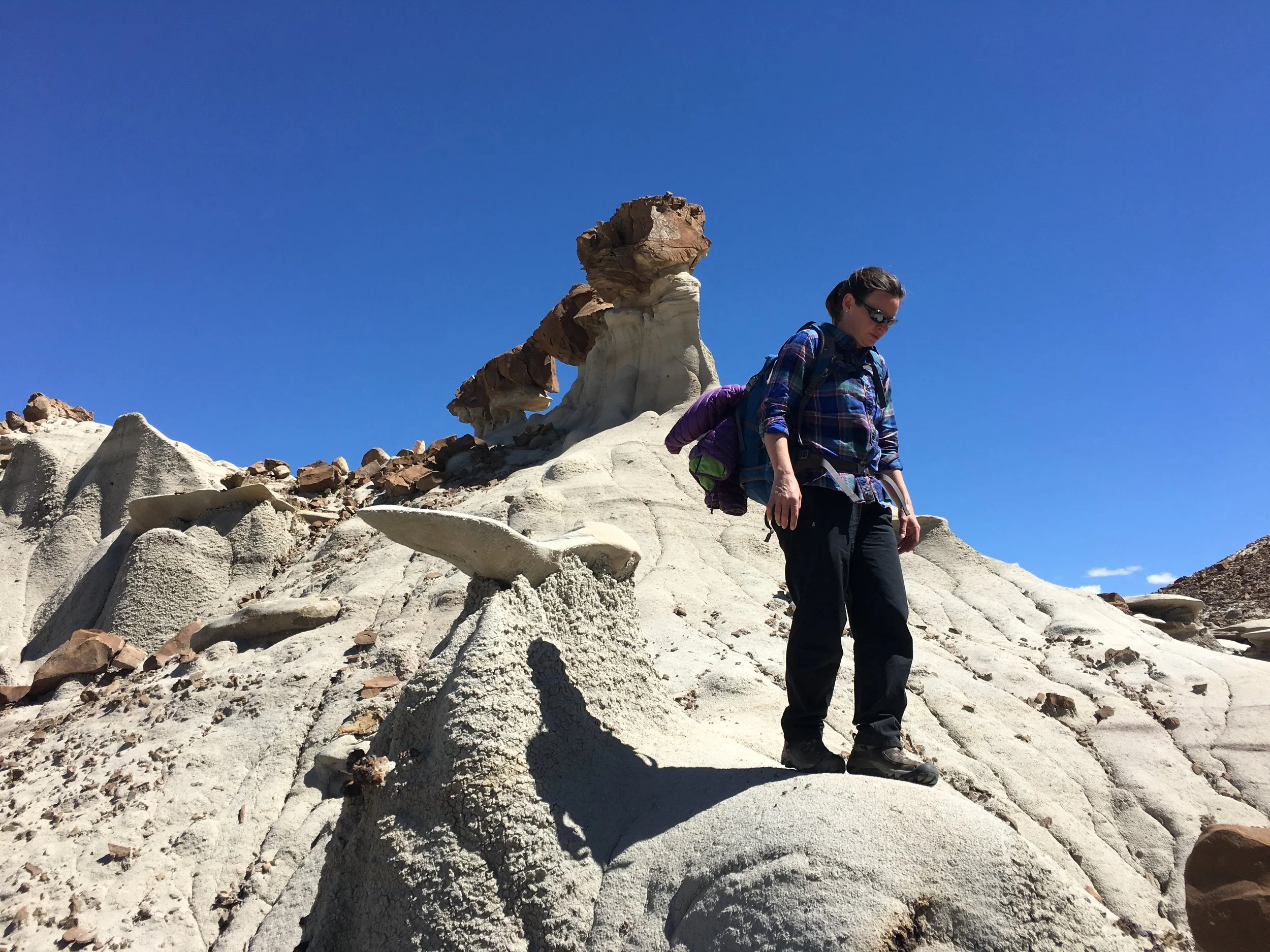
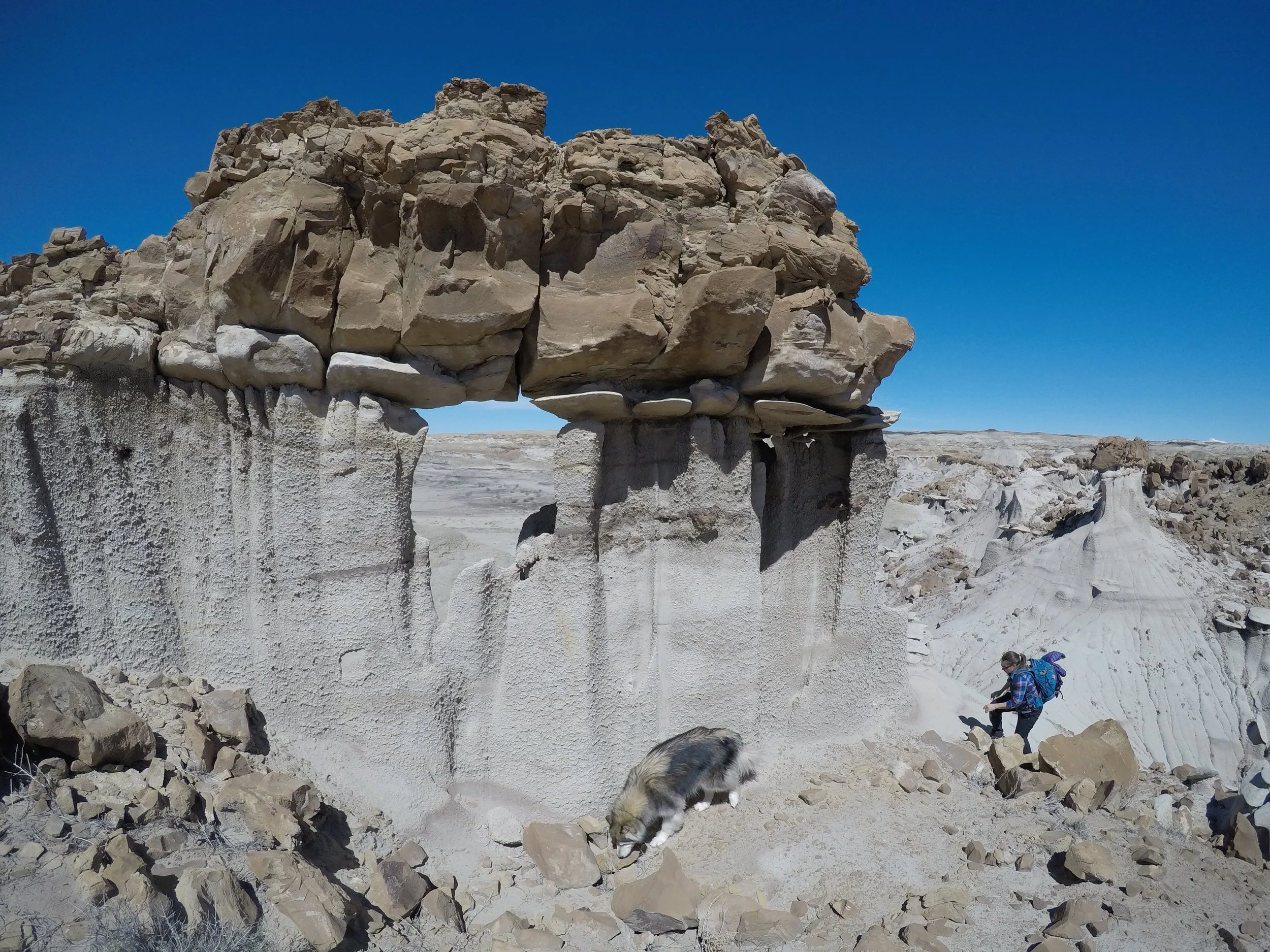
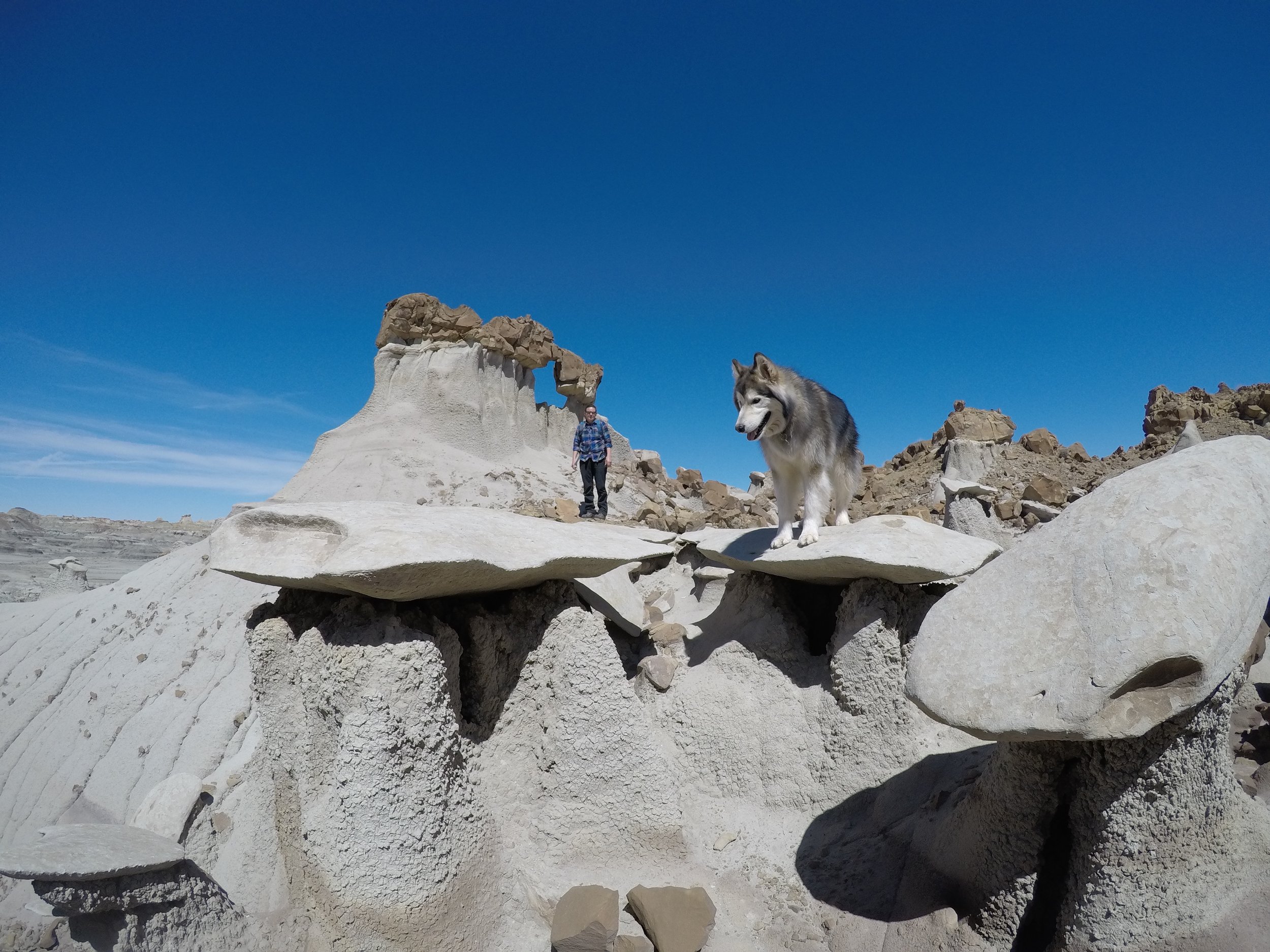
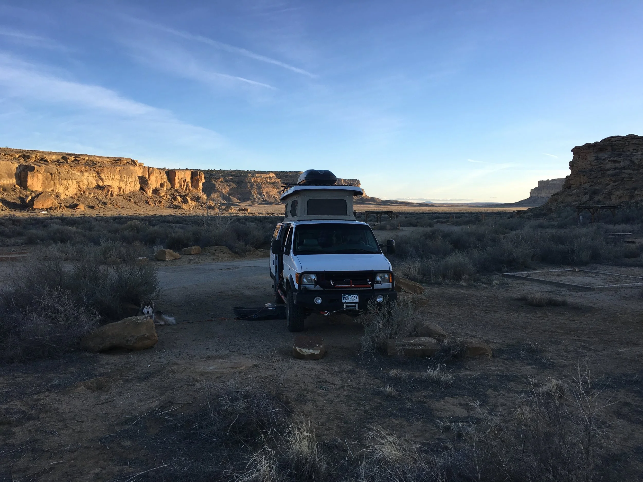
Current Location:  Chuck’s Speed and RV, Phoenix AZ (no drama, just oil change-HA, wait until the next post!)

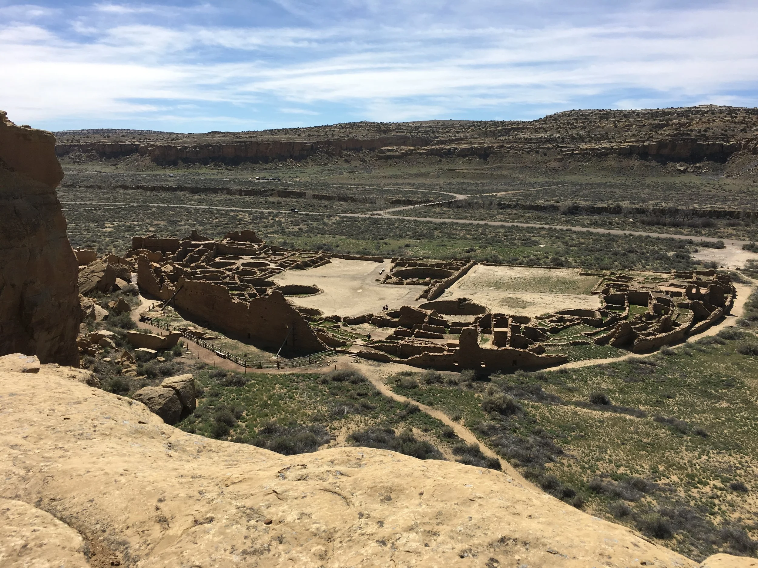
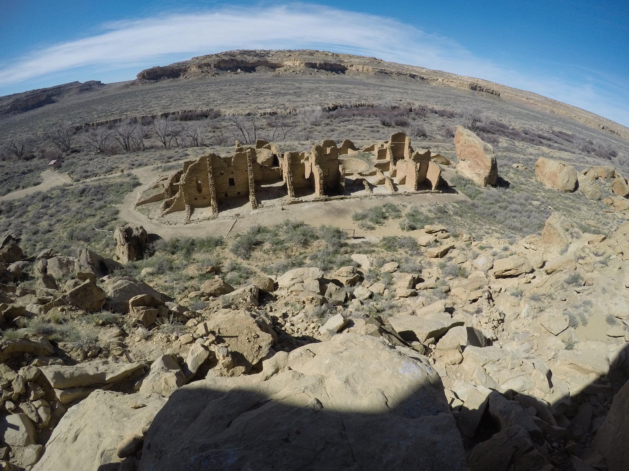
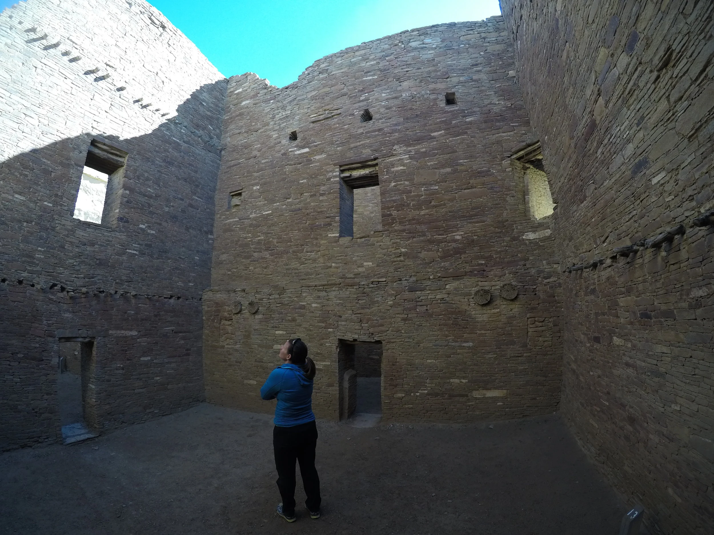
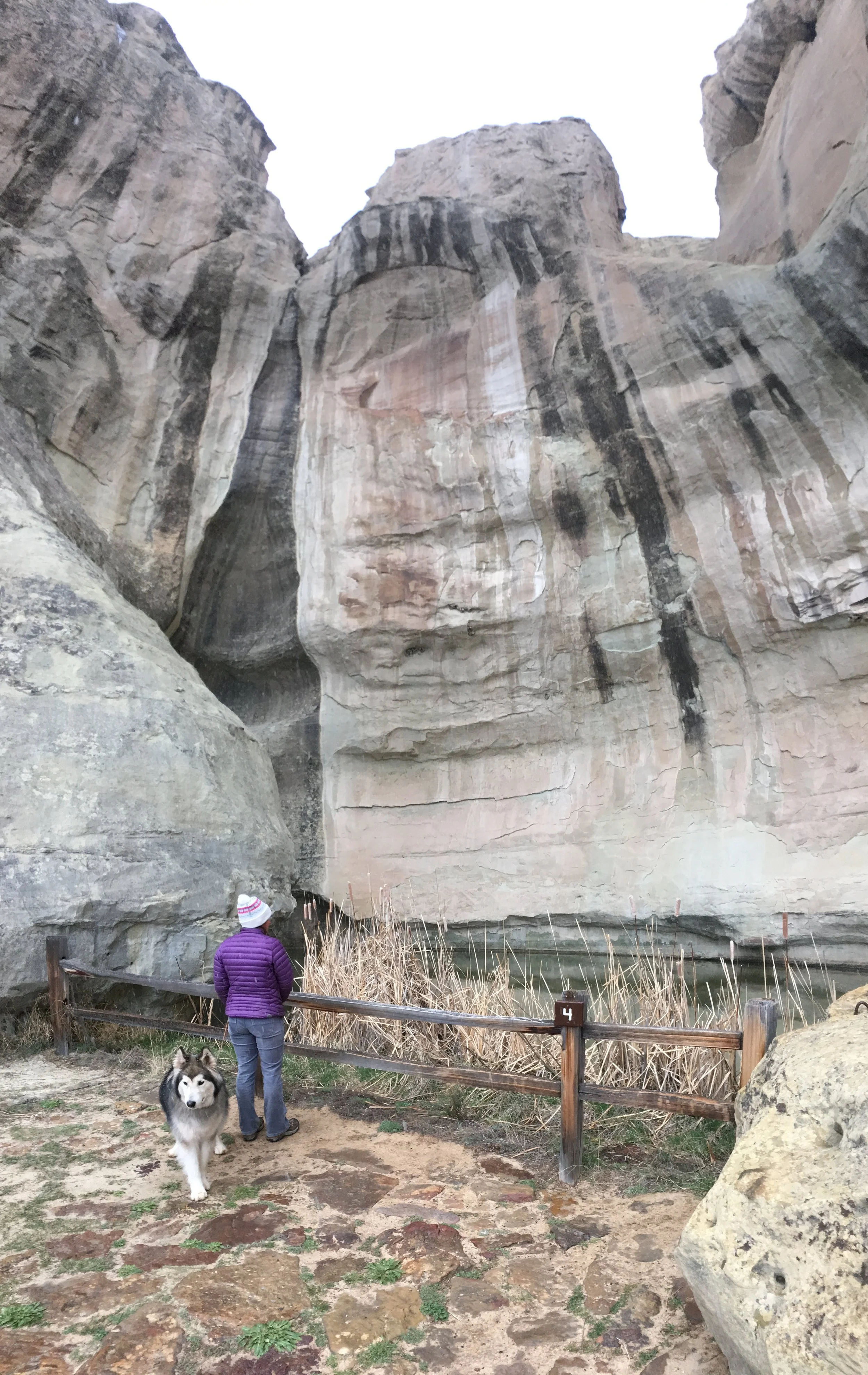
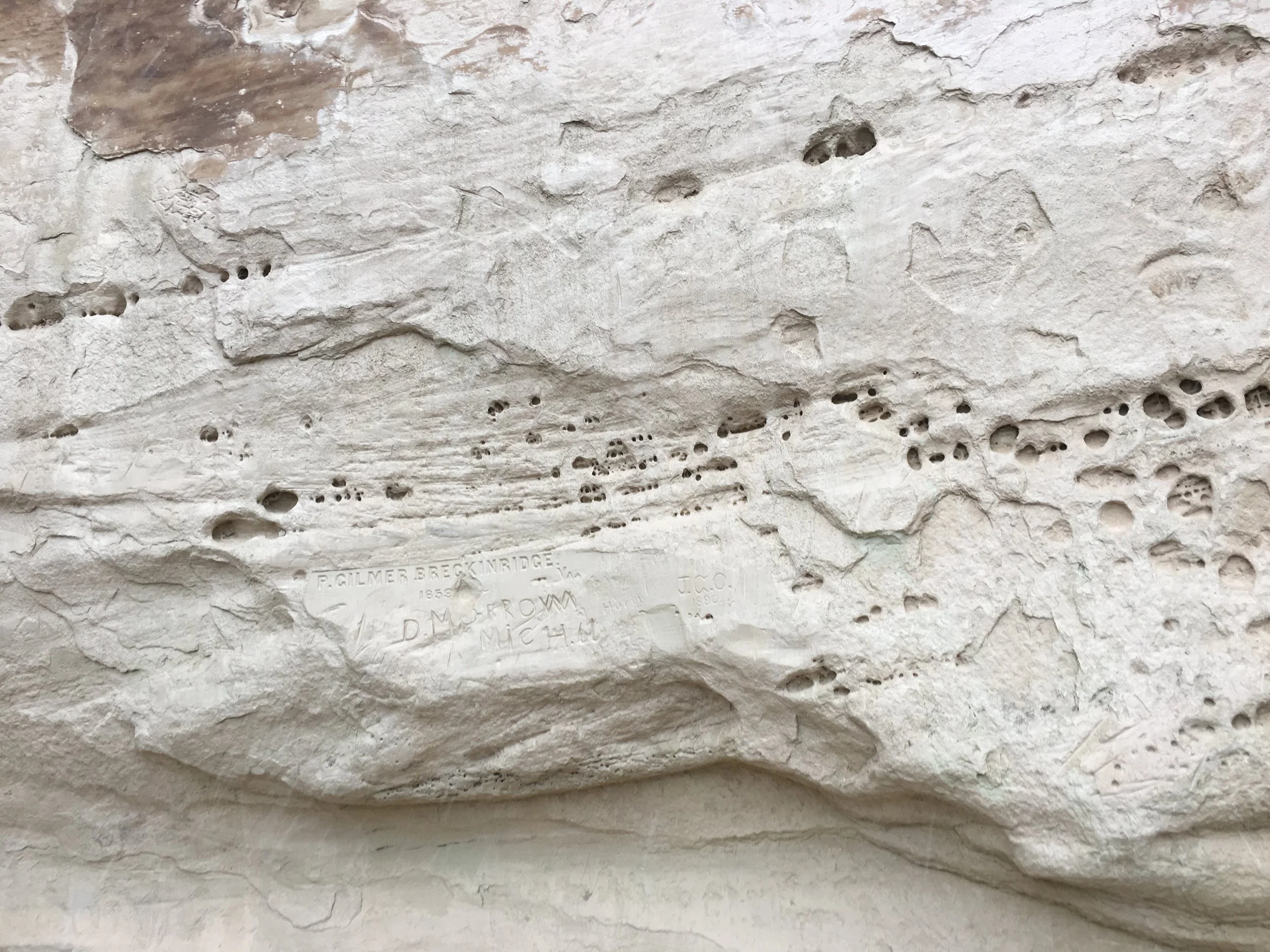
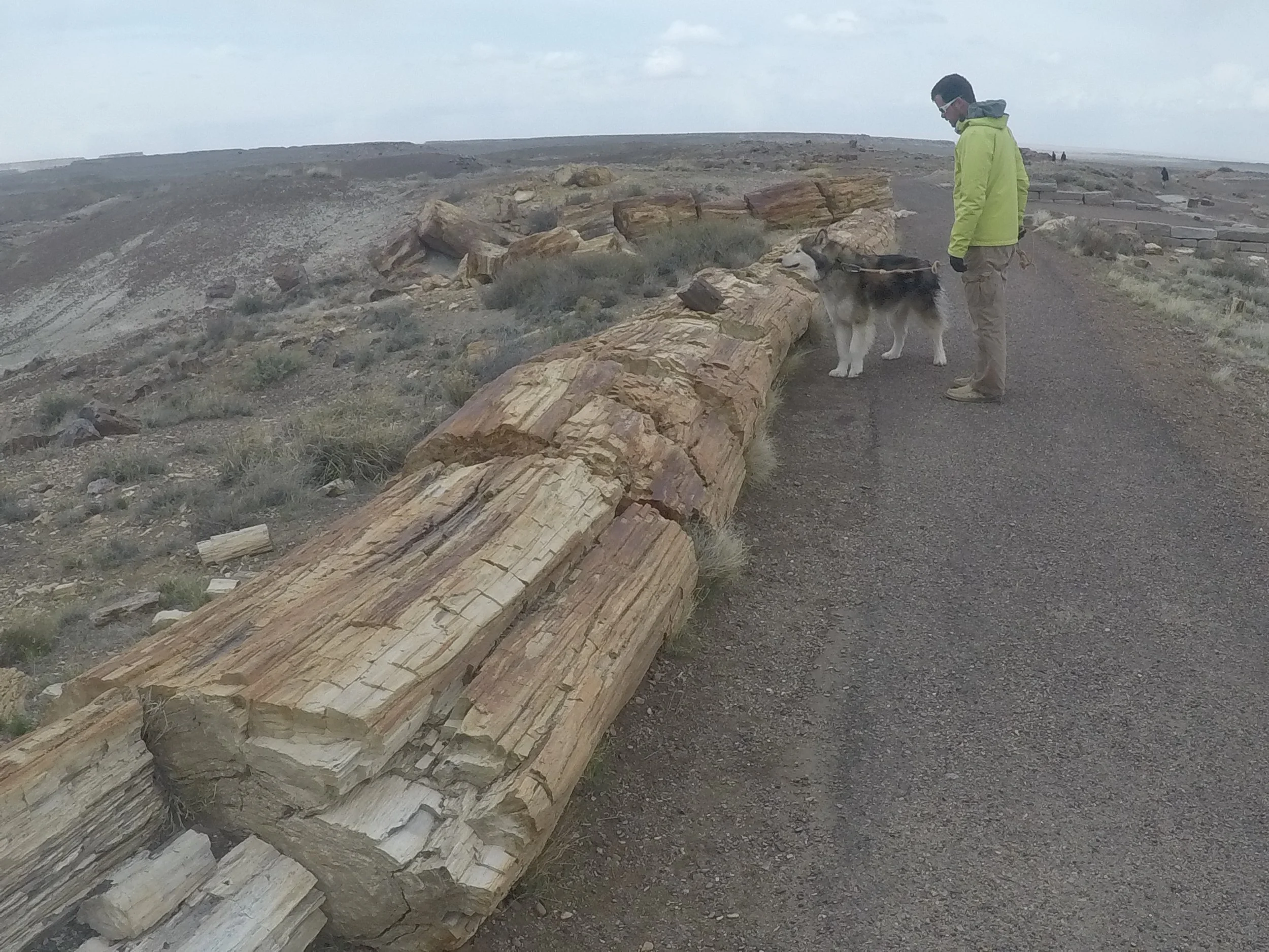
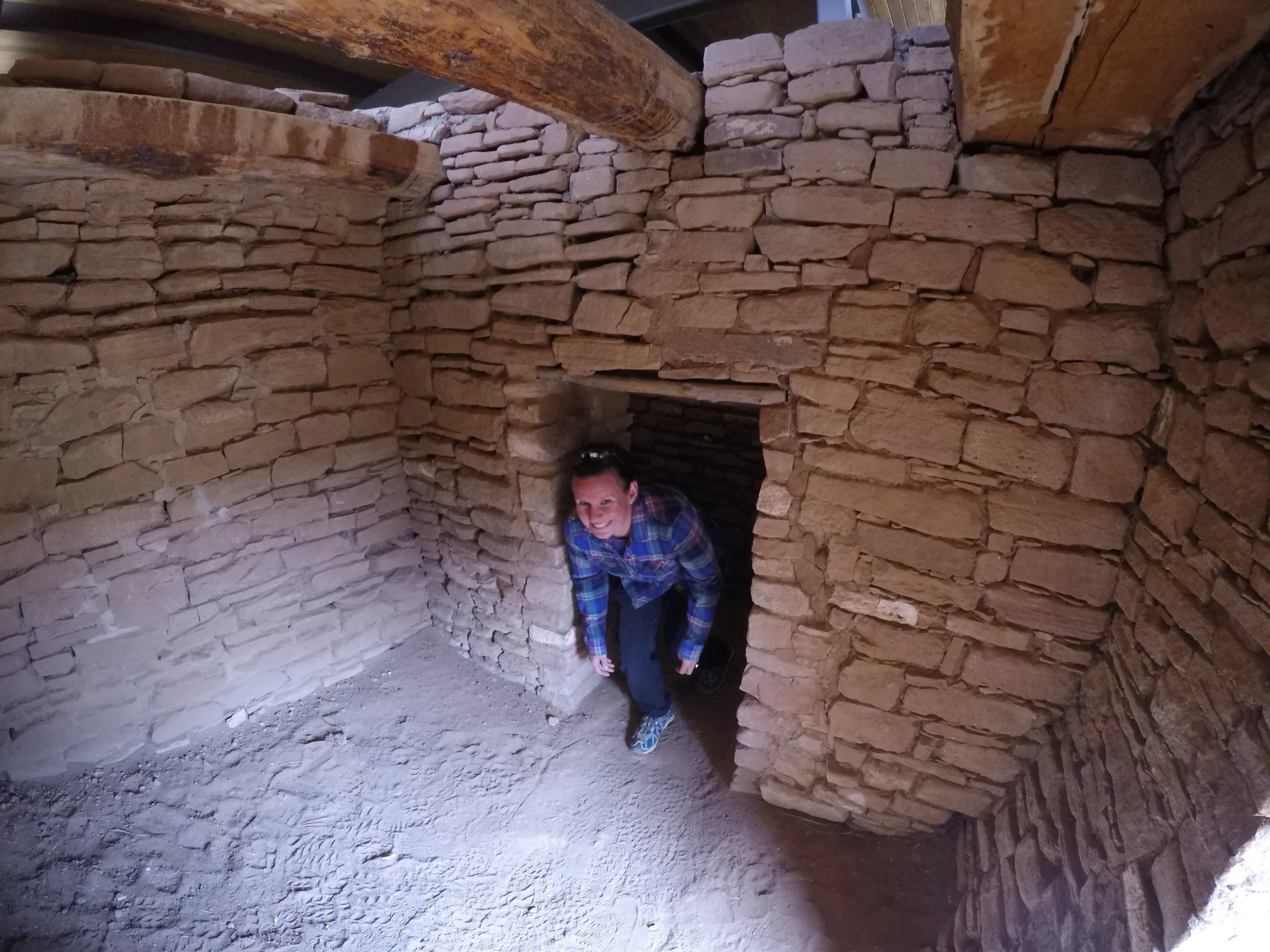
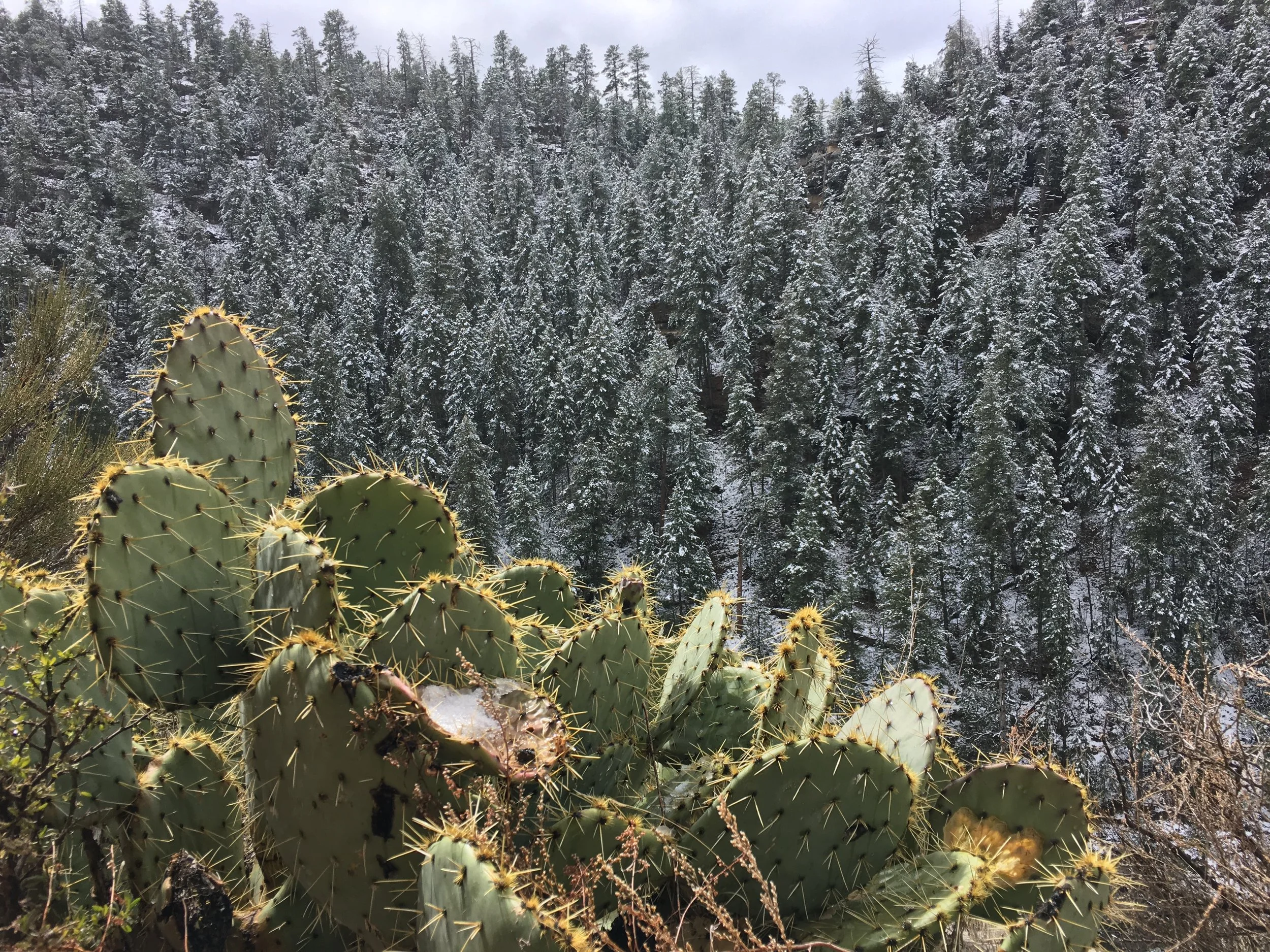
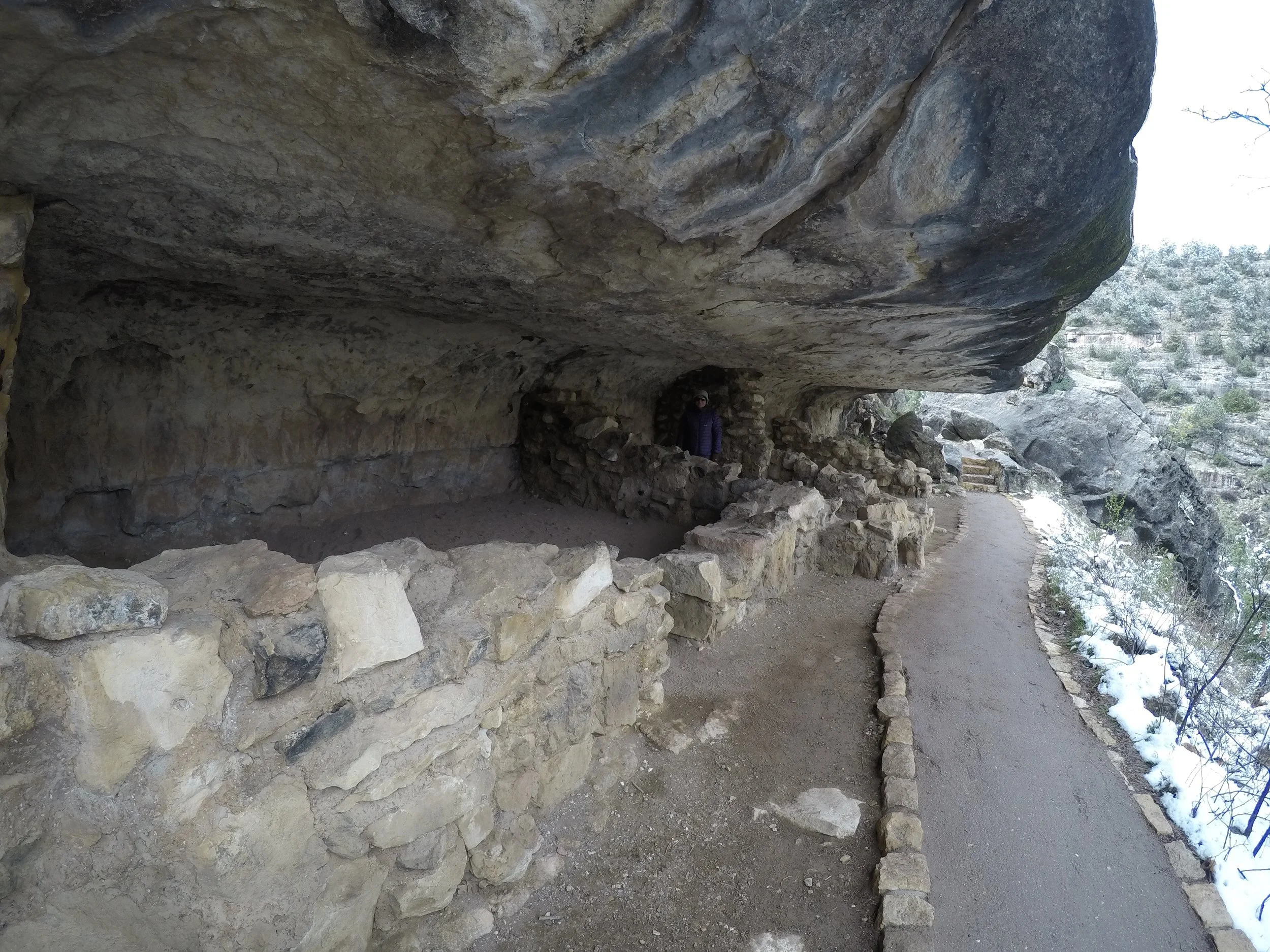
We awoke to a nice coating of snow on the trees but the dirt roads held up nicely.  We made the very short drive into Walnut Canyon National Monument which consists of a few short hikes that take you down into the canyon where Native Americans made their homes in the cliffs.  The trail descends past and through these cliff dwellings and you get a sense of their ingenuity and community scattered around the canyon walls.  It was particularly interesting to think of their system of communication and travel in/out of the canyon as well as across and around the canyon to other family dwellings. 

IMG_6391.JPG
IMG_6452.JPG

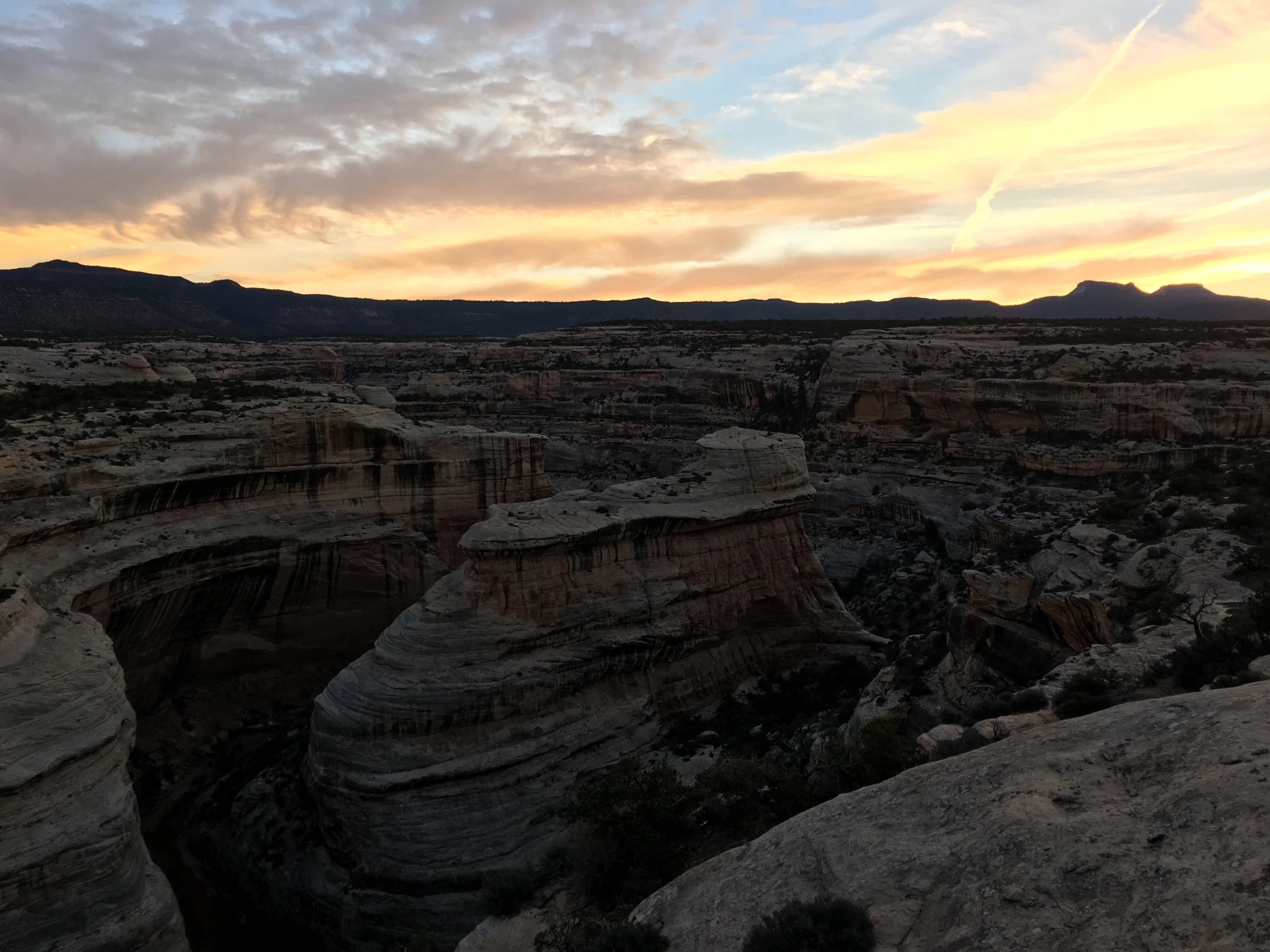
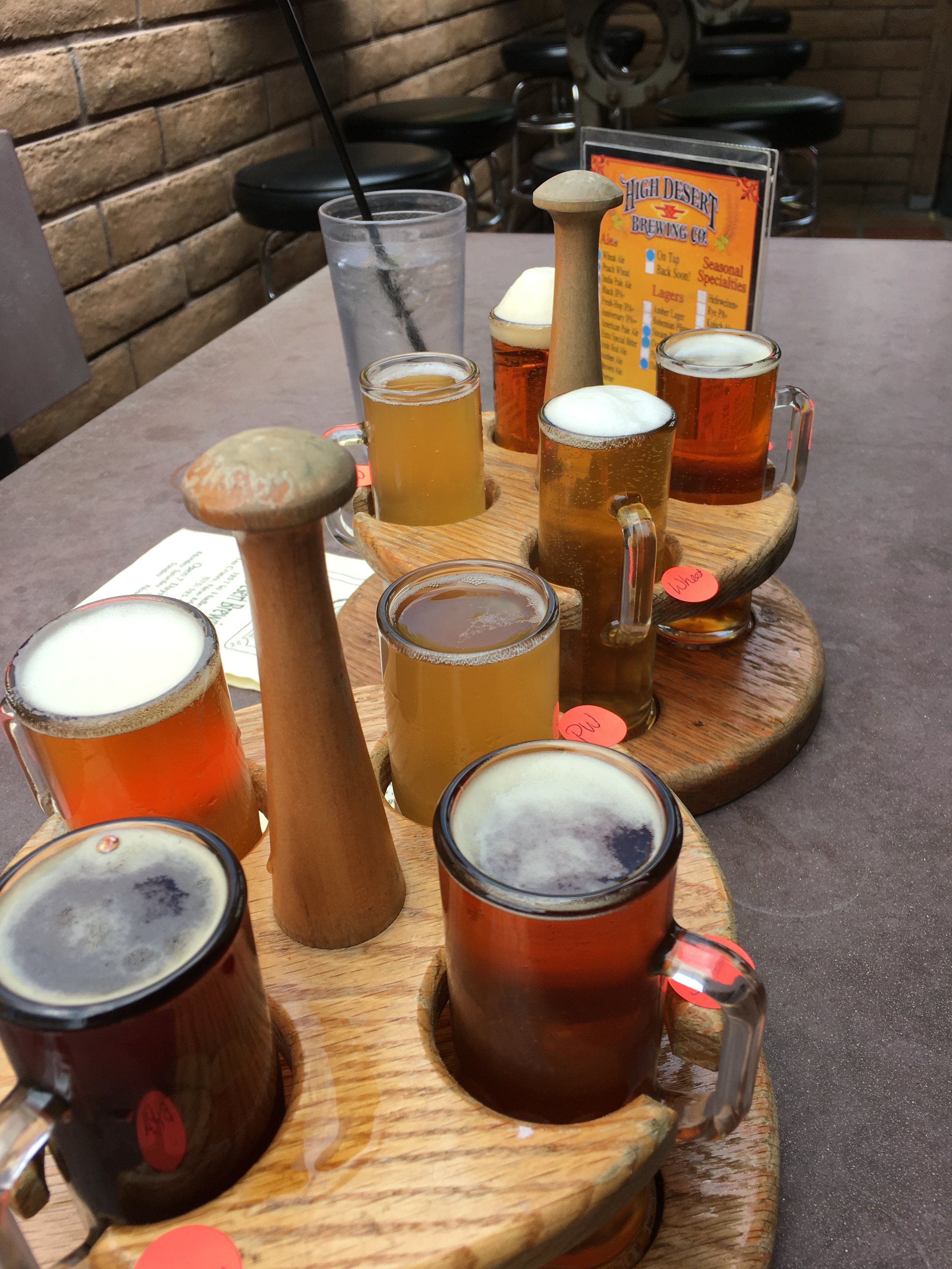
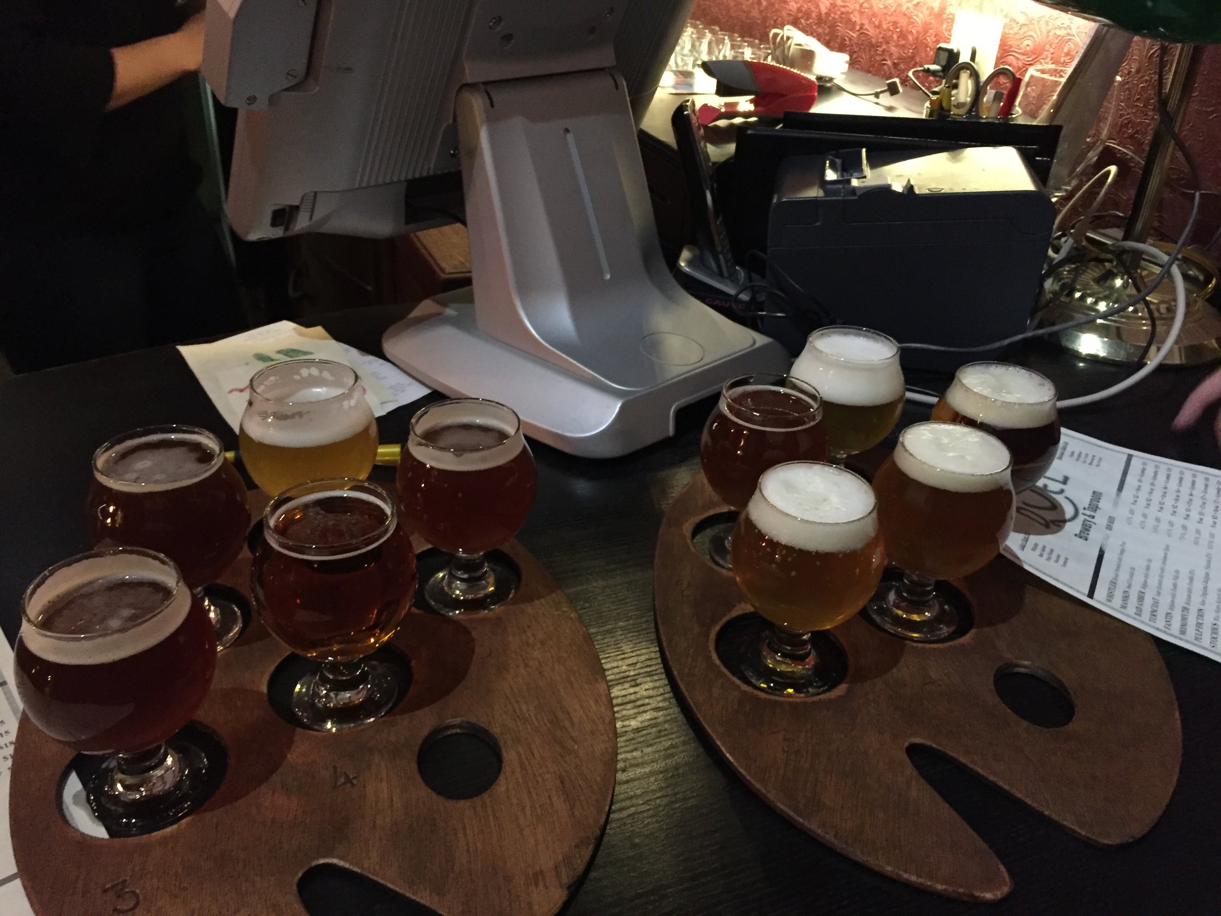
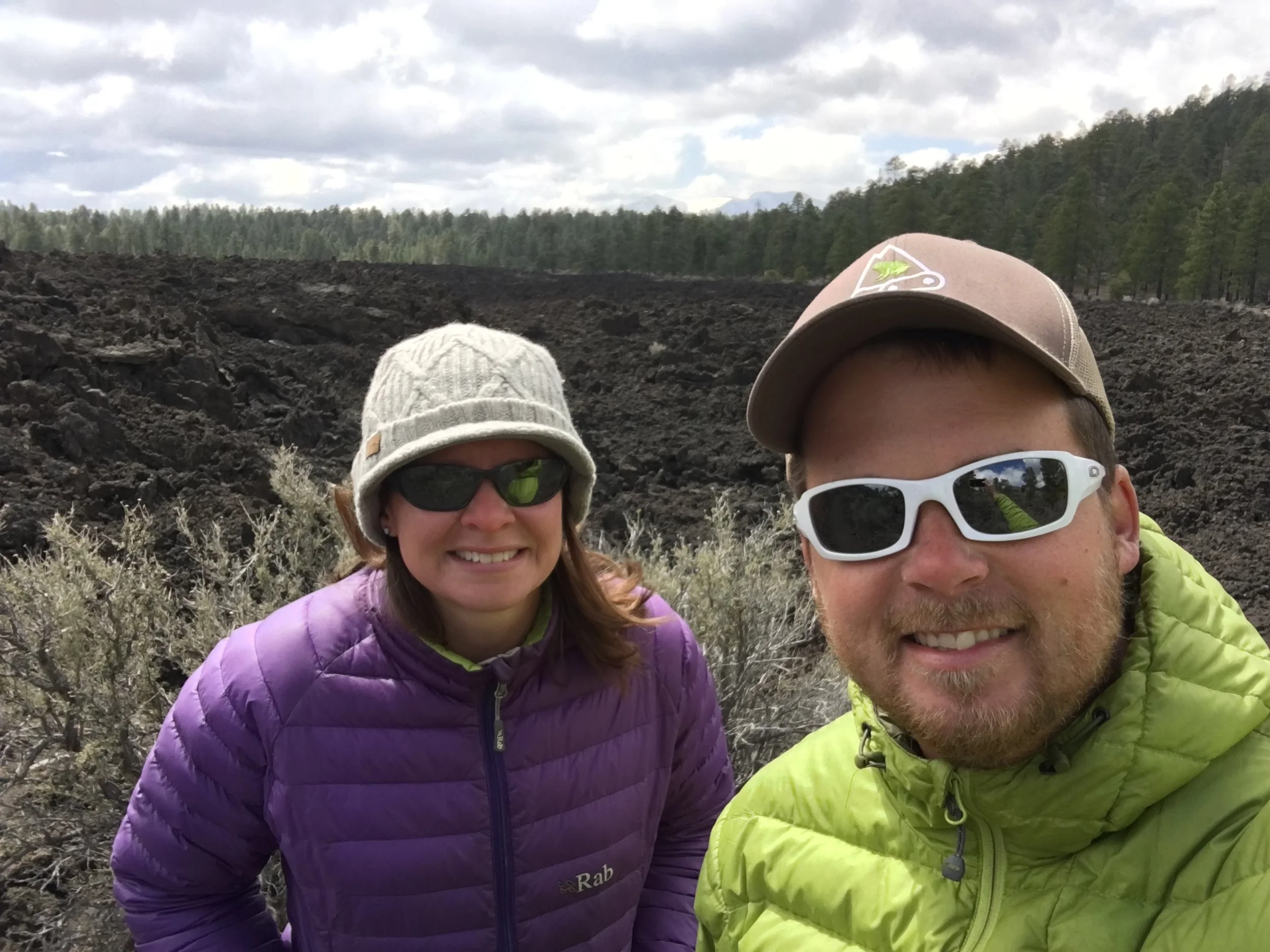
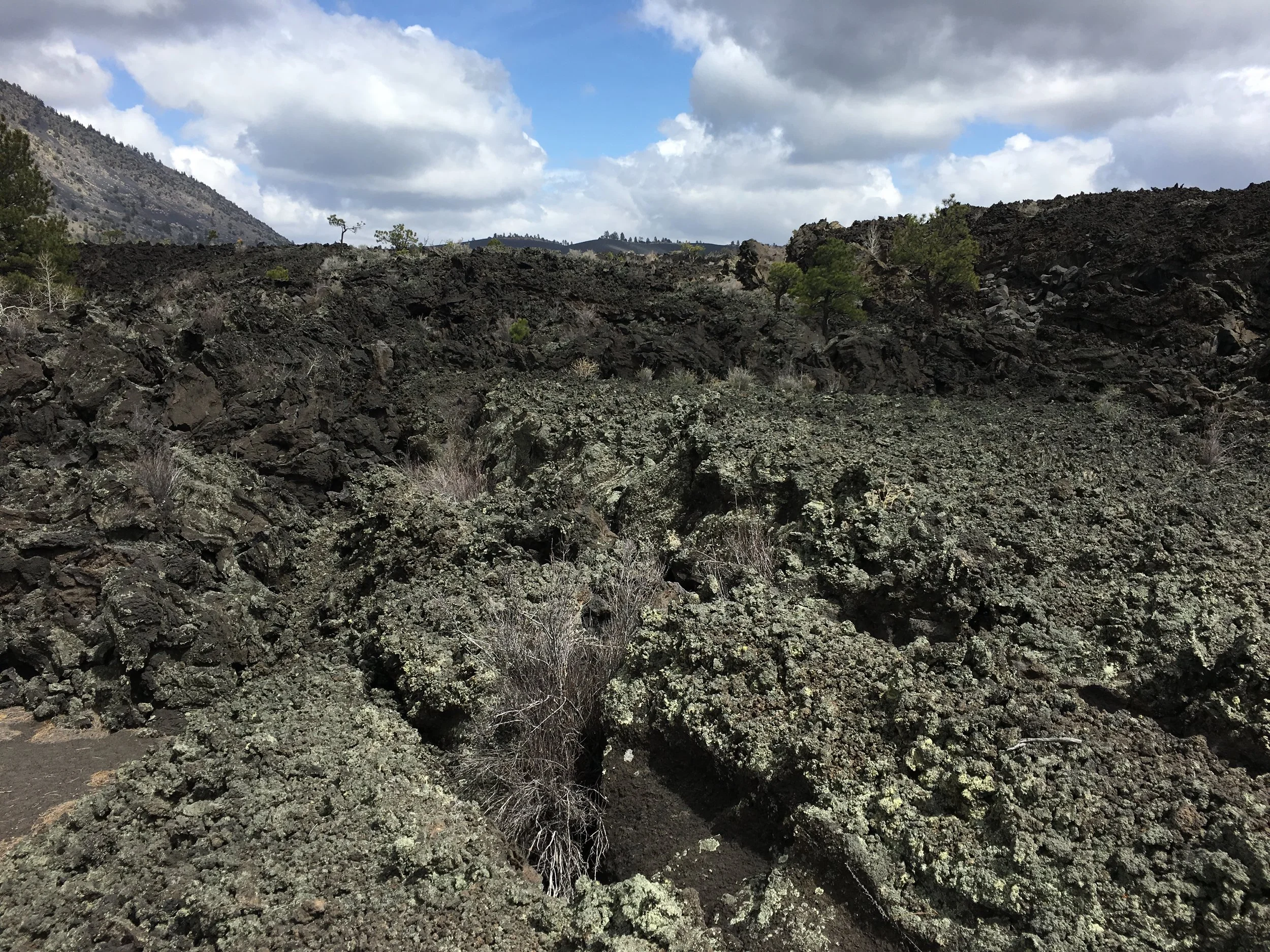
We headed out mid morning to another National Monument in the Flagstaff area, Sunset Crater. We had just about zero knowledge that this area of Arizona had some 600 volcanic craters, cinder cones and lava flows. Each dots the landscape and sunset crater is at least 800’ above the surrounding area. We were kind of perplexed by hiking through huge lava flows and up cinder cones to take in the views. After some exercise we headed into Flagstaff for some lunch and some samples of the local breweries, including Dark Sky, Wanderlust and Historic Brewing.

IMG_6392.JPG
IMG_6393.JPG

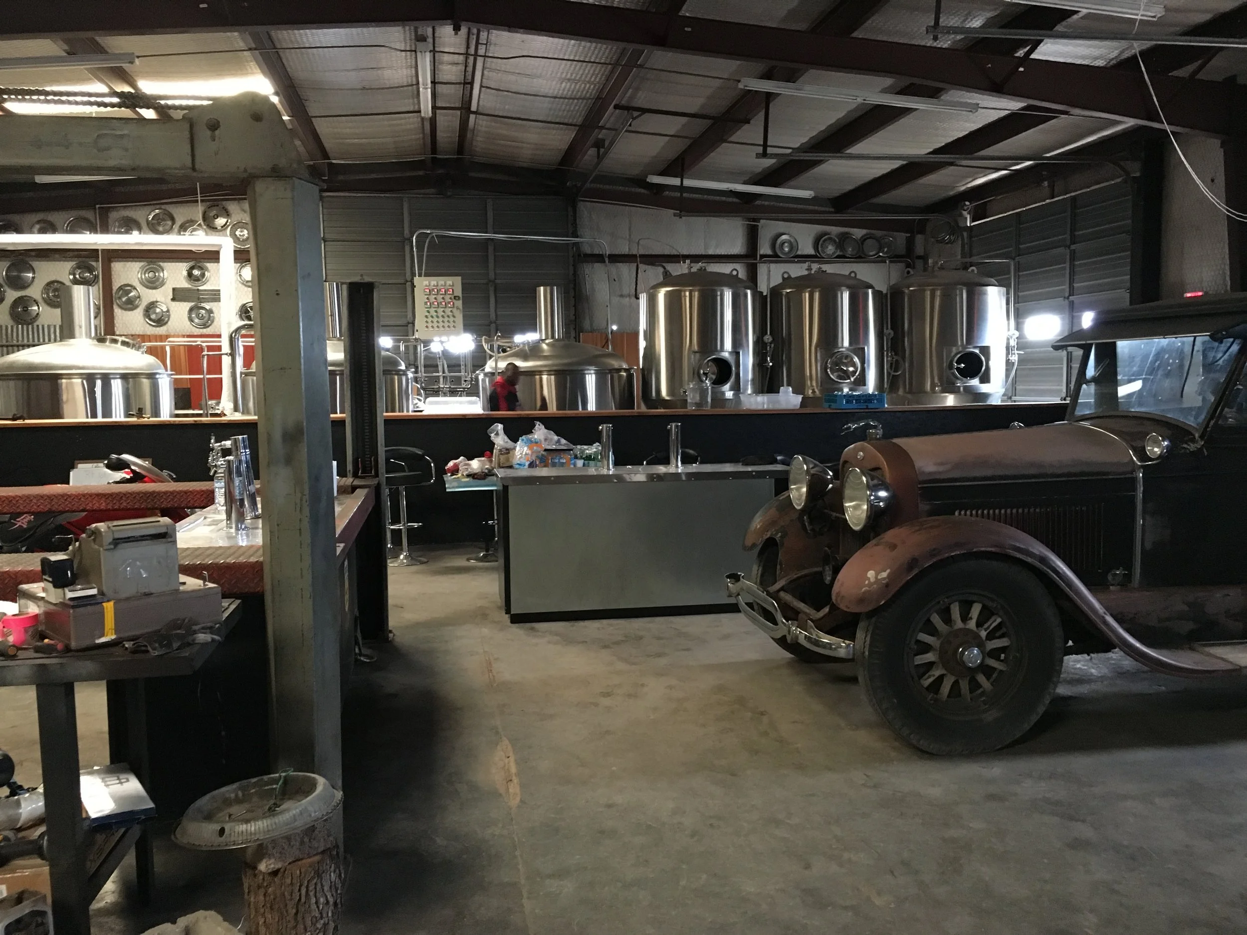
At the last, we swung open a door of the industrial building with the Historic Brewing logo on the window to a few dismayed looked of people bottling bombers. I asked if we had the wrong door and they joked, “Not if you wanted to work!” “Okay, sure, why not?” Even more dismayed looks as Lara and I tossed jackets on the table and assumed spots at the bottle cleaning and capping “stations”. They loved that we just stepped in to help them out for the last half hour or so. Apparently we should have showed up earlier as they had been bottling for most of the morning and afternoon. Our 30 minutes of joking, bottling and capping earned us some new friends (Jersey natives as well!) and a free beer. It was a great experience and even better people. We settled in to a different but similar area camp spot in the national forest just outside of town.

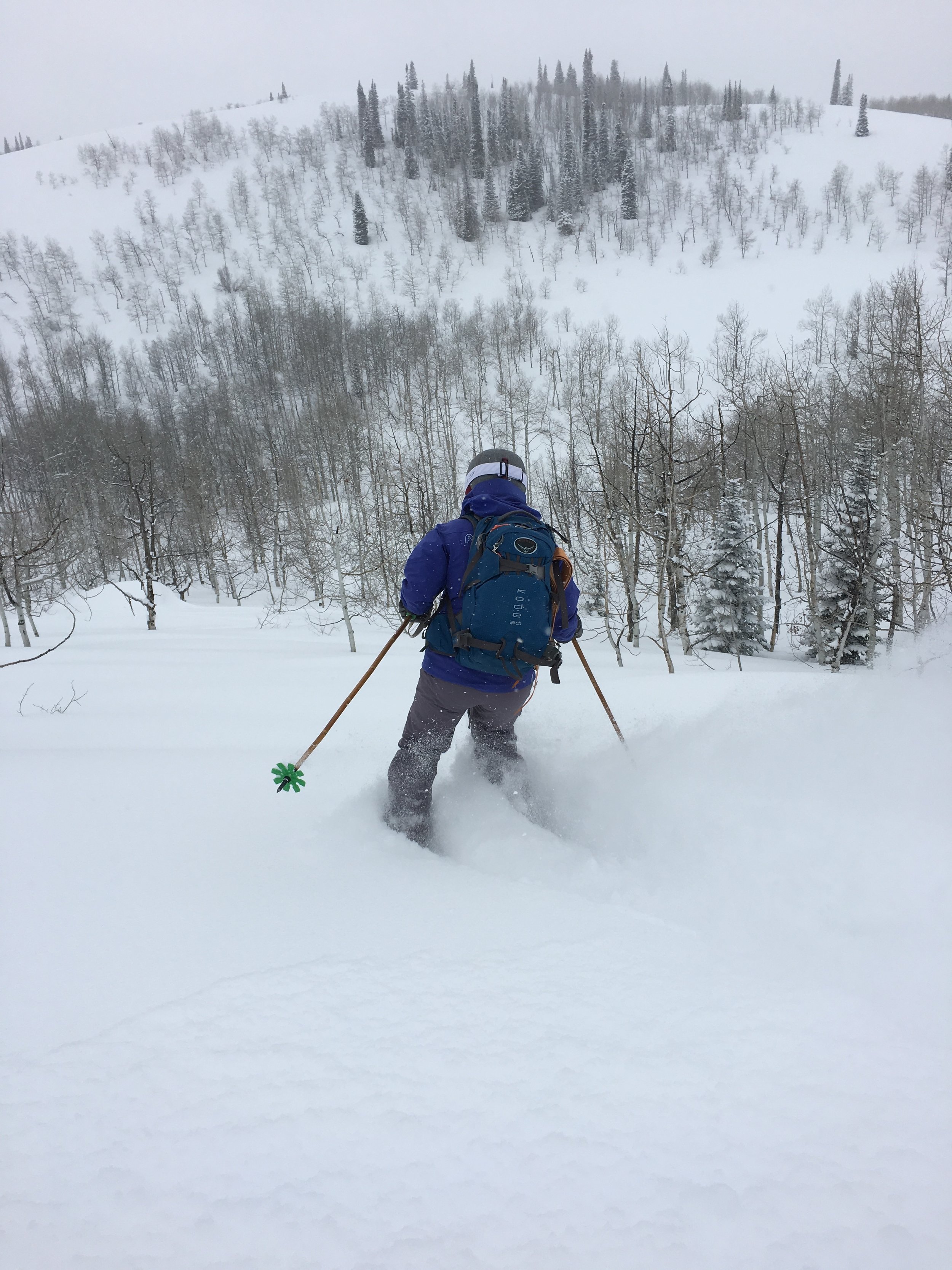
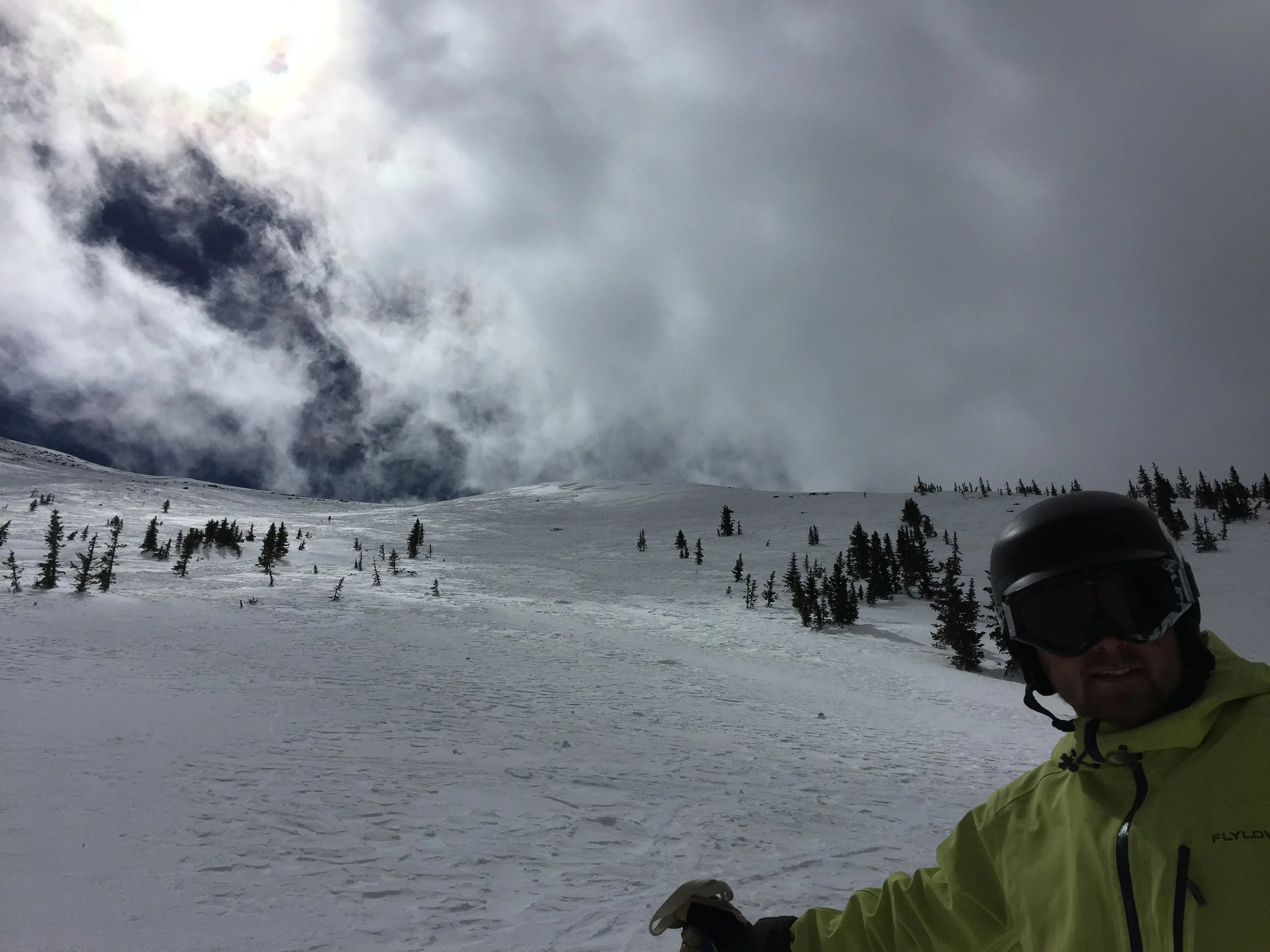
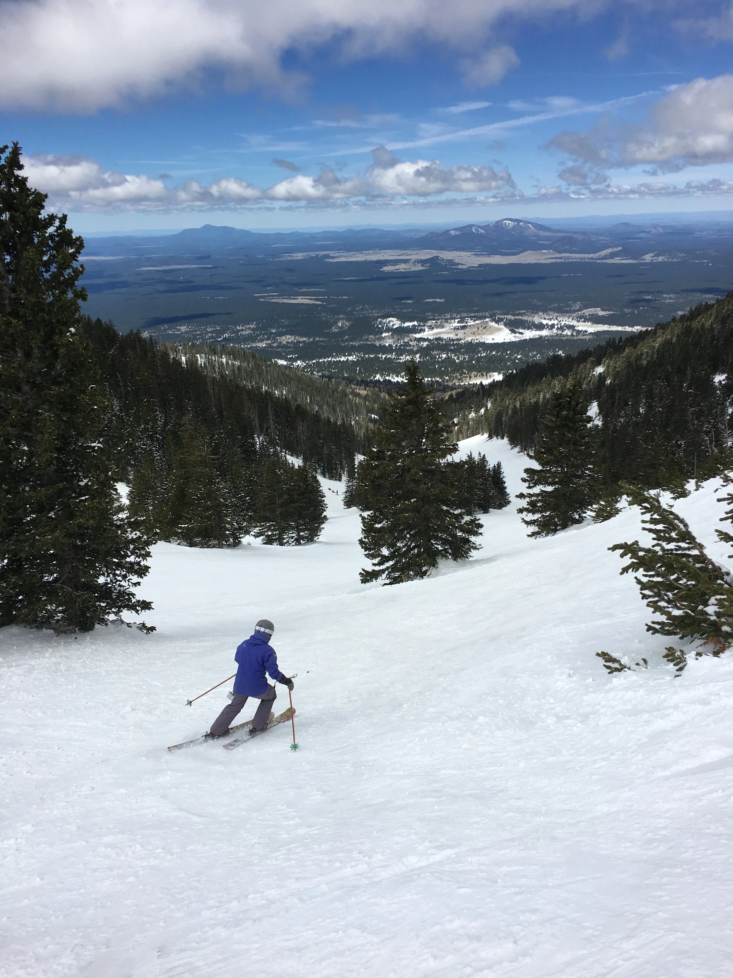
Sunday we awoke and headed up to the ski area just outside of Flagstaff, Arizona Snowbowl. They had a great spring break deal for $29 to ski and get a $15 credit for food/drinks. We spent the morning and early afternoon poking around the mountain searching for softening snow as the sun got higher and temperature climbed to the 50’s. Ahh, Arizona in April!

IMG_6415.JPG
IMG_6398.JPG

We headed into town for a stop at a couple other of the breweries (they have a lot in Flagstaff) and enjoyed the afternoon in the sun and 70 degree weather. Camp was again in the national forest only 10 minutes outside of town.

IMG_6401.JPG

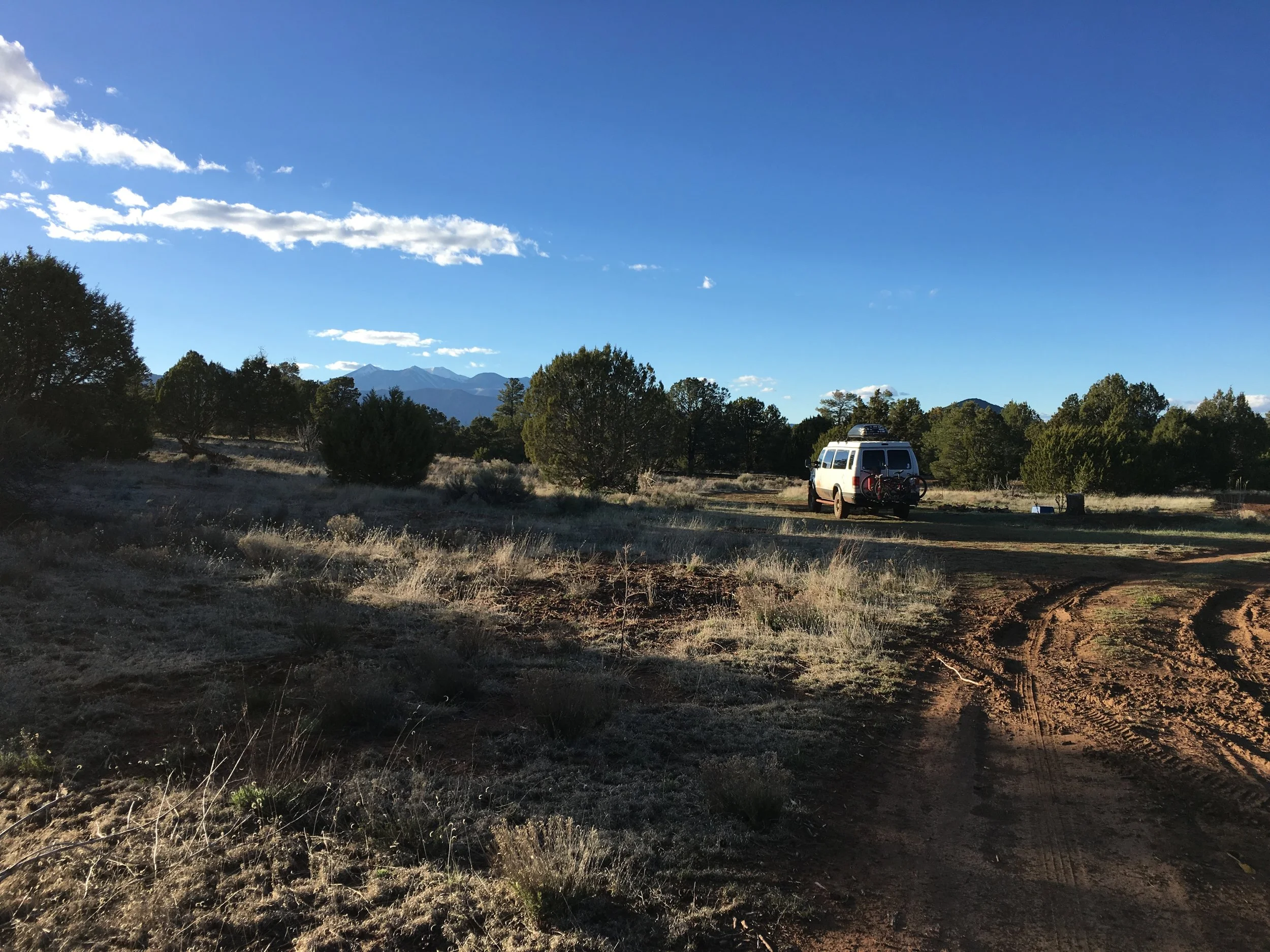
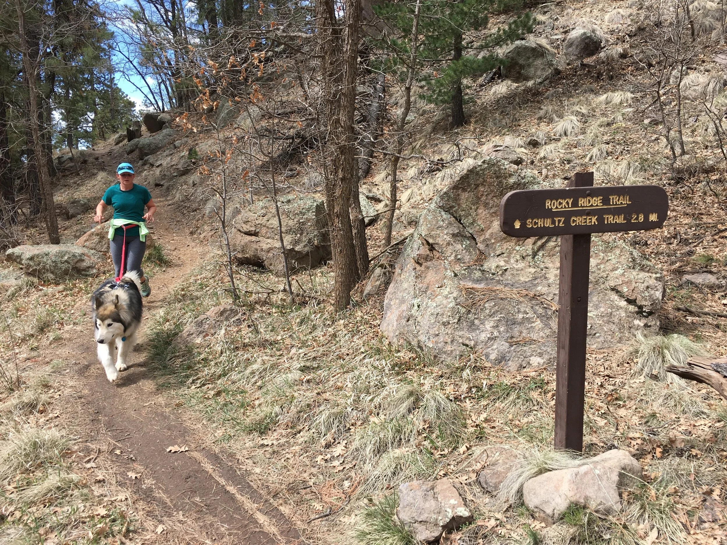
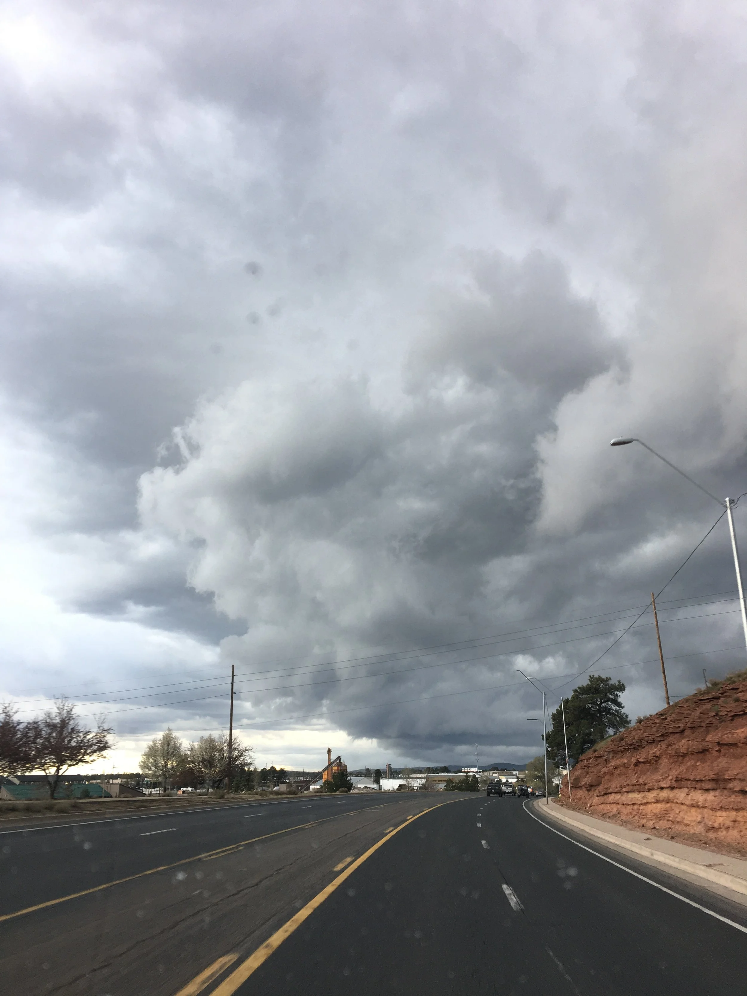
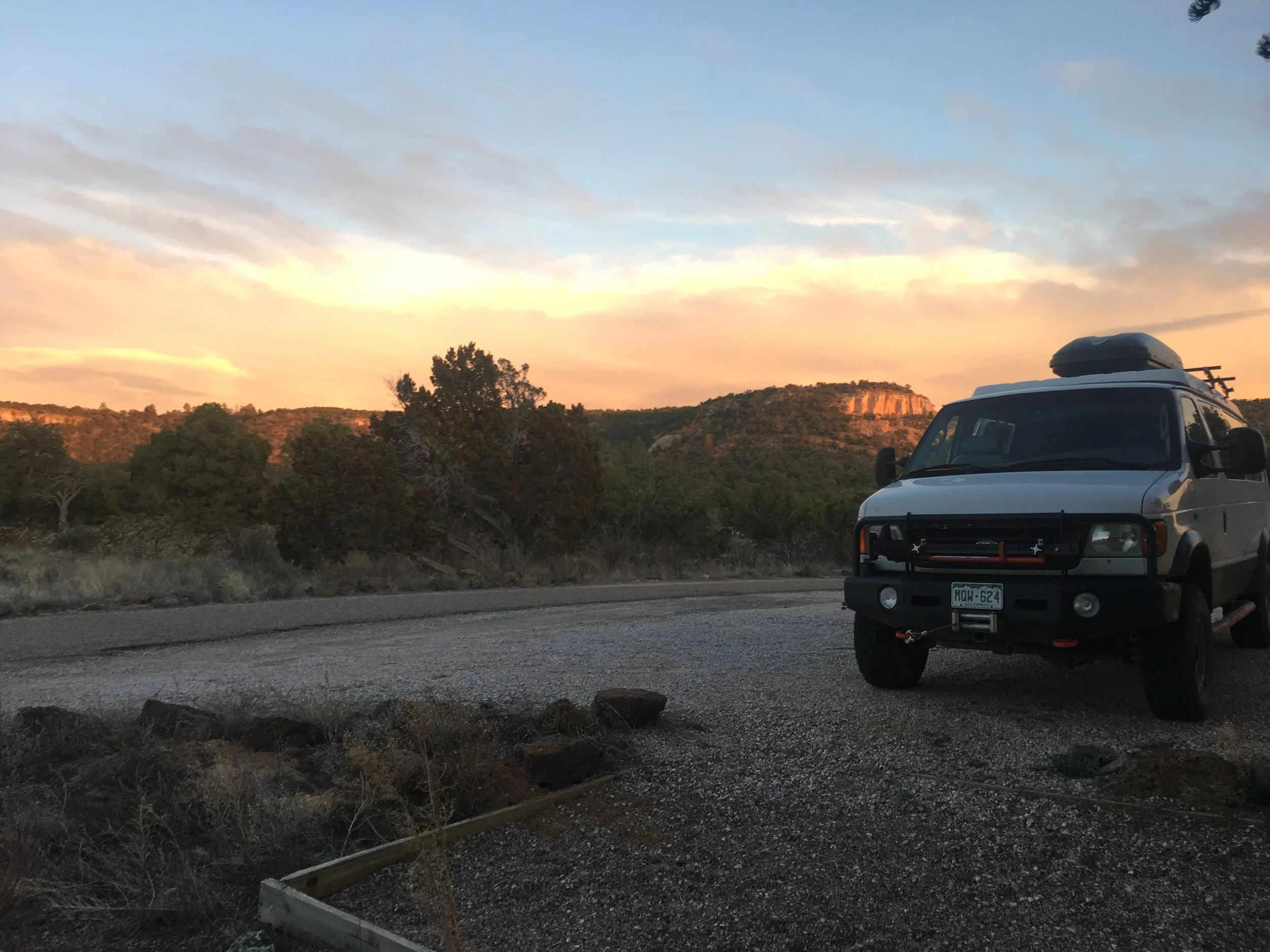
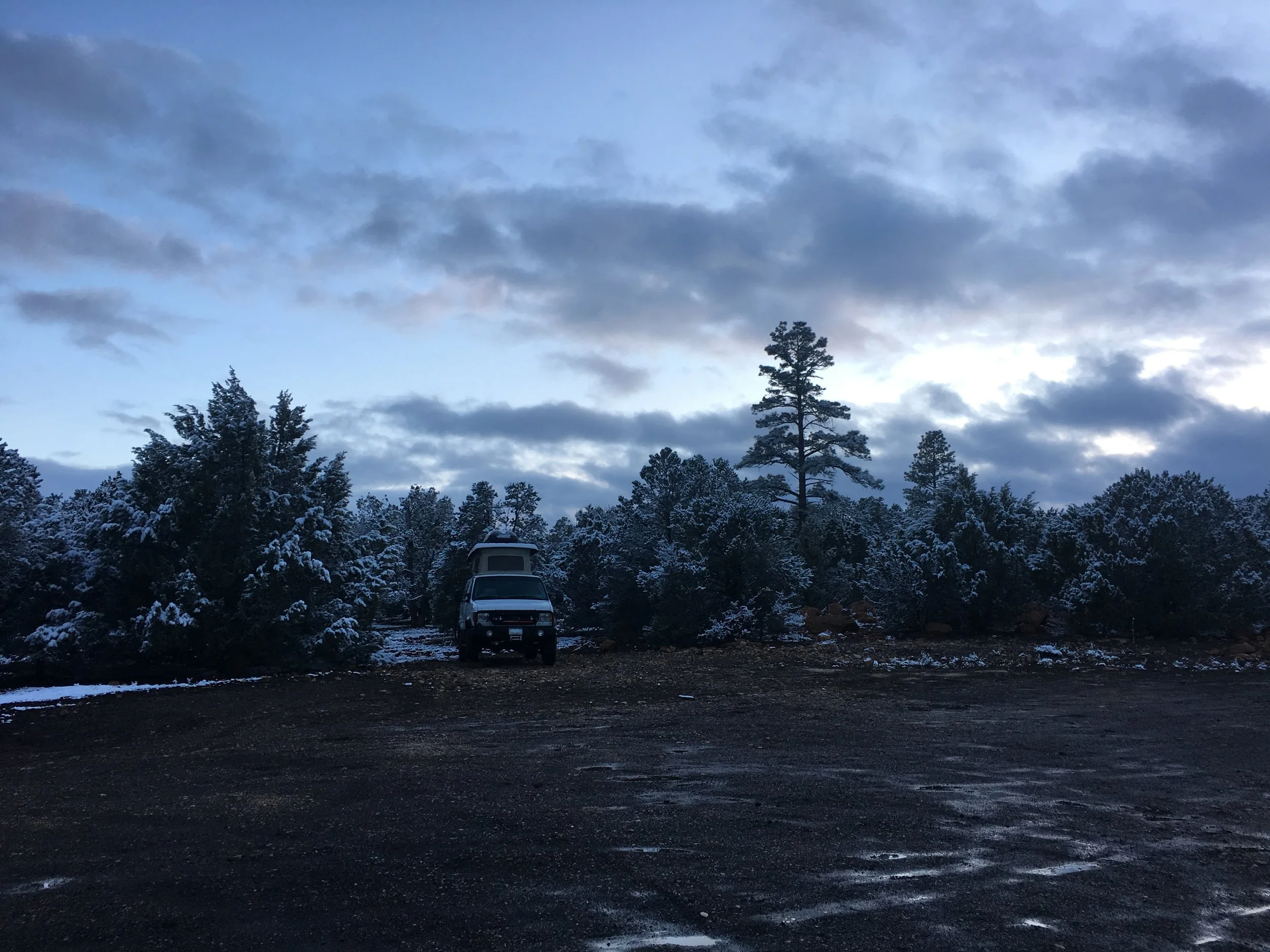
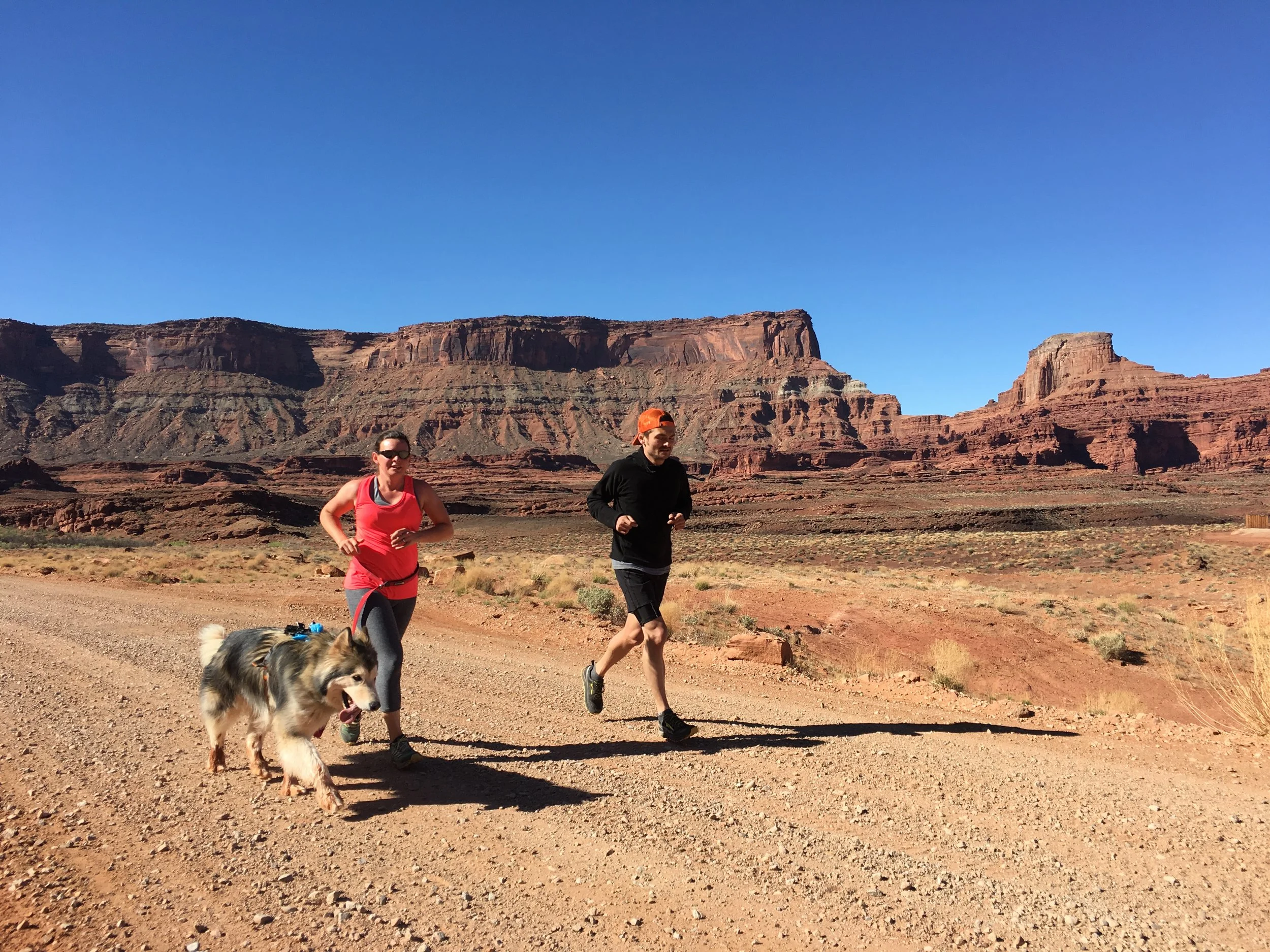
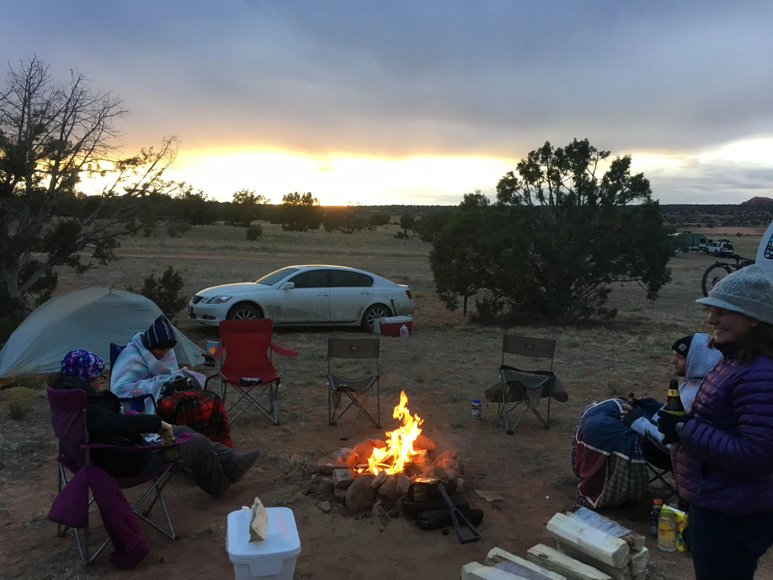
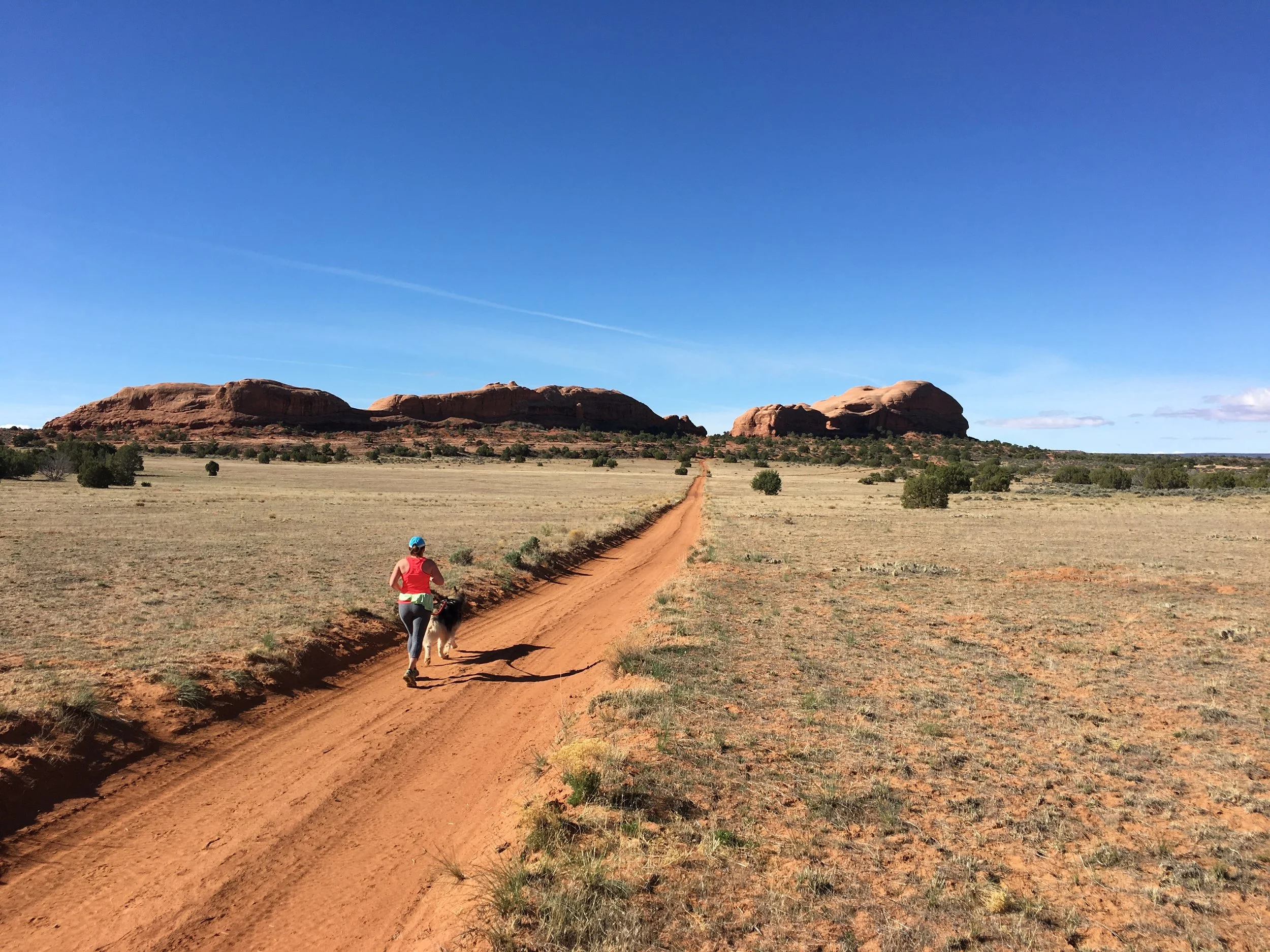
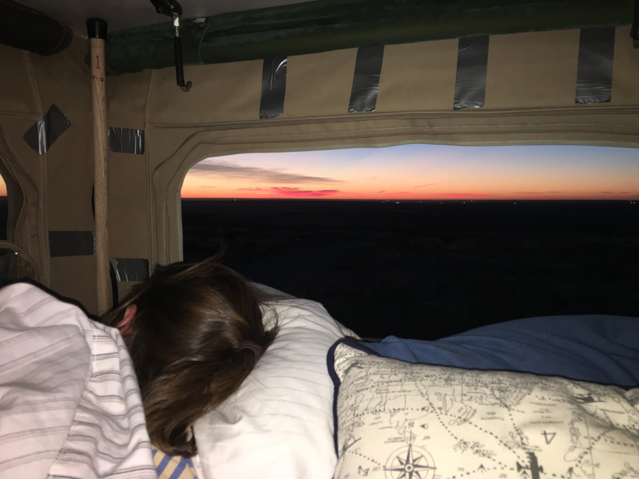
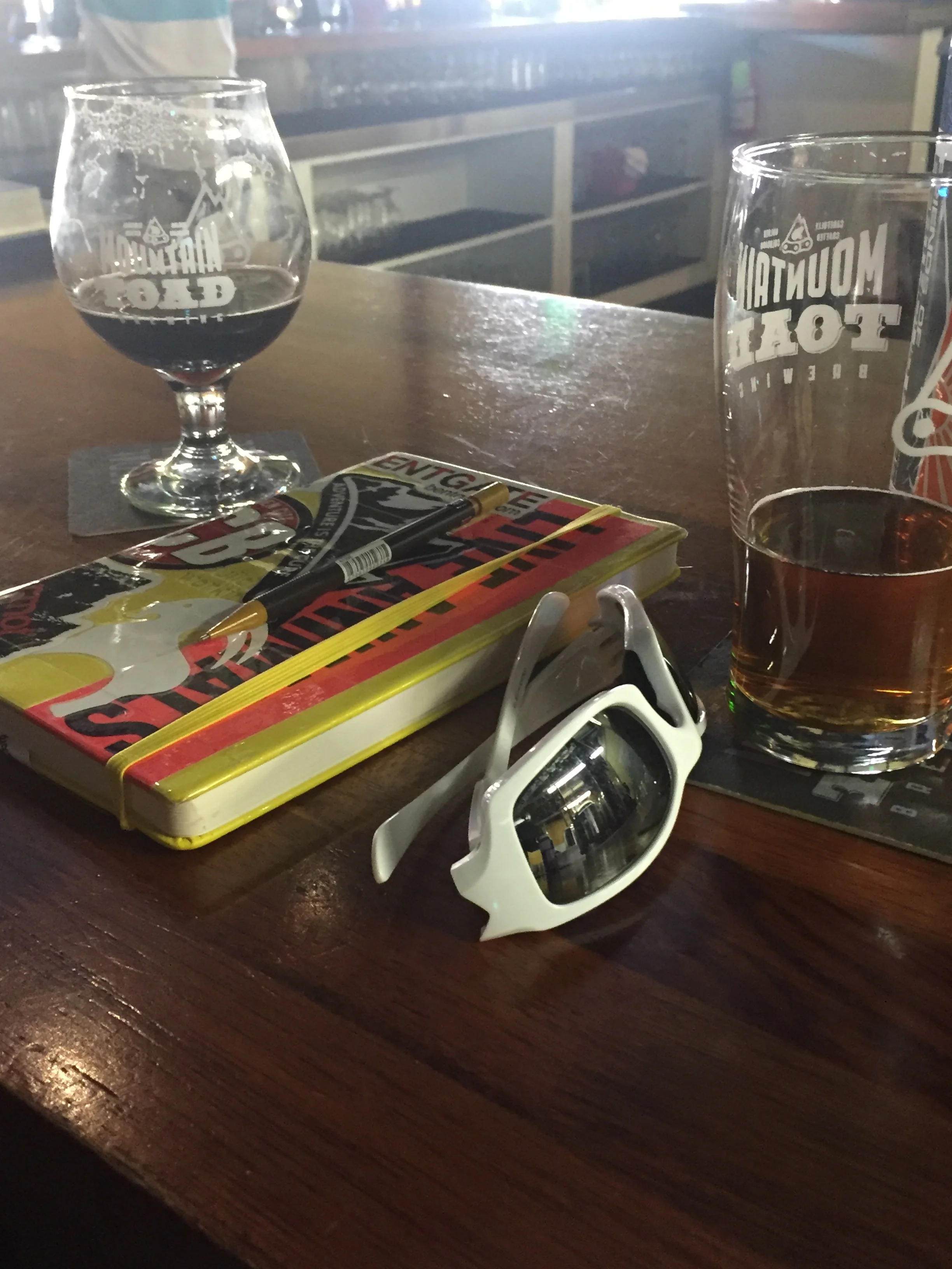
The next morning we took advantage of some local knowledge gained while bottling beer a couple evenings before and got onto some trails in the area. We did a 6-7 mile trail run up above town on a gorgeous morning. We were becoming slightly overdue on a shower and decided to book a campsite at a campground just outside of town to fancy ourselves back up. We watched the NCAA championship game at a brewery/pub in town that evening. On our drive into town from the campground we watched a huge, dark cold front loom over town and as we sat down for dinner the snow came in with vengeance. It only snowed for about an hour or two but it was enough heavy wet snow to plaster all vehicles and we set up camp that night after cleaning the roof off of a couple inches of snow. Flagstaff had been really good to us. It was a much smaller town than we had expected and given that it is actually located IN national forest, there are a ton of activities in the outdoors, National Monuments, trails and even skiing just 30 minutes up the road. Oh yeah, their breweries were pretty enjoyable too.

IMG_6409.JPG
IMG_6413.JPG

Sidetrack #4+ - More videos!!!

We haven't been too good on updating the blog with words because we've been having so much fun making videos.  We'll get back to regularly scheduled blogs shortly but with internet during #houselife we've been catching up on these compilations.  Enjoy!!!

#6:  Our first part of Utah (mainly Zion & the surrounding area) + the Grand Canyon.  


#7:  Some more Utah.  See the description for all the awesome places we hit during this leg of the trip.

Sidetrack #3 - HALF WAY! Nerdy statistics.

So we did the math recently and realized that today (Sun 4/9) was our halfway point of our trip.  We started compiling a nerdy but fun list of random statistics from our first few months on the road.  Let us know any other details you'd like to know.

Places visited:

    > States-37

    > National Parks-15

    > National Monuments-9

    > National Forests-7

    > State Parks-5

    > National Seashores-3

    > National Recreation Areas-2

    > National Preserves-2

    > Scenic Backroads-2

    > National Historical Places-1

    > National Memorials-1

    > National Grasslands-1

    > Ski Areas: 7 (3 nights spent in ski area parking lots)

Plus: National WWII Museum & The Alamo

---------

Miles: ~16,000

Gas Mileage: ~11-12mpg when the bikes were on the roof; ~13-15mpg after the move to the hitch

---------

Breweries: 43 + 2 home brews

---------

Nights:

    > In friends and family homes-31

    > Hotel (paid)-5

    > Hotel (points)-2

    > Campsites (paid)-35

    > Campsites (free)-36

    > Campsites (free that we were supposed to pay for)-3

--------

Sleeping Arrangements:

    > Roof up/sleeping up top-58

    > Roof down/sleeping on bottom-16

Longest streak sleeping in the van: 31 days straight

Coldest morning temperature- +8F

-------

Other stats:

    > Laundry Cleaned-11 times

    > No. of paid showers-3 (showers at paid campsites not counted - just those paying via quarters)

    > Longest streak w/o a shower-7 days (plus a 6 & a couple of 5'ers)

    > No. of days spending less than $20-13

    > No. of days spending $0-2

    > No. of days spending a crap load on van repairs:  I don't want to talk about it!

-------

Any other details you're interested in?  Let us know.

#30 - A bit off the beaten path

3/29-3/31/17. Current location: Mojave National Preserve, California

IMG_6453.JPG

Refreshed and rested, we decided to give Four Corners Monument a go.  From our online research we found that the monument can get quite muddy after precipitation.  Luckily we pulled in and had the place to ourselves, sans vendors setting up for the day.  We wandered through the monument, taking the standard pictures of feet on each corner for the four states that meet there- Colorado, Utah, New Mexico, Arizona.  It feels pretty magical to be the only visitors in a place you know is always busy with lines of people waiting to have their picture taken in the center of the monument.  Our drive out wandered back and forth over the state lines, eventually landing in New Mexico through tribal land.  The rolling hills bought us past the namesake formation for which the town of Ship Rock gets its name.  It does indeed look like an old ship, mast and sails leaning into the wind. 

The bright blue skies and warm sunshine felt good through the windows after a few days of being chilly and wet.  Spring green grasses were a blur as the rock walls of the canyon rim above us slowly moved through our windshield, and then out the side windows and into the rear view mirror.  

IMG_6341.JPG

We turned off the highway onto a washboarded dirt road to the BLM wilderness area of Bisti Badlands.  The parking area was located about 10 miles from the 2 lane highway.  Upon first glance the area looks like canyons of shades of grey, withnot much to see.  As the three of us started to wander into the badlands, the shades of grey started to tell their story.  Darker stripes of grey cut through the badland walls around us.  Lighter grey and whitesandstone eroded into the valley floor, shaping the hoodoos and saucer looking formations along the boundary of the canyon walls.  Wandering through the valley with no clear direction we wanted to travel, we climbed up and over several mounds wanted to see what was just on the other side.  What only looked like dark spots of rocks in the middle of the valley floor, we eventually learned was indeed petrified trees which have been broken down from the weathering process over millennia.  Near the far wall of the typical day use area of the badlands, the valley rose to the canyon walls and offered the Bisti Badlands version of two arches; eroding pillars with a thick rock slab bridging the space between. The 2 mile +/- hike back to the parking area took us through the main area of the valley floor through the petrified tree forest, now reduced to ground level stumps and what was once the trunk and branches is now long lines of darker rock.  What didn’t look like much from the parking lot turned out to be a fun little travel back in time, imagining what the landscape looked like and what animals populated the area.  Side note: a complete T-Rex skull was found somewhere in the Bisti Badlands area in 1997.  How excited was that guy to be wandering around and find that?!  

IMG_6344.JPG
IMG_6455.JPG
IMG_6468.JPG

Bumping our way over the washboarded road back to the highway, we had a decision to make.  Try to get to Chaco Canyon National Monument or continue on south.  We read in our research that any moisture mixing with the dirt roads into Chaco makes it impossible and impassable.  A quick call to the visitor’s center to check on road status only resulted in status for the northern entrance.  Seeing how dry our other stops were we decided to give it a go.  If the roads ended up being muddy, we’d turn around and figure out where to head to next.  The approach from the south into Chaco Canyon turned out to be bone dry and relatively smooth.  There was evidence that someone drove on the road before they were completely dry as there was one set of tracks creating ruts.  The thirty miles of unmaintained dirt road rolled and winded through cow pasture and ranch land.   Entering the national monument the road turned to washboards, a result from the grading process.  Luckily the dirt road within the boundary was short-lived and gave way to pavement.  Quickly we headed to the campground for fear that we’d miss the last remaining campsite and would have to travel back out the dirt road and 3 hours away.  The drive through the campground put any of those worries to rest.  While there were a bunch of people camped, there were more empty spaces than filled.  The air cooled, and song birds sang their last songs as the sun set over the canyon walls.  We strolled down the road to catch the colors over the butte in the distance.  Owls and bats took advantage of the setting sun to catch their dinner in twilight.  The stars began to shine in the moonless sky as we made our way back to camp. 

IMG_6347.JPG
IMG_6354.JPG

Chaco Canyon is full of pueblos once occupied 800-1500 years ago.  We were able to explore a few of them, but many are left in their current natural state- filled in by the desert sands and grasses to protect the fragile structures.   The main attraction at Chaco is Pueblo Bonito, a D shaped structure covering 3 acres and contains at least 100 rooms and was occupied for over 200 years.  The pueblo walls remain in tact, some still 3 stories tall, others 3 feet tall.  The styles of construction shifted over time from larger hand carved blocks to smaller more intricate designs in the walls.  We tried to imagine when the valley was a bustling area, people working together to build additions on the pueblo, gathering rocks for construction, or logs from mountains far off in the distance.  As we walked through the pueblo, ducking through doorways 4 feet tall, we pointed out how the floor supports stretched across rooms and continued through the thick walls to the next room.  All artifacts have been removed from the rooms, making it difficult to understand what the room was used for.  Was it a bedroom, social room, or somewhere ceremonies were held?

IMG_6469.JPG

A highlight of our adventures through Chaco Canyon included the hike up the canyon wall onto the plateau above.  Rooney was able to join us as we traversed the rim of the canyon over shrimp burrows solidified in the rock, along old roads from Pueblo Bonito to lands far beyond the canyon and up to Pueblo Alto.  Views from Pueblo Alto stretched over the valleys on either side of the mesa to the mountains at the edge of the horizons.  It must have been awesome to see thousands of people making the journey across the land to Pueblo Bonito.  

FullSizeRender.jpg
C253D312-A256-48DC-98F8-01ACA11840C7.JPG

We headed south not really knowing where we were heading next.  In the town of Grants, we found ourselves in another place that people flock to- a brewery.  Junkyard Brewery is on Historic Route 66 and is exactly as it sounds: a working junkyard and a brewhouse.  We walked in not really knowing what to expect and were asked if we were there for parts, or for beer?  Beer, please!  We looked around the garage area/brewery as we waited for our beers to be poured.  Unfortunately, some work was being done on their boiler, and they didn’t have any of their own brews on tap.  We drank our pints and chatted with the two guys working at the duel establishment.  I have to say, it was one of the more interesting places we’ve had a beer.  

IMG_6359.JPG

Continuing through town and into the hills beyond, we noticed a shift in the scenery from desert sands to volcanic boulders and lava fields.  Feeling kind of silly, we admitted we had no idea New Mexico had a volcanic history.  We pulled into El Morro National Monument and set up camp as the temperature began to drop, giving hints that a cold front and some weather was making its way towards us.  Strong winds pushed the van around as we made dinner and relaxed.  We’d be sleeping ‘downstairs’ tonight.

IMG_6369.JPG

The next morning started decently well but the weather did show up with snow and wind while we were walking around the paths of El Morro National Monument.  The key features of this park are a large pool of water at the base of cliffs about 500’ high that was used by native Americans, Spanish explores and westward pioneers.  While they were resting at this oasis they also inscribed their names on the cliff walls for hundreds of yards.  We saw petroglyphs directly next to Spanish explorers from the 1500’s and up to names and cities from explorers in the 1800’s.  Some were perfectly chiseled into the rock like professional engravers.  A cool spot to walk around in a snow storm for an hour or so.

IMG_6373.JPG
IMG_6376.JPG
IMG_6377.JPG

We continued westward to get through some of the weather rather than stay up higher in the mountains for another day.  On our way we made a stop at Petrified Forest National Park.  We drove the scenic road with some short stops and did hikes at Crystal Forest and Big Logs.  It was really interesting to learn about how these perfectly preserved trees are now rock and colorful based on the minerals in the volcanic ash that crystalized them some 200 million years ago.

IMG_6380.JPG
IMG_6470.JPG
IMG_6461.JPG
IMG_6466.JPG

We rolled into the national forest just outside another national monument near Flagstaff as snow started back up and we picked a semi-dry pull out about a mile or so away from the park.  We waited to see how much it might snow that night…in Arizona…at the beginning of April. 

IMG_6384.JPG

Sidetrack #2+

We've posted a few more video summaries of our trip. The east coast, the southern coast and the Rockies. Enjoy!!!


#29 - Some new and familiar places. Some new and familiar faces.

Entry #29 3/21-3/28

Current Location:  Mojave National Preserve, CA

IMG_6230.JPG

In no particular rush to leave Muley Point we leisurely took in a different perspective at sunrise and early morning.  We met and chatted with a fellow van-traveller (@josiahq on Instagram) who’s green Westy, Barb the Barbarian, took some very photogenic shots perched atop Muley Point.  Plus Josiah gave us the spark to pull Hobbes up to the same edge and get some pretty awesome photos as well.  No Mom, we didn’t sleep right on the edge like that…don’t worry!

IMG_6229.JPG
IMG_6426.JPG

We packed up and headed down the famous Moki Dugway switchbacks, a 1,000’ or so of winding dirt state highway down to the base of the Valley of the Gods.  We poked around Mexican Hat, UT and its namesake rock formation just outside of town and then drove the dirt road through Valley of the Gods.  The road is pretty darn smooth by dirt road standards and we cruised along in and out of the pillars and cliff walls.  We eventually settled on a nice camp spot set up above the road by about 20 feet and looking west towards much of the valley.  We spent the afternoon relaxing, airing out some sheets in the dry desert wind and reading as the sun creeped closer to the horizon.  Sunsets in southern Utah rarely disappoint and this was no exception.  We set an alarm with sunrise at the famous Monument Valley road on the agenda.

IMG_6431.JPG
IMG_6443.JPG
IMG_6446.JPG
IMG_6420.JPG
IMG_6448.JPG

The pavement stretched out like an arrow, narrowing to an almost point as it reached its low point a couple miles away and then continued onwards in a thin line you could no loner distinguish road paint or lanes.  The buttes and spires that form the backdrop were dimly lit by the pre-dawn reds and pinks that come with a partly cloudy sunrise. I’m sure there are innumerable other ways to describe this view but you likely know exactly what scene I’m painting; movie scene that is.  I believe the quote is “I’m pretty tired…I think I’ll go home now.”  Forest Gump ends his years’ worth of running on this stretch of road on a very similar morning.  The producers chose a hell of a spot and even if it wasn’t such an iconic film or scene, this stretch of road still would have drawn an early alarm and every form of ridiculous moment capturing technology we have at our disposal.  I always catch myself clicking away at photos but thankfully in places like this I still remember to just stop and listen to a silent desert and watch one set of headlines about 5-10 miles away silently climb the hill towards the towers.  I actually expected there to be more people there but save one other guy with a tripod driving from pull out to pull out capturing a similar scene to us, it was mainly the school buses (only two actually) that shared the road for the better part of 15-20 minutes.  

IMG_6255.JPG
IMG_6424.JPG

As the sun rose behind a good bank of clouds we made our way towards the “official” Monument Valley on tribal Navajo land but decided we didn’t want to pay an extra $20 to see a very similar scene to what we got to watch along side the silent highway.  We did an about face and pointed north to Moab to meet up with some friends for the weekend.

We rolled into town for much needed groceries, laundry and showers (!!).  After we met up with Mike Moriarty, in town for a borderline crazy run of 50 miles on Saturday.  We headed up to a spot above Pucker Pass at the top of Long Canyon near the entrances of Canyonlands National Park and Dead Horse Point State Park.  We pulled into windy, cloudy skies and found a spot on the slick rock to set up our little compound for the night.  It’s funny how having one other vehicle around and stringing a set of lights between them feels like a little town to us.  We spend the evening and next morning wandering the top of the canyon and catching up on recent doings.  The next day we took the scenic route into town via Gemini Bridges road for a bit of easy wheeling, broke out the climbing shoes for what by most climbers would be considered a half-ass, joking attempt at bouldering but it was nice to feel the fingers and forearms burn a bit.  

IMG_6264.JPG
IMG_6432.JPG
IMG_6428.JPG

We set up shop down Kane Creek road, further than Lara and I had been before which was a nice new exploration of the Moab area.  An afternoon of chatting, watching the sun make its pilgrimage to the horizon and drinking a beer or two.  

IMG_6268.JPG

We got in an easy jaunt of a run on Friday morning to help Mike stretch the legs a bit and get Rooney and our lazy asses some exercise.  We partook in some more new-to-us Moab via the Moab Museum which is a great collection of geologic, native, exploratory and recent history.  You’ve got a climbing cam right around the corner from some petroglyphs which are next to the gieger counter used in the uranium boom. 

IMG_6280.JPG

We met up with a few others in the group and headed towards the start-finish line of Mike’s race.  We circled the wagons, so to speak, of the 5 cars we had in a big open field with a few hundred other people, most of which were there for the 50 mile, 50k or 30k trail race the next day.  We laughed our way through a few bundles of wood and beers.  We arose early for Mike’s 50 mile o’dark thirty start and watched the line of 50 or so headlamps romp into the distance.  We drove what seems like a hell of a distance back through town and out Kane Creek road again to watch Mike come through at mile 18 and mile 33, both times he seemed pretty strong.  In the downtime we wandered some short side canyons and chatted with friends.  Eventually we worked our way back to the finish to see an impressive run by Mike at 9:50 (+/-).  Ten hours of any Moab activity (biking, jeeping, 4-wheeling), on difficult trails is a big day but the same route on your feet is both gorgeous and truly impressive.  Well done Mike, we’re glad we could be there for it.

IMG_6299.JPG

On Sunday the area cleared out and instead of poking around town and/or moving on we decided to take advantage of one more beautiful spring day before some weather was scheduled to move in Monday.  We went for a run on bits of the course from the day before making a drastically shorter loop than any of the race lengths and set up camp against a prominent rock feature in the Behind the Rocks section south of town.  This particular site we saw on our run and features a huge cave that we can only imagine how many people, both recent and historic, have spent a night or had a fire.  We ran around finding different vantage points during a brief but surprisingly vibrant sunset before salvaging some left over firewood in the cave for what would only do the site justice.  I’ll let the pictures do some of the talking here but it was truly a great evening reflecting on our site we occupied for such a minute piece of history.

IMG_6307.JPG
IMG_6310.JPG
IMG_6314.JPG
IMG_6458.JPG
IMG_6463.JPG
IMG_6460.JPG

We got in a brief morning run before heading out of Moab.  It was bittersweet because knowing we won’t be a 6 hour drive from this absolutely amazing place in our life was difficult to swallow.  I have no doubt we will be back to Moab because its that special of a place for us but having no foreseeable plan for such a trip was definitely on my mind.  

We headed through rural southeast Utah and into southwestern Colorado with a stop down a long dirt road and the Lowry Pueblo, part of the Canyon of the Ancients National Monument.  This was the first in numerous stops in the next week or two to interact with the human history of the southwest over the past numerous millennia.  We also stopped at the Anasazi Heritage Museum in Dolores, CO which houses an impressive mix of geologic and, mostly, native history.  The winds that were strong all day now drew in much colder air and we settled in at a campground/RV park just outside Mesa Verde National Park for electricity, showers and a quick jump in the hot tub as storm driven snow started to fly.  

IMG_6467.JPG
IMG_6337.JPG

The night and much of the next day were a mix of rain, snow, clouds and an ever present wind.  We spent most of the day catching up on odds and ends and relaxing in the van.  We decided to venture out for some shopping and a nearby brewery.  A day well spent as we planned our next compass direction.  

E

#28 - Goblins and Bridges and Sunsets, oh my

3/19-3/20

Current Location: Chaco Canyon National Historical Place, New Mexico

We made our way from Capitol Reef to Goblin Valley State Park on Utah highway 24, but only passed a few people along the 2 to 3 hour drive. We felt secluded and the landscape around us didn’t suggest otherwise. We were able to find a dispersed campsite outside Goblin Valley, near the Wild Horse Canyon Trailhead, off BLM Road 1160. There were many other people camped around the area, but we had this little corner of the road to ourselves.

See lil ol Hobbes down there? 

See lil ol Hobbes down there? 

After setting up the van into Hobbes mode aka into camper mode vs. van mode (like the tiger, he comes alive when no-one else is around), we hiked up a hill to overlook the area around us. The vertical gain of about 100 feet did change our perspective a bit, and we could see much further into the valley surrounding the San Rafael Swell.

Near sunset we hiked down the wash a half mile or so, and found a natural spring/ seep off the off-roading track. The lush green grasses gave away the location of water in the desert. The number of deer and other critter tracks indicated they knew the secret too.

IMG_6190.JPG

We arrived into Goblin Valley State Park before the offices opened. After filling out our self pay envelope we continued onto the main parking area. From the parking lot, you overlook miles of valley filled with hoodoos, spires and goblins- pillars of eroding sandstone with rounded rock tops. All of Utah’s state parks are dog-friendly, and the 3 of us were quickly down into the valley, wandering among the formations. For the next few hours, Rooney had a smile on his face as he smelled all the smells, and explored all of the nooks and crannies of the valley, happy to be out exploring with us. At one point we pointed ourselves towards the canyon of hoodoos. We climbed over, ducked under and around fallen hoodoos and goblins. Without much effort we climbed to the top of the area and could see for dozens of miles outside of the park. That spot ended up being a complete dead end and we amused ourselves at trying about half a dozen other exits to the random section of the park with, not surprisingly, quite fewer footprints than the rest. But alas, through the maze of formations we were able to retrace our steps back from whence we came and made it back to the parking lot as it was getting more crowded and the temperature started to rise.

IMG_6122.JPG
Goblins and grins  

Goblins and grins  

IMG_6203.JPG

A quick stop into the visitors center for our souvenir patch led to learning about Little Wild Horse Canyon, just outside of the park boundaries. Little Wild Horse Canyon is a canyon formed by the flash flood waters, much like other canyons in the area. This one happens to be extremely narrow yet hundreds of feet deep and, quite accessible as a fido-friendly hike. The trail heads straight up the wash into the ever narrowing canyon. The closer to the cliff walls, the more the walls around you twist and turn, exposing the colorful underlying sandstone smoothed over time by violent floods. We had been looking for an easy/beginner slot canyon to go explore and this was a perfect fit that came out of nowhere.

IMG_6189.JPG
IMG_6185.JPG
IMG_6134.JPG
IMG_6196.JPG

From Goblin Valley, we continued our tour of Southern Utah to Natural Bridges National Monument and Bear Ears National Monument. That afternoon we made the drive down towards the pair of monuments crossing over the top edge of Glen Canyon, where we had camped a week or two ago at the far southern end. This area seems truly wild. The canyons had not been flooded by the lake and it turned out to be one of the most remote places we had driven, seeing only a handful of other cars for the hundred or so miles we gawked at the slot canyons we passed.

Somebody's pooped!! 

Somebody's pooped!! 

We camped on Elk Mountain Road outside of Natural Bridges. We had tried to explore some upper parts of the mesa that the road tops but a number of those sites were taken so we “settled” for a nice, level pull-out from the road still clear of the trees and a great view for sunset to the west.

IMG_6155.JPG

The alarm went off early and so we could get into Natural Bridges and see the sun rise over the canyon of the San Juan River.  The sky filled with pinks and purples as the sun rose over the  Bears Ears formations of Bears Ears National Monument.  We drove around the park, stopping at each pullout to get out and see the bridges in the canyon below.  We decided to hike down to the river bed, at Owachomo Bridge.  I could have sat next to the river all day listening to the river echo against the canyon walls in the warm sunshine and the cool breeze. We didn’t however - Rooney was confined to the van and we knew of a few great camp spots we were looking forward to getting to. 

IMG_6178.JPG
IMG_6162.JPG

Mulley Point over looks Valley of the Gods and Monument Valley in the distance. Even another layer down is the San Juan River that carved itself a few more hundred feet of canyon walls already about 1,000’ below us. We weren’t sure of exactly where we’d camp but as soon as we pulled up, at 10am, we knew we’d just set up shop and enjoy the rest of the day.

IMG_6436.JPG
IMG_6216.JPG

We spent the afternoon wandering and sitting on the hills of sandstone overlooking the many layers of valley and canyon below. As the afternoon wore on, we watched a storm build and pass over the valley and our campsite. It was nice to see some “weathering” as we called it after numerous days of straight blue sky and afternoon winds. Just as the sun was about to set an arch of clear sky formed directly in the west allowing the sun to drop below the billowing clouds above our heads. The wind calmed and the sun shone directly across the mesas, buttes, canyons and desert below us and lit up the clouds above us. We jumped around like little kids ooo’ing and ahh’ing at the pillows of orange and yellow in the clouds and how green a tinge the desert floor below us was. We hopped around the rocks to take our sunset pictures as the monuments below were lit by the setting sun. For an added bonus, the sunset cast a vibrant rainbow against the dark storm clouds to our east. It was frankly one of the best sunsets we could have asked for. The setting, the clouds and the sun all came together for a lengthy period of time for us to sit, snap photos and silently take in this beautiful place.

IMG_6430.JPG
IMG_6221.JPG
IMG_6226.JPG
IMG_6439.JPG


Post-script: We put a post on Instagram about this pretty magical place we spent a few days in known as Bears Ears National Monument. I don't want to get into a political shitstorm (because our current American Culture can't help but deteriorate to that instantaneously these days) but this National Monument should be kept for this type of enjoyment. There are lands with historical and sacred meaning to a people we have so easily set aside in the past. Seriously, there are dozen of native dwellings, meeting places and relics scattered about Bear Ears. There is natural beauty that rivals any National Park (sans gift shops and snack shacks). To revert this land to private enterprise and forever alter it because it's easier than tackling a broader energy discussion will dot those pictures above with man's/America's fingerprints. It will eliminate the possibility of anyone who just read our post and said 'man, that's gorgeous. I'd like to see that one day.' from experiencing it the way we were so privileged to. I'm not going to tell you what to do, think or believe. Just give it some thought and I'm sure you're all bright enough to find the resources you feel most compelled to support. I hope you decide to defend Bears Ears. 

#27 - Another day, another park

3/18-/19/17

Current Location: Valley of the Gods, Bear Ears National Monument

IMG_6026.JPG

The drive up to Bryce Canyon was scenic and relatively quiet. We were among a few cars we assumed were all headed to the same place, but gradually we separated from each other. As you get closer to the park, but still several dozen miles away the land begins to change and you get glimpses of how the geology of the area is changing. Passing through bridges cut from the sandstone, and past hoodoos (unusually shaped spires) we started to get giddy for what we were about to experience. After a stop in the visitor center to have a chat with a ranger, who was excited to have an original conversation about where to camp in the area, we drove out of the park to try and find a place for the night.

After several attempts up dirt forest service roads, only to be turned around by what looked like dry dirt, but clearly wasn’t, we decided we’d opt for a small loop road near the park. Not our first choice, but there was nothing wrong with it either. Back into the park for some exploring.

IMG_6027.JPG
IMG_6187.JPG

By all accounts, Bryce Canyon is nothing like Grand Canyon. The rock is shades of oranges, chiseled away from the pine tree covered mountain side by freeze/thaw cycles and wind. A much smaller park, and with much less people, it was even easier to find quiet areas. The amphitheater is the famous must-see of the park, and it does not disappoint. We got out and wandered around the main areas of the park before driving out to the end of the road to work our way back so that all of the pull-offs were on the right.

IMG_6206.JPG

As the day wore on, there were less and less people in all of the pullouts, many making their way towards Sunset Point. We opted to stay further within the park at Ponderosa Point to watch the sunset and the stars come out. We made dinner in the parking lot as the sky grew darker. Pulling into another pull-out we saw an RV parked for the night. Decision made- we parked and set ourselves up to spend the night in that parking lot. Seems like the 'rules' are the same here as Grand Canyon. 

IMG_6035.JPG
IMG_6205.JPG

The alarm went off early, and we made our way to the amphitheater for sunrise over the hoodoos. We packed our backpacks and had a quick breakfast and set off on a hike down through the formations along Queens Garden to Navajo Loop. The sunlight over and thought the hoodoos was spectacular. The oranges of the rock were vibrant against the bright blue sky. The 3 mile walk was slowed by taking lots of pictures and looking around at the beauty around us. Returning to the lot, and to Rooney who manned the van while we were gone, we leisurely had a second breakfast of snacks and got the van ready for drive-mode.

IMG_6039.JPG
IMG_6213.JPG
IMG_6086.JPG
IMG_6197.JPG

The drive from Bryce Canyon to Capitol Reef took us between ranches on either side of the road, down through a canyon and a few little towns. We stopped in Torrey just before the park for some water. As we crested the hill between town and the park, the landscape shifted dramatically and instantaneously. From large cottonwoods and grass to desert and towering cliffs and deep canyons. Early explorers named the area for the dome shaped rock, resembling the capitol building dome roof that was among the cliffs. Reef refers to a barrier because many of the earl explorers were of the sea-faring type and a reef was any difficult barrier. 

Capitol Reef NP: where you constantly look like a drunk photographer because the landscape is tilted. 

Capitol Reef NP: where you constantly look like a drunk photographer because the landscape is tilted. 

We opted to drive along highway 24, through the top of the park stopping along the way at pullouts, the visitor center and any quick jaunt.  We ended up out the other side of the park to find camp. There was a great spot just outside the park boundary on BLM land along Notom-Bullfrog Road that over looked the canyons below. While there were a few cars that stopped along the road to take in the scenery, no-one pulled into the other campsites. Sunset did not disappoint and neither did the stars.

IMG_6052.JPG
IMG_6181.JPG
IMG_6057.JPG

Up with the sun and into the park to explore before the heat of the day set in. We drove the scenic road through the park to the trailhead for Cassidy Arch. ‘Trail’ is up the wash and along the sandstone walls above. The wash was dusty dry, but told the story of high waters from flash-floods. At the top of the trail, overlooking the arch, we stopped and watched a group of boy-scouts out for an adventure- rapelling into the canyon below the arch. Their trip would take them down three 100+foot rapels, down to the wash below. We were able to get in another quick hike up Capitol Gorge, a hike up a different wash to the “tanks” in the sandstone. The tanks are depressions that fill with rainwater, some quite deep, harboring the tiniest lifeforms of shrimps, water bugs and worms that spring to life after being dormant in the dry environment.

IMG_6207.JPG
IMG_6069.JPG

We continued down the road to find a shady spot for some snacks and to continue our trip planning for the next few days. Rooney was happy to be out of the van and sprawled out on the cool sandstone pavers under the picnic tables.

IMG_6071.JPG

While the parks and areas we have visited in Utah are close in proximity, they are extremely different in geologic formation. With each new area we explore, we continue to be fascinated with the different environments within the desert.

IMG_6073.JPG

Last year we took a photo with the Alma, CO town sign. Now Lara and I covered the D'Orvilliers grandparents with Giles, UT

#26 - All the National Parks

 3/12-15/17

Current Location:  Notom-Bullfrog Road, BLM Land just outside Capitol Reef National Park


We took advantage of Rooney enjoying another night with his new best friends to hike Zion National Park and get some riding in.  As we had partook in the last day of the year to driving yourself around Zion we headed in to ride the shuttle around Zion Canyon and sightsee and hike some other trails. 

IMG_6104.JPG

We knew what a mess the park would be midday on a weekend around spring break so we got there around the first shuttle, about 7am, and started a hike shortly after to the Emerald Pools.  This was a nice morning jaunt of a few miles and a decent climb.  We could see the lower pools but the trail directly to (and under I believe) was closed due to rockfall.  We had the upper pools to ourselves and I scrambled nearly under the falls that fell a 100-200 feet from the narrow crack on the red rock canyon wall.  The water cascaded into a veil by the time it crashed onto the rocks below, all funneling down to the basketball court sized pool before working its way further down into the canyon.  We stayed around for a few minutes watching the sun crest the walls a thousand feet high on the opposite side of Zion Canyon and light up the waterfall.  We scampered back to the shuttle and took it to the end of the canyon road to the Narrows.  The river had increased from about 50 cf/s only 3-4 days ago to over 150 cf/s this day, meaning any upward travel through the riverbed was not allowed.  Looking at the river and knowing the temperature of the water was only about 40 degrees we were glad the decision was made for us.  We were told the day before (at 115 cf/s) sections were waist to chest deep so full wetsuits were needed.  We looked at the Narrows from a distance, a little disappointed to not see one of the highlights of the park but glad we got a similar experience at Kanarraville Falls the day before. 

IMG_5919.JPG
IMG_5940.JPG

As predicted the park was a zoo around lunch so we headed out back to our campsite from the night before knowing there is a nice system of trails to mountain bike directly from camp.  We had a beer and geared up for some easy trails that rolled through the sagebrush bushes along relatively smooth single track.  Not having truly mountain biked in a while it was a nice couple hours of screwing around on easy trails and enjoying the nearly 80 degree afternoon.  After we made dinner under another beautiful sunset across the 40-50 miles we could see in each direction from our site. 

IMG_5930.JPG
IMG_5936.JPG
IMG_6204.JPG

Without any real plan we pointed ourselves towards the Grand Canyon the next day.  We made it as far as the UT/AZ border and the Glen Canyon Dam visitor center where we chatted up a fellow Sportsmobile owner.  In talking about each of our respective trips he mentioned he had spent the previous night on Alstrom Point above Lake Powell back in UT.  A 5 minute internet search and with his recommendation we pointed back north into UT and some healthy dirt roads.  We traveled over 20 miles on ever-less smooth roads.  I don’t want to say they were rough because by off-roading and by our van standards they were pretty tame.  We seemingly passed through just about every geological era as we covered the van in numerous shades of dirt.  From volcanic gray dust to red sandy double track we had just about every form of dirt road you can imagine.  At about 20 miles and a few random turns around the desert we approached the edges of cliffs above Lake Powell and the “rock garden” everyone described.  All 2wd high clearance and cross over SUVs are typically turned back here (not that we saw a soul for this entire drive).  We poked our way across slick rock, marked only by piles of rocks every few hundred feet and a general compass direction where we thought we wanted to go.  We finally rolled up to the highest and last point we could to Alstrom Point which, if the gas is hit instead of the brakes, we’d end up pulling a Bonnie and Clyde launch into oblivion.  This was a narrow point, maybe a football field size plateau overlooking a thousand feet or so of southwest sheer walls down to the curving shores of Lake Powell

IMG_5961.JPG
IMG_6200.JPG

Although our expectation, and everyone else’s experience, has been solitude we did have a group show up right behind us in a side by side ATV and an SUV who were taking engagement photos at the point.  They stayed much of the afternoon and through sunset but they were nice and we chatted a few times as we all wandered around the mesa top and enjoyed the sun.  At one point we heard a buzzing rapidly approaching from the southwest and in an instant a scenic helicopter buzzed our two groups not more than 30’ above us at full speed.  They clearly knew the area because their aim was perfect to almost scrape Alstrom Point and the top of the van and then in a second be over 1,000 of cliff, dropping quickly towards the lake.  They made a beeline for a huge feature known as Gunsight Butte and threaded the needle through the namesake notch in the butte.  We were all left stunned for a few seconds and then, giddy, tried to track the helicopter across the lake to its next move. 

IMG_5971.JPG

The happy couple, their friends and photographers departed as the sky fell dark and we sat out on some rocks looking down onto the lake eating dinner.  The sunset beauty was equaled by the full moon rise shortly thereafter.  Photos abound in the desert during early and late parts of the day. 

IMG_6183.JPG

The next morning, alone for dozens of miles other than the one boat we could see camped on a sandy beach well below us on Lake Powell we ate breakfast and wandered the mesa before bouncing ourselves back towards dirt and civilization.  This was a perfect sidetrack from a random recommendation in a touristy parking lot.  The remote nature of this spot, the views and the weather were exactly what we had pictured for our trip.

IMG_5985.JPG
IMG_5990.JPG

We now headed south towards the Grand Canyon, fully preparing ourselves for the exact opposite to the solitude we had experienced the few days prior.  We stopped at the famous Horseshoe Bend with about a few hundred of our closet foreign tourist friends and made our way to check out some forest service roads just outside of the Grand Canyon for campsite ideas.  We hung out for the afternoon, cleaned some and made lunch before heading into the park for a round of late afternoon braving of parking lots that are absurdly large, snack bars and yelling children.  That aside the views into the Grand Canyon are gorgeous and it’s not too difficult to find some quiet pull outs and view points.  We watched sunset with about a hundred other people from a random view point.  As the sun set the crowds disappeared and only a few of us remained to watch the colors change in the sky and the stars come out.  We went back to the van and made some dinner while the sky darkened and saw a few other campers in the lot, clearly set up for the night.  We somewhat did the same but had planned to leave back to the forest service roads after cooking and taking some star pictures with the canyon.  After another stop at a view point and more campers set up, we decided to just set up ourselves where we planned to watch sunrise, at Grandview Point.  Turns out there is either a policy to allow or at least no enforcement to the contrary for sleeping in a car/camper in the lots for the view points of the Grand Canyon.  Who knew?  Worked out well for us.

IMG_6111.JPG
IMG_6099.JPG
IMG_6211.JPG
IMG_6208.JPG
IMG_6013.JPG
IMG_6095.JPG
IMG_6018.JPG

The next morning we walked the few feet to the viewpoint to take in the sunrise of the canyon with some other hearty tourists and photographers. 

As a bit of a sidebar, I have to say the Grand Canyon was beautiful but it did not blow me away.  It’s shear size is impressive.  When you see a tiny, tiny headlamp almost 4,000 feet below you at 10pm while you’re taking star photographs under a nearly full moon, you get a good sense of the scale.  The terrain though is not particularly new for us.  The canyon walls, the shades, the stepped levels giving away millions of years of geological secrets.  They are all impressive but not particularly unique to the Grand Canyon itself.  I believe I would feel very different if I was able to spend more time hiking down or being on the river itself but taking the tourist route of viewpoints and staring down at the small glimpses of the Colorado well below, we were glad to have taken advantage of a great sunset, full moon and sunrise for our Grand Canyon experience. 

We made our way out of the park in early afternoon back towards Utah.  After an unsuccessful attempt in figuring out how to get a Navajo Tribal permit to hike some slot canyons around Page, AZ we decided to find a campsite within striking distance of Kanab, UT.  The main attraction of Kanab is the BLM visitor center that each day holds a lottery for only 10 walk-in permits to hike “The Wave”, a world famous rock formation that only few knew of and even fewer hiked until the Windows 7 background featured the phenomenon and a permitting system had to be implemented to only allow 20 people per day to hike the 6 miles or so to the rock formation.  This time of year there are 100-200 people arriving at this tiny office at 8:30am each day for a bingo style, wooden ball, spherical cage lottery drawing.  We figured we were in the area so we better throw our name in.  No such luck though and we decided not to hang out for another couple days to try again and again, as many people we talked to at the office were doing. 

IMG_6195.JPG
IMG_6092.JPG
IMG_6087.JPG
No soup for you!! 

No soup for you!! 

On to Bryce Canyon then Capitol Reef National Parks.

#25 - Southage

3/7/17-3/11/17

Current Location: BLM campsite Virgin, Utah


After showering at our hotel in West Yellowstone we walked across the parking lot for dinner at the Slippery Otter.  We sampled the local brews and had a delicious dinner.  Walking out of the hotel room in the morning we quickly were happy we chose the hotel room over the RV site- it was a blue bird day, but the temperatures were quite chilly at about 8 degrees.

IMG_5813.JPG
IMG_6082.JPG

Driving west/south towards Salt Lake City, we passed through Idaho.  Subconsciously we were both checking out the terrain along the road.  We decided to pull into a lot along the road and get out for a quick ski lap (and to check off Idaho of the run/bike/hike/ski list). We thought we'd get a run in later in the day but the fresh, white blanket was too enticing. A quick skin up a slope a few hundred yards from the highway and some fun turns down.  We weren’t out long, but it sure was fun!  I think Rooney was happy to romp around in the snow too. 

IMG_5811.JPG
IMG_5821.JPG

We pulled onto Antelope Island in the Great Salt Lake and set up in the otherwise empty campsite.  After a leisurely start in the  morning, we headed up to Solitude Mountain.  There was also no one skiing here.  We could get used to empty campsites and empty ski areas!  Just 2 days prior we were skiing powder. Here the snow was full on spring conditions and made for a very fun, very tiring day.

IMG_6116.JPG
IMG_6209.JPG
IMG_5829.JPG
IMG_5826.JPG
IMG_5949.JPG

On our way back to Antelope Island for a second night, we stopped at Rooster Brewing Company to catch the Patriot League Championship. Unfortunately Lehigh did not make it to the Dance this year. We actually had 2-3 other people camping in the campground this day and the evening was calm and quiet.

IMG_6201.JPG
IMG_5835.JPG

The next morning, as we were getting ready to go for a run around the island a bison wandered down the hill about 200 yards from our camp, and decided to take a nap on the trail we were planning on running.  Bushwhacking through the sage brush, giving a wide berth, we passed the bison with no problem.  The trail meandered through some boulders and along the mudflats of the lake.  As we neared the opposite trailhead, we had another detour around a small group of bison.  They too did not care that we were there.  The plan was to meet back up with the road and take it back to camp.  Overlooking the route, we noticed the road divides a larger herd of bison.  With no way around them, we cut across the prairie back to camp. 

IMG_6184.JPG

Stretching/trip planning/bison watching at camp we learned the last day to drive yourself through Zion National Park was the next day (there is a shuttle bus system for the rest of the spring, summer and fall).  Rearranging some of our thoughts, we decided to head to Zion. We jumped on I-15 south for a couple hundred miles and felt the air warming drastically compared to the single digit skiing only a couple days prior. 

We pulled into camp in Kanarraville, within striking distance of Zion.  After dinner and a shower, we packed for an early morning departure to the park.  The alarm went off at 5 am, and we left soon after.  We arrived at Zion about an hour later to a mostly empty parking area at the Angels Landing trailhead.  The air was cool and was a bit breezy.  Hiking up the first bit of trail quickly warmed us up. The trail is paved (term used lightly) and climbs rapidly along a seemingly vertical face of rock. It eases but the trail then goes through at least a dozen short switchbacks.

IMG_6328.JPG
IMG_6088.JPG
IMG_6114.JPG

As we gained the saddle, the wind which had died down started to pick back up a little bit.  Looking uphill to the trail that was to come, I began to feel the nerves I hoped wouldn’t show themselves.  Passing the warning signs of the hazardous trail ahead, we took our first steps onto the sandstone ledges, using the chains for handholds.  As the trail continued and became more “spicy”, my eyes became more and more focused on the trail directly at my feet.  I could see the land start to slope away to the canyon floor below, but I definitely was not going to look around and take in the views.  We gained the summit ridge as a few small groups were heading down.  With more land under my feet, I was much more comfortable to look around and have real smiles in pictures.

IMG_5948.JPG
IMG_6327.JPG
IMG_6322.JPG

The way down the mountain was much easier for me.  I was able to look around and appreciate the mountains, cliffs and valley below.  Our early morning departure paid off- we had the summit to ourselves, and we didn’t have to pass a conga-line of people on the chain section. 

Eric was an awesome cheerleader- giving me compliments as I passed some very exposed areas of trail, without going overboard.  He even put up with my serious, please stop talking to me face. 

IMG_6332.JPG

The quiet, mostly empty parking lot we left in the morning was a gong-show as we returned.  Cars were parked anywhere and everywhere it was slightly possible to park.  I can easily see why there is a shuttle system in place.  Some snacks and a drive through the rest of the park and we called it a day in Zion.  As we headed out of the park, we stopped at Zion Canyon Brewing Company for a beer and some wings before setting up camp in the BLM land above Springdale. 

IMG_5872.JPG

Our camp site may have been the only area that was close to that half mile off the main dirt road requirement. The Smithsonian Scenic Backroad has seen a lot of use and they now require any camping to be at least a half mile off the actual 'road'. We didn’t hear or see anyone else camped up there.  We sat atop some large rocks overlooking the surrounding desert, ate dinner and turned in.  In the morning we split up for about 45 minutes- I ran with Rooney and Eric bouldered not far from where we slept.  The road down from camp was much smoother than the way up. 

As we pulled into the doggie day care in Hurricane, Rooney became very excited, forgetting how tired he was from the run only about an hour and a half ago.  We dropped him off for his vacation from us, and continued back up to Kanarraville to hike the Kanarraville Falls.  The hike takes you straight up the river bed to a waterfall about a mile and a half in.  As you got closer to the waterfall, the walls of the canyon closed in closer.  The sound of the water increased and the walls were separated by only about 10 feet apart and towered hundreds of feet above us.  The water, a constant 40 degrees, began to feel much colder.  We climbed above the falls via a log with a ladder attached, and gazed up in awe of the pink sandstone.

IMG_6329.JPG
IMG_5890.JPG
IMG_6326.JPG

The swirls of the sandstone walls were quite beautiful.  The river takes curves every few feet it seems like and the rock has been smoothed from its victor, the river.  The river bed was all stone and we scrambled around some trail, river and makeshift work arounds. 

Home for the night is on the BLM land above Virgin, UT.  An easy dirt road in about 5 miles and some more obscure double track roads have led us to the middle of the massive desert area within view of only a few other campers but still at least 1/4-1/2 mile away.  We made dinner as the sun set, lighting up the sky with bright oranges and reds above Zion.

IMG_5902.JPG
IMG_5905.JPG

-L

#24 - New states

2/28-3/6/17

Current Location:  West Yellowstone, MT

A big post to catch up on the last week or so of adventures.  Leaving, Wyoming with the winds still whipping we crossed over into South Dakota in some very open and rural roads.  We pointed towards the Black Hills and our first foray into this new state.  

The Black Hills are a very cool area, with forest service roads into remote terrain, rolling hills, some jagged crags and generally a great place to go run, bike, hike or, this season, snowmobile.  Our first destination was Wind Cave National Park.  We somehow found another cave national park with malfunctioning elevators so we partook in an abbreviated hike in tour.  This cave could not be more different than Carlsbad.  The entrance to the 3rd largest cave in the world is 8” x 24” and because of the small size, the pressures between the outside and inside cause significant winds either in or out, hence the name.  For tours their is a air lock entrance and the cave is much narrower and smaller than Carlsbad.  Plus the visitation is a tiny fraction.  We were two of only three people to take the tours that day.  What is most astounding is that the cave, at just over 145 miles long, still has over 3,000 “leads”, meaning there are 3,000 points in the cave that have yet to be explored.  

IMG_5590.JPG
Crap... 

Crap... 

Next was Mount Rushmore.  Unfortunately, we picked a day in late February that had the monument fogged in, with only a 20 second glimpse at the famous American heads of state.  We continued along the clearly tourist trap roads which were empty given the season and stopped at a local brewery before finding a great campsite just a few hundred yards off the main road on a snowy forest service road.  Night was cold in the upper single digits and intermittent snow showers kept things frosty in the morning.  Feeling bad for starting the van in very cold temps a few too many times we finally busted out our generator and, in the morning, gave Hobbes a proper warm up before pointed back towards Mount Rushmore.  

This morning thankfully was clear and the quick stop to see the carvings was worth it.  We dropped out of the Black Hills and towards the Badlands.  Along the way, we stopped at the famous Wall Drug and, we learned, the only National Grassland Ranger Station in the country.  The latter was hugely informative and provided us with a map and a few recommendations to camp for the evening  

We headed into Badlands National Park and took the scenic drive and made a quick jaunt up a hike through the rock and plateau formations that make the park famous.  We had been watching the sky, clouds and sun much of the afternoon and we timed a snack, sunset, gaze perfectly.   

We drove a short ways out of the park and up a double track dirt road as the skies turned dark and a healthy snow squall went through.  Now, we have driven many a forest service road before, however, this was quite different.  First, “forest” is not the right word.  This is National Grassland.  For as far as the eye can see there is 2 foot high grass, occasionally interrupted by the famous South Dakota Badlands.  In this case, our recommendation had both.  We perched ourselves in the dark, with 20 mile per hour wind blown snow, atop a plateau overlooking what I can only imagine was the rest of the state of South Dakota.  Of course, we didn’t know that at the time because of the snow and darkness.  Only in the morning, after sleeping with the sound of winds buffeting the side of the van, did we realize our view.  That empty void 10 feet to our passenger side was the perfect place for sunrise overlooking miles of eroded earth and prairie.  

IMG_5671.JPG
8B7C7F5C-15CC-4557-9162-F6621AA74652.JPG

We got an official run in with windy, cold weather in the morning along the plateau and did a little off roading, grassland-style.  The rest of the day was spent heading west back into Wyoming, eventually ending at Devils Tower.  We arrived at a “campground” overlooking the tower late afternoon and did a quick walk around the tower.  Turns out we were the only people all day to do the easy 1.3 mile hike around the base of the tower, as evidenced by the lack of any footprints in the paved, snow covered walkway (other than the squirrels and rabbits of course).  We had to partake in the local bison burger speciality at our campground, being that we were the only people staying there and the convenience store/restaurant/trinket shop was open until late.  

We headed back to the tower the next morning for a quick visit and then headed into some more remote roads towards North Dakota and Theodore Roosevelt National Park.  

I can’t say that this national park is the most impressive I’ve seen but the North Dakota Badlands (apparently, they distinguish between North and South in this respect) were still beautiful scenery. We visited Teddy’s original cabin, learned us some history and did the short scenic drive in the park.  Similar to South Dakota was wanted to get a run in so we ran the winter-closed loop road in 50 degree sunshine and dry pavement.  That dry pavement is frequently interrupted by various versions of animal excrement, namely buffalo.  No far up the road we ran into a herd of said buffalo and promptly returned the way we came, given those huge land mammals are nothing we or Rooney wanted to mess with.  

See our large brown mammal friends in the background?? 

See our large brown mammal friends in the background?? 

We stayed in another empty campground and made our way back west in the morning into Montana.   

We didn’t want to do the drive across Montana in one full push so we found a place in Billings that had RV sites, electricity, showers and laundry.  Accomplishing all of the above we also partook in their local brewery scene for much of the evening.  Having checked out the largest city in Montana we continued on towards the mountains of Montana and Big Sky.  We got up early to make the extra 3 hour drive to Big Sky and got in a nice afternoon of exploring the largest ski area in the United States.  It definitely feels much larger than anything we had skied before.  It is also seemingly empty.  We found good snow on the far side of the resort and marveled at the terrain and map as we decided where to go next.  After a few hours of zero lift lines and seeing fewer people than there were runs in one small section of the mountain we called it an afternoon, once again finding a local brew to sample before settling in for the night in an obscure parking lot on the Moonlight Basin side we had heard was okay to stay in from internet researching. 

IMG_5802.JPG
IMG_5803.JPG

That research turned out to be accurate and we had a quiet night with snow falling on the van.  We awoke to new snow and a lot that was 100% empty until after the lifts opened.  We didn’t take the chance though and got first chair to sample the goods on an 8” powder day that skied much, much deeper than that.  It’s easy to get fresh turns a few hours into the day when the lift lines are nonexistent and your find some great terrain.  We lapped the Moonlight Basin side, did some hike-to terrain and giggled our way through knee deep freshies.  

We called it a day after lunch and geared up to make the drive through the mountains (much different than Colorado which is OVER the mountains) down towards and, apparently, through the corner of Yellowstone. 

We are now posted up in West Yellowstone where the motel room was only $20 more than the snowed in RV site with no bathroom so we made the easy choice to take a shower, have heat and charge every electrical device we have.  

E

#23 - Small towns, good people

2/23-27/17

Current Location:  Douglas, WY

Since leaving the comfort of Golden, Co, we have visited Steamboat Springs, Colorado, Glendo, Wyoming and Douglas, Wyoming.  The two locales in Wyoming are not very far apart.  Steamboat was beautiful as always.  We spent Thursday afternoon at the resort skiing, and Friday in the back country.  It had snowed overnight leaving a foot of untouched powder over a solid base of icy snow (that Colorado persistent slab ever-persent in the CAIC forecast)  We skied a few laps off of Buffalo Pass before heading into town to meet up with friends.  The snow was light and fluffy.  All 3 of us enjoyed the freshly fallen snow, exhausted from the exertion of climbing and skiing and breathing at altitude.  It has been a while since we’ve done both after all.  We met up with a friend Friday evening and Saturday morning for brunch. 

IMG_5559.JPG

After a meal and a visit, we headed north into Wyoming.  The drive was under clear skies, but very heavy winds.  At one point we stopped along the way to switch the hubs to put Hobbes into 4 wheel drive and we made the Wyoming driver rookie mistake of opening 2 car doors at the same time, to almost have them blown off the hinges.  We quickly learned that lesson.  Glendo State Park was the destination for the evening.  We drove in just before sunset and quickly found out that we picked up a broken chain link in our rear tire.  We changed out the spare like champs and headed back into town to try and find someone who might be able to fill up the spare which was looking a little tired.  Where does one go to to find an air compressor on a Saturday night when the gas station’s is broken?  To the local watering hole of course!  

In small towns everyone knows everyone.  And in small towns at a bar called the Bulldog Tavern you get into some pretty amusing conversations.  We had ourselves a beverage while the other patrons called their friends to see if they had air compressors/ were home and willing to help a few “greenies” out (read: ‘you’re a bunch of hippies for living out of your van, visiting national parks and skiing’).  To them, Colorado could fall off the map and no one would care, other than the Broncos of course.  They also had a difficult time fathoming why, as 33 & 34 year old married folks we didn’t have any kids…unless of course, ‘you’re shooting blanks.”  Yup, laughs were had by all…all 6 of us in the bar which included (seriously, I’m not joking) the mayor.  

After we finished our beer and our Glendo local friend carried his beer out to his truck, we were escorted to a local’s home workshop a few block away.  There we filled our spare tire up and said our goodbye to our new friends who were at least 5 beers/whiskey’s deeper than we.  We made camp a few miles outside of town in the state park that was very much snowed in.  We fell asleep to the sounds of cattle mooing closer and closer, convinced we’d get up in the morning to a herd huddled behind the van as a respite from the intense winds.  No such luck though.  

Chilly campsite  

Chilly campsite  

In the morning, we drove north towards the next town with tire repairmen.  We stopped at the nearest truck stop, bought ourselves a plug kit and had ourselves a delicious truck stop breakfast.  Soon after finishing breakfast, we discovered our plug didn’t hold and we changed our tire back to the spare and drove slowly on to the next town to find a mechanic that could do the repairs on Monday morning.  

On our way to find said mechanic, we found ourselves needing much more than a tire repair with the electrical issue we thought we resolved in Texas rearing its ugly head once again.  We got the same warning lights, the same “limp home” mode but in this case, the batteries did not kick back on magically and we pulled into a camp site at the Douglas KOA.  Hoping for the best, but preparing for the worst, we watched the charge in our battery sink lower and lower, until we were set up in a steel, aluminum and rubber home planted squarely in site A3.  

Monday morning arrived and there was no juice for our van to even think about turning over. The people at the KOA were incredibly nice and helped jump Hobbes back to life.  Eric drove into town with the owner following, to give him a ride back to our digs for the night in the camper cabin at the campground.  An hour and a half and 4 jumps later, Eric returned from dropping the van off 2 miles away.  Turns out the post from the alternator wasn’t tight and melted from the friction/bouncing during our drive.  A surprisingly simple fix, thank god!  

With that fixed, Eric hitched a ride back into town to pick up Hobbes.  With some driving around town, the battery was fully charged, and ready to be back in action.  We celebrated our one-day van repair by visiting the local brewery and pizza joint.  

Tomorrow we head out to Wind Cave National Park and out towards Badlands National Park. Hopefully this will be the last of our mechanical issues for a very long time to come.  There are a few things I’ve learned from these last few days: 1.  It doesn’t matter how long you’ve known someone, it’s always great to get together with friends and chat over a meal and a cold brew.  2.  It doesn’t matter who you are or where you are going.  Truly good hearted people who are willing to help out those in need exist, even if they are “greenies” living out of their van from Colorado.

#22 - Golden living

​2/18-22/17

Current Location: HOUSE life, Golden, CO

IMG_5494.JPG

Our few days in Golden were a result of some work being done on Hobbes and wanting to catch up with some old friends.  Both were successful, one just happened to cost significantly more than the other.

Our quick synopsis of our time “back home”.

  • Catching up with friends is an absolute highlight of this segment and the entire trip.  Swapping stories and laughing over a beer is exactly what we wanted and needed.  Thank you everyone who made some time!
  • It is super convenient to work on various van projects with a roof/bathroom/washer/dryer/refrigerator/etc. only 20 yards away.
  • Our projects included swapping out the swing gate box and building a platform to hold the bikes and putting the roof cargo box up top.  Other minor items included trimming the door below the sink so it can open even with our carpet/yoga mat flooring, finally covering the sliding door with fabric, adding our favorite brands’ stickers and one hell of a clean job. Oh yeah, and Rooney got his hairs did. He's allll fancy now. 
  • The van work performed by the diesel professionals included a page and a half invoice in size (tiny) font.  However, Hobbes is feeling fresh and new with a couple new brakes, a handful of leaks fixed, a new hose to the intercooler, a new ABS control module, new air filter, new fuel pump…yeah, it added up quick!
  • Getting back to a couple of our favorite trails to lace up the shoes and get some vertical felt surprisingly good.  These trails are some of our favorite anywhere and we are glad we didn’t commence full wind sucking during our runs.  Green Mountain and North Table both hurt an appropriate amount but gave us great views, blew us off the trail a few times and left us happy to stretch in the 70 degree sunshine afterwards.  It is February right??
  • Special thanks to Rick for allowing us, including the big fur ball to invade his house for a few days and lend his tools and skills to our projects. 

E

IMG_5491.JPG
IMG_5487.JPG
IMG_5506.JPG
IMG_5490.JPG
IMG_5523.JPG
IMG_5537.JPG
IMG_5512.JPG
IMG_5513.JPG
IMG_5539.JPG

#21 - Changes in climate

New Mexico & Colorado 2/11-17/17

Current Location:  New Terrain Brewing - Golden, CO

Big post with a whole slew of pictures (ahh, solid wifi...)​

Another round of stories to be told over a beer.  At the moment I am enjoying a beer at one of our favorite breweries in Golden (I’ll get to why we are here for the length of time that we are in a moment).  I hope that you can also crack open a bottle, can or pour of your favorite beverage while you read along.

IMG_5323.JPG
The password was 'baaaahhhh' 

The password was 'baaaahhhh' 

We awoke to a sunrise dozens of miles away on the horizon by unzipping the front window of the roof while laying in bed.  We watched as the big red, orange and finally gold orb popped its head up for the day.  We slowly packed things up, stretched, walked the dog and threw the solar panel out for a couple hours before heading north through Carlsbad and turning west to cross some of the southern New Mexico mountains.  On the way we were intrigued, as everyone probably is, by the restrooms/petting zoo/farm market on highway 82 to Cloudcroft.  To get to the restroom you entered the petting zoo and scooted by the goats.  Just on the other side of the fence was the camel and water buffalo.  Separately was the zebra section and numerous other obscure animals you wouldn’t expect to find on a random NM highway.  The locally grown and made salsas and fruits were top notch.  

IMG_5336.JPG

A bit further on, Rooney awoke from a dead sleep, sniffing the air, seemingly smelling the fact that we were high enough to have some left over snow on the sides of the roads.  He hadn’t been in snow in over a month so we stopped and let him romp around like a little kid.  We dropped quickly back down to what most people would assume is New Mexico and headed straight to White Sands National Monument. 

IMG_5342.JPG
IMG_5502.JPG

It was an impressive view onto the hundreds of square miles of gypsum white sand dunes.  We have been to Great Sand Dunes National Park in Colorado a number of times so the height of these dunes were not as impressive but what it lacked in that department it made up for in the wow factor.  It was miles of clean white sand, much with sculpted ripples and naturally placed photogenic grasses.  We did a bit of a wander to let Rooney again forget that he couldn’t eat the sand and then partook in the Sunset Stroll ranger led walk learning about the ecology and formation of the dunes while watching the sunset over the mountains to the west.  The park closes right at sunset during mid February so we were ushered out after the ranger walk and we drove a few miles down the road to BLM land around a lake at the edge of the White Sands Missile Range (don’t worry, no testing being done this day). 

IMG_5356.JPG
IMG_5532.JPG
This is Rooney doing his 'I'm just going to wander away' move

This is Rooney doing his 'I'm just going to wander away' move

IMG_5379.JPG

The next day we headed back to the park as the gates opened and drove the white sand road to the far end and wandered into the vastness of the dunes.  Without any real plan we hiked up and ran down certain dunes, watched the clouds build in advance of a healthy winter storm affecting much of NM.  There were a few drops of rain but the layers of clouds were a nice contrast to the white sand.  Because of said storm, we decided to head further into central New Mexico so we had a good spot to spend an extra day with ran and snow flakes playing pitter patter on the roof.  Along the way we made a stop at High Desert Brewing in Las Cruces, NM and then onward to Elephant Butte State Park just outside Truth or Consequences, NM.  (Yes, it’s named that.  In the 1950’s the famous game show made a deal with any town willing to change their name to the game show they’d broadcast from there.  And it’s stuck). 

IMG_5391.JPG
IMG_5386.JPG

We spent the evening and next day lounging in the van, writing updates in our journal and making some videos of our trip.  The first night we stayed at one of the organized campgrounds in the park to charge up our electronics and the battery that runs the fridge.  The next night we decided the weather had mostly cleared during the day and the wind had died significantly that we would camp out on the beaches of the park.  We drove across the sand/dirt beaches of the reservoir and out on the isthmus to Rattlesnake Island. 

Little Hobbes all alone below

Little Hobbes all alone below

IMG_5533.JPG
IMG_5534.JPG
IMG_5414.JPG

The morning we wandered to the top of the island and then packed up, pointing north towards Santa Fe and a hotel.  We decided to book a hotel with points that accepted Rooney so we could explore Santa Fe for an evening…and to shower.  That evening we got a ride into town and went to dinner (Valentines day apparently) and stopped at a couple of different breweries in the area.  We had always heard good things about Santa Fe and it is indeed a nice city/town.  It still has a very small town feel, history and great food.  It is definitely somewhere I could spend much more time. 

IMG_5442.JPG

But alas, the next day we continued north, into colder territory.  On the way we experienced the quiet roads of central New Mexico and eventually the Colorado border.  We couldn’t decide if we should stay near Copper Mountain to ski there the following day or get some exercise during the beautiful winter day.  We concluded that even though we had been there many times we’d make a quick stop to take a hike up High Dune in Great Sand Dunes National Park.  During a stop in the visitor center we also learned the Sandhill Cranes were starting their migration through the San Luis Valley in which the Sand Dunes sit.  We had talked about trying to see this for years and it was nice to happen upon the right time of year to see a few on our slightly indirect drive out of the park. 

IMG_5528.JPG

We continued to feel the air cool as we went north into central Colorado and made an evening in Leadville to grab some food and beer at Periodic Brewing.  We knew we’d have some easy places to stay at trailheads in the area so we parked at the Leadville Fish Hatchery to a cold evening dropping into the single digits. 

IMG_5444.JPG
IMG_5464.JPG

The next day we finished the rest of our drive to Copper Mountain and a day full of sun, softening snow and empty chairlifts.  We even met some Friends of Berthoud Pass friends in the parking lot while we sat in the sun and drank a beer.  It was good to be back on snow and feeling like you have the entire mountain to yourself helps.

The afternoon and evening was spent sampling a new brewery in Summit County and meeting up with a friend for dinner as he headed west to Moab.  We however, continued to point east towards Denver, stopping just shy and spending the night at Berthoud Pass, the true stomping grounds.  We quickly went to bed and set an early alarm to climb up Colorado Mines Peak for sunrise.  The 5:15 am alarm hurt pretty bad and the clouds overhead in the night sky were not too encouraging.  However, we are well versed in the art/science of sunrises and sunsets so we knew a certain level of cloudiness will actually produce the best sunrises.  That or you get skunked and hope the morning brings some other fun. 

IMG_5498.JPG
IMG_5472.JPG
IMG_5525.JPG

This morning did not disappoint in the slightest.  It honestly may have been one of the best sunrises we’ve ever seen in Colorado.  Our cold and groggy selves did not make it up to the top of Mines Peak but we were well above treeline to watch the mix of clouds go from a dark purple, to reds/oranges, eventually to a neon green and yellow all the matter of minutes.

IMG_5474.JPG
IMG_5526.JPG

  It was one of those times in nature that your immune to cold temperatures or (in our case “and”) healthy breezes chilling your core.  You point and exclaim, you ahhh and point, you stand silently.  It was very short lived as the sun rose into said clouds rather than the momentary period when it was just below lighting them from below.  We clicked into our skis and had a casual few hundred feet slide back to the van.  Onto Golden we go.

IMG_5524.JPG

E

# 20 - On the road again

​Current Location: BLM Land (Bureau of Land Management) between Carlsbad Caverns and Carlsbad

IMG_5304.JPG
IMG_5315.JPG

Let’s play good news/bad news with the current van situation. Good news- we didn’t need brakes. Bad news- we needed a new alternator. The mechanic had to order the part, and scheduled us for first thing Friday morning to install it. Thursday morning, however, as we were about to leave on a run, he called with good news- the alternator was in and could install it for us asap. Eric brought the van over, and rode his bike back to the RV park, while Rooney and I went for a run around Alpine. The day started off cool, and quickly warmed up. For the second day in a row, we sat in our empty camp spot, with a dog, some water, a folding chair, laptop, and books…Thursday was slightly better than Wednesday when we also had 4 loads of laundry in bags/pillowcases with us too. We did get some looks from the ‘locals’ of the rv park, while others were very kind and checked up on us several times over the course of the 2 days. When the van was ready, Eric hopped back on the bike to go pick it up. We quickly showered and swept out the van before we left. A quick stop at Cowdog Food Truck for lunch and the grocery store for meals for the next few days, and then we were on our way out of Alpine. 

IMG_5301.JPG
IMG_5279.JPG

The land was wide open, capped by mountains along 3 sides, and the road stretched well past the horizon in a straight strip of asphalt. Our route took us up into the Guadalupe Mountains and into Guadalupe National Park. Unfortunately, we did not get to explore much of the park since dogs are not allowed on most of the trails.  We did however get to camp in a parking lot alongside a dozen or so rv/motorhomes. There could be worse places to share a view with other people. To celebrate being back on the road, we grabbed a beer, some snacks and the deck of cards and played a few rounds of 500 Rummy.

IMG_5283.JPG
IMG_5303.JPG
IMG_5286.JPG

After our beef stroganoff dinner, we packed up some things we’d want to bring with us on our tour of Carlsbad Caverns and called it a day. With 2 alarms set, one on central time and one on mountain time we fell asleep. In the morning, our phone had updated and held onto the mountain time zone. We were up and pulling out of our parking spot within a half-hour. Breakfast was eaten in a pullout as the sun rose. Hobbes was one of the first cars into the parking lot for the Caverns. Rooney had a tour of the parking lots before we dropped him off at the kennel. The elevators were out of service and the only way into and out of the caverns is to walk the steep and windy paved trail into the mouth of the cave down into the depths.

IMG_5295.JPG
IMG_5300.JPG

I have to say, that is the way to truly experience the cave.  It was easy to imagine yourself as Jim White when he discovered the cave for himself and became the first person to enter and explore the cave.  Many of the names he gave to the features remain the same- Witches Fingers, Devils Pool among others.  The names of the features he would have come across in his early exploration of the caves have a very different connotation than when he became accustomed to the darkness and what lays beyond.  Our ranger-led tour took us into The Kings Palace, Papoose Room, Queens Champers and The Green Lake Room.  These areas are no longer open to the general public, and are only seen if on a tour.

To say that these areas were stunning/beautiful/awe inspiring doesn’t quite do them justice- and neither do the pictures.  We’ve never seen anything on this scale.  It was incredible.  Our tour guide was someone who truly loves his job, and you can tell!  He himself is a caver and geologist and was able to give tons of information beyond the standard info. The tour includes a full blackout of all the lights in the Queen's Chamber. Pretty darn crazy to not see a single speck of light...or your hand directly in front of your face.  At the conclusion of the tour we grabbed a quick snack from the underground lunchroom and continued our self guided tour into the Great Room.  We said it many times along the way, Carlsbad Caverns is easily on the top of our list of favorite places we’ve been.  We'll let the pictures do some of the talking. 

IMG_5418.JPG
IMG_5422.JPG
IMG_5424.JPG
IMG_5428.JPG
IMG_5429.JPG
IMG_5430.JPG
IMG_5425.JPG
IMG_5426.JPG

After reuniting with Rooney, we drove to check out our options for camping and hung out in the sun for a bit while we waited for Milton’s Brewery in Carlsbad to open.  We sampled the local suds and returned to camp under a setting sun and rising eclipsed moon.  A pretty stellar day!

L

#19 - It's not called 'Little Bend'

​Current Location: The Lost Alaskan RV Park Alpine, Tx

IMG_5172.JPG
IMG_5247.JPG

Big Bend National Park is indeed huge. After a couple of stops at the biggest Target ever and Big Bend Brewing, we pulled into Big Bend just before sunset on Saturday night and ended up boon docking/breaking the rules, camping in the backcountry without a permit.  We nervously made dinner and slowly became more relaxed as the night went on that a) a park ranger wasn’t going to come by and kick us out of the park and b) we didn’t take a spot from someone who had a permit.  In the morning we got up, had breakfast and drove back down to the Castolon Visitor Center.

IMG_5184.JPG

We made a few stops along the way at Santa Elena Canyon Overlook and the Rio Grande, as well as along the side of the road to check out some javelinas that were having their breakfast along the ridge. - for once the animal I thought I saw was indeed an animal, not just a rock. We had every intention of mentioning we broke the rules the night before, but quickly learned that their system won’t let them go back and log that information. A backcountry permit is $12 and you can plan out anywhere from 1 night to 14 all on the same permit. If you decide to add nights, you need another permit and another $12. With 2 nights booked at a backcountry site, we headed out to explore. Big Bend is a beautiful park- desert filled with tons of cactus and yucca and rugged mountains. There are bears and mountain lions, but we didn’t see any during our stay. We learned that there were a bunch of recent sightings however throughout the park.

IMG_5203.JPG

A stop at one of the exhibits along Chisos Basin Road and the all too familiar smell of overheating brakes made us rethink our plans. (Having lived near I-70 at the end of the downhill coming from the Colorado mountains, we have smelled our share of overheated brakes.) We wandered around Chisos Basin Visitor Center and store, and did a bit of research for mechanics in the nearby town of Alpine, only 100 miles from the entrance of the park. We wrote down a few numbers to call on Monday morning. We decided to scrap the plan of backcountry camping for the night to limit the amount of downhill/braking we’d have to do and stayed in Chisos Basin Campground.

Not a bad place to watch the Super Bowl.

Not a bad place to watch the Super Bowl.

We spent the afternoon sitting at the covered picnic table at our campsite reading, looking at the park map, or looking through binoculars at the surrounding peaks. While we had to try and block out the conversations of others around us, it was very relaxing to just sit and watch and listen to the world around us. Rooney passed the afternoon napping in the shade and chasing flies as they flew around his nose. Around 5 or so we drove up to the Chisos Mountain Lodge to have a beer and some snacks from the patio with the ‘best views in the park’. The views were indeed spectacular, add the setting sun and a patio full of dirty campers watching the Super Bowl and you have yourself a fun time. We left after halftime and headed back to our campsite to walk Rooney before going to bed. Although the moon was only half full, it lit up the night sky and the mountains surrounding the basin. Not to be outdone by the moon, the stars also put on a spectacular show.

The alarm went off at 6:15. As we got up and started moving, we saw we were among like-minded people- get up and breakdown camp as quick as possible so we can head out to see sunrise from … (insert an awesome location in the park here) The sun rose as we drove the 30+ miles to the hot springs along the Rio Grande. There were 2 other trucks already in the parking lot at 8am.

IMG_5316.JPG
IMG_5243.JPG
IMG_5239.JPG

We passed one woman on our way in, and another woman was there with us for only a few minutes after we arrived. A quarter mile hike in and we had the place to ourselves - pretty impressive for a popular spot. The pool is about 30 yards by 20 yards in a little rock pool in the Rio Grande, not 40 yards from Mexico. As we were thinking about leaving, a fellow dirt bagger arrived. We chatted him up a bit- he had been kayaking down the river the day before. He said the pool was full at about noon when he passed.

From there, we continued our drive to Boquillas Canyon Overlook and the Rio Grande Village, just past Boquillas Crossing, the only border crossing within the park. We stopped in the ranger station and picked the ranger’s brain about the area. A 10 minute drive up the road, and we found the pullout the park employees use to make phone calls- one of a very few spots in the park with cell service. We set up an appointment to have brakes replaced on Wednesday. The rest of the afternoon was spent in our backcountry camp at Pine Canyon. We decided it was the most scenic place in the park. The mountains around us lit up in pinks, purples and oranges at sunset. After a hot afternoon, the evening cooled off and a breeze picked up just before sunrise at 7:30ish. I could get very used to waking up to watch the sunrise at 7:30am.

IMG_5227.JPG
IMG_5237.JPG

We decided we’d spend some time at the Rio Grande Village catching up on some tasks- updating the blog and instagram, researching why our van decided to have some dashboard icons illuminate on our drive out from camp, as well as utilizing the showers! Fellow campers came and went as we sat at the picnic tables. Shower, check email, read a book, some did laundry. We set up the solar panel and had the sun do some work for us charging the GoalZero battery we run the fridge off of. Our drive out of the park back towards civilization was not without its own excitement. The check engine light had been on since we had a hard-start this morning. At one point about 75 miles from Alpine, the battery light illuminated and we watched the battery gauge slowly drop only to have the light turn off and the gauge return to a normal level. We continued to press on, watching our phones for the return of cell service. The battery light returned, the gauge began to drop. All gauges dropped and the van decided it didn’t want to run anymore. Ride it out as long as we can…the closer we get to the highway, the less we have to get towed. The van sprang back to life what seemed to be a few minutes later- all gauges were back, we had some giddy up, (not much, but some) and the ‘limp-home’ light disappeared. Nervously we watched the dashboard and our phones for service. We made it into Alpine and the RV park, with a huge sigh of relief. We’ll see what tomorrow brings… At least we’ll have new brakes.

L

#18 - The adage is true

​Current location:Terlingua Abajo campsite, Big Bend National Park, TX (yup, a bunch of entries from alongside the Rio Grande under a truly dark sky).

Yup, it’s a big ass state. Their overpasses are large. Their speed limits are almost ridiculously high. And they freaking love their state flag. We entered at the NE corner of the state and the I-20 mile marker read 650 (or something close to that). Damn that’s a lot of miles to get across a state. We later noticed on the atlas that I-10 further south starts at 835! We spent a little while on interstates but because we were cutting diagonal down to San Antonio we ended up on a lot of state highways. We saw quite a lot of farm land and surprisingly treed rolling hills. We hadn’t realized how diverse the state is, particularly on the LA border/east side. The highway was a 2 lane road, very little shoulder and questionable pavement practices but for some reason the state has no problem saying “yup, crank away at 75 mph”. Hobbes was pretty happy at 70. Better yet, Lara and I were happy at 70. We shot for and ended up at Davey Crocket National Forest. After a pretty lengthy chat with Chatty McParkRanger at the visitor center (we were probably the only people she saw all day) we headed out to “dispersed camping” one of of the small forest service roads. We decided we should start taking free accommodations when they arrive, even if their is a campground with electricity and bathrooms nearby. The 45 minutes of verbal excitement from the park ranger we talked too was useful and informative because we learned about an endangered woodpecker they were bringing back to the park with homemade “inserts”/bird houses they cut out and inserted into certain trees. These trees were located right near our site for the night. We unfortunately didn’t get to see any of the birds but that didn’t stop us from making the kissing sounds/calling they had taught us back at the visitor center. The night was quite in the pine forest and the birds were our alarm clock in the morning.

IMG_5095.JPG

The next day we continued SW with a stop in Austin for lunch and to check out the graffiti park. Onwards we ended up in San Antonio to visit an old work friends of mine, Aaron. Before he was able to get off of work (I wasn’t even sure what “work” meant anymore) we did the touristy stop at the Alamo to get our history lesson for the day and walked the River Walk with Rooney. We were then shown some locals highlights with some legit, authentic Mexican food and stops at some unique San Antonio watering holes. It was another great visit with old friends, reassuring us we have a great group of people scattered around the country.

IMG_5102.JPG
IMG_5110.JPG
IMG_5147.JPG
IMG_5127.JPG

The following day we pointed ourselves onto some more backroads of Texas to see where we ended up. US-90 was more of the Texas we expected. Remote, ranches, open land. We could either drive a good amount to Big Bend National Park (6+ hours) or stop early at Amistad National Recreation Area (2-3 hours). We only got in the morning part of the drive and decided instead to see if any local mechanics had time to install our new drive shaft that has been sitting in our van for two weeks. Three stops, some picking of mechanic’s brains and a few YouTube videos and we decide, “ahh screw it, we can do this”. We pulled into a quiet parking lot along side the Amistad Reservoir and got to work. It was only after about an hour did we get a visit from your friendly, local border patrol agent. He was really just seeing if we were all good and was really nice about it and loved petting Rooney. We didn’t mention that we were all of about 3/4 of a mile from the border so the van probably drew some attention. Well it took us about 60 minutes to realize we just didn’t have the right tools and went back into town. We did learn valuable things during our first hour so we actually did the install rather quickly in the Napa Parts parking lot in Del Rio, Texas. This foray into 4x4 mechanics solidified that we would stay at the reservoir that night and we headed to a little part of the National Recreation Area for a quiet night off of Spur 406.

IMG_5166.JPG

We will continue some more of Texas in the next post because we are now on our way to Big Bend National Park which I’m sure will be a whole ‘nother aspect of this state.

#17 - Big Easy and Big Emptiness

Current location: Terlingua Abajo campsite, Big Bend National Park, TX (like I said, we got a bit behind).

I (Eric) have been to New Orleans a few times for work. Each time I came home with a story of great food and a really interesting city. This was one of a very few cities that Lara said she really wanted to go to and experience. Our first stop was the National WWII Museum. Each time I was in NO for work I heard great things but had never been. It did not disappoint. It was extremely well organized, it coupled interactive stories with videos and artifacts from the war. It covered the history from a macro and micro perspective with each visitor getting a “dog tag” to follow along a singular storyline from one American soldier. What I found truly intriguing were the handwritten letters, the journals kept by soldiers and even the actual flight log of the Enola Gay, who famously dropped the first atomic bomb. There was something about seeing handwriting, actual ink and the phrases of these soldiers that hit home. I think it has something to do with the handwritten journal we are keeping for our, obviously, much less historic journey.

IMG_5032.JPG
IMG_5042.JPG
IMG_5164.JPG

From the museum we checked into our hotel…wait, whaaaa?? Yeah, we got a hotel so we could safely leave Rooney in the room as well as take a shower and be all fancy-like. Well, as fancy as we can be with our vanlife wardrobe. I made a reservation at Restaurant R’Evolution, which I had been to before and was one of the locations I spent a few minutes raving to Lara about on the phone the last time I was in NO for work. I knew the food would deliver the local flavor that she was looking for. We partook in the Death by Gumbo (quail, andouille and rice) and turtle soup, crab bingets, grouper with crabmeat and seafood cioppino. Needless to say the desert menu did not even make it to the table. We continued the night with a wander down Bourbon Street and a stop in at Fritzel’s Jazz Bar. The live jazz band was New Orleans to a T. Sitting on the old wooden benches that have probably seen and heard thousands of musicians, drinking a local beer was just about perfect. We wandered back through some of the historic parts of the French Quarter and along the mighty Mississip! It was a very short jaunt into New Orleans but we hit the highlights perfectly.

IMG_5037.JPG

The new experience we had with this life in the city was having to park Hobbes in a surface lot overnight. There was zero doubt that the valet would not be parking it in the parking garage next door or even at the surface lot across the street because it used the car-elevator dealios. We had already put the bikes inside the van, packed up all the valuables and a nights worth of clothes and Rooney’s food and nervously walked away from this honking van parked amongst the sedans of the office workers nearby that would soon leave Hobbes under a street light for the night. Such a sad story, I know!

Alls well that ends well though, right? No issues and we loaded everything back up in the morning for a trip northward. On our way we purposefully crossed over the Lake Pontchartrain Causeway bridge which is the longest bridge in the world. Well, okay, there is some debate but Guiness World Records does classify it as the “longest continuous over water bridge” in the world. Apparently a few bridges in Asia are hundreds of miles long for the use of the bullet trains. New Orleans still claims its title though. Either way, it was impressive; almost 24 miles of arrow-straight asphalt. Screws with your head really.

IMG_5066.JPG

We pointed north to end up in Arkansas, another state we had never visited and needed to get a run in. This was slightly out of the way and a little unnecessary but since I was only down to 4 states left, I figured this was a perfect time. Lara was happy to oblige and check off another state for her too. It turned out to be a gorgeous drive through some really remote parts of Mississippi. We very clearly dropped into the huge Mississippi delta and had tiny “highways” along massive farms. We even made a stop at a mound. Exciting, no? It actually is part of the Mississippi Mounds Trail, a stretch of a few hundred miles with ancient mounds built by Native Americans for somewhat unknown reasons, either meeting places, potentially burials grounds or places of rituals. It was a great random, brown-sign, stop.

IMG_5055.JPG

We crossed over the Mississippi and up to Lake Chicot in the far southeastern corner of Arkansas. The lake is the largest natural lake in AR and is one of many that was formed when the Mississippi decided to take a tangent rather than a huge meandering curve. Eventually the new banks filled in an what was left was a massive 20-30 mile long “C” of a lake. At the far north end was Lake Chicot State Park and a campground of maybe 100-150 sites, of which we were the 4th site occupied for the night. The next morning we awoke and did a run around some of the quiet roads adjoining the park and THE mile long nature trail as part of the park. We relaxed and stretched for a while longer and late morning pointed southwest with our eyes set on Texas. 

IMG_5082.JPG

E​

#16 - Some more Florida

Current location: Terlingua Abajo campsite, Big Bend National Park, TX (sorry, we got a bit behind).

We took Friday morning to get an oil change for good ol’ Hobbes and then pointed ourselves west. We commented how we’d be heading almost entirely west or north for quite a while. This day, however, didn’t see a significant move. We drove across Alligator Alley on I-75 and quickly realized they were not joking around with that title.

4 lane highway, divided grass center, fenced sides followed by a canal then a pile of alligators for about 50 miles or so. We started as full on tourists saying “ooo, there’s one” or “that one looked pretty big” at 70 mph. After saying “alligator, alligator, alligator, alligator” in a matter of 10 seconds we realized we could give up on the count-the-alligators game. Early afternoon we ended up at the Big Cypress National Preserve visitor center and with the help of a ranger made the decision to stay in the park and enjoy a leisurely afternoon of scenic driving and picking out a campsite at Burns Lake.

IMG_4988.JPG
IMG_4982.JPG

When we arrived we paid our minimal fee and looked out at the resident alligator in the center of the lake, not 40 yards from our site. We also took note of the signs about being in an active panther crossing and, oh yes, they have bears here too. Nothing like forgetting you have a few other apex predators at your feet when you sleepily step out of the van at 2am to take a whizzer then realizing it after a few steps and having a mini heart attack while you scan the ground with your headlamp in expanding circles from your toes to the bushes beyond. Good times. Earlier in the afternoon we had taken a drive down the park’s loop road and got up close and personal with a few alligators sunning themselves not 3 feet off the side of the one lane dirt road. We did take a few minutes to stand in the middle of the road amongst the dark, meandering water of one of the ‘strands’. As we stared at the egrets and marveled at the cypress trees lurching out of the water we just listened to the swamp. We could hear the wind passing through the wings of the few dozen of vultures circling over the canopy, the multitude of insects and birds. We talked later that day about wanting to increase our sound memories and focus on those as much as sight or even feel or taste. It really is something we use so heavily but don’t particularly think of as a memory. But we all have those sounds or, most likely, songs that bring us back to a certain point in our lives.

IMG_4986.JPG
IMG_5254.JPG
Smallest Post Office in the US

Smallest Post Office in the US

After a restful evening and slow start to the morning, spent stretching and relaxing in the sun, we loaded up and continued our northwest trajectory. We played the game of vanlife tetris, meaning we lined up the next few days, what fixed dates we have, how far we do/don’t want to drive, what highlights do we want to see, what secondary places would we hit if we had truly unlimited time and, most importantly, where are we sleeping at night. We settled on a solid plan to stop at Ocala National Forest, after a stop at a brewery of course. We rolled into the campground at Fore Lake to a steady cool rain that we heard tapping on the roof after falling from the huge trees enclosing our site. The next morning we had grand plans to stop at a state park featuring a natural spring that the manatees flock to in winter. However, a completely locked gate at our campground lead us to having to wait until 8am to get out. Side note: We had heard of locked gates at parks or even campgrounds but there was always a secondary way to get out. We found it kind of mind-boggling that this was somehow 100% closed, locked, can’t-get-out. Oh well, the state park and the manatees were out and we just made our drive north to the Florida panhandle towards Pensacola Beach.

IMG_5252.JPG
IMG_5148.JPG

We had reserved a site at the Fort Pickens Campground on the Gulf Islands National Seashore so we were set to hang out, enjoy the sun and wind, bike down to the fort and wander onto the dunes for sunset. The beaches here are barrier island, similar to those at Assateague and the Outer Banks but the water is crystal clear and the sand is a perfectly fine white.

IMG_5007.JPG
IMG_5157.JPG

The fort was really interesting and the self tour took you into the caverns used to hold cannonballs and, later, artillery shells as well as onto the 10’ thick walls with huge cannons staring out at the Gulf.

That night we met our campsite neighbors and they invited us over for some their own home-brew beer. We stood around the trio’s campfire for about an hour or so, chatting about our trip, what they did for a living and one guy’s run in with Colorado Search and Rescue on a trail run that went awry outside of Crested Butte. They were all from the panhandle of Florida somewhere and were all runners of some sort, 5k’er to frequent marathoner/trail runner. They were in their upper 50’s or low 60’s. One even had his own accounting firm and we spent plenty of time nerding out about public accounting and “how the hell did your company allow you to do this??”. It was nice chatting with some new faces, albeit darkly lit faces.

IMG_5021.JPG

The next morning we continued on westerly into Alabama, Mississippi and eventually Louisiana. After spending a week and a half in Florida it was nice to breeze through some states, even if it was just a moral boost. We did, however, make a stop in Gulfport, Mississippi and did a nice 3 mile run overlooking the beautifully white beach. This was a state neither of us had ever been to and I wanted to make sure I continued my check-off-states-I’ve-been-active-in exercise we are doing on this trip. We stretched on the sidewalk next to the beach in the sun and light breeze on a 70 degree day. It was gorgeous.

IMG_5030.JPG

We saddled up again and made our way to New Orleans for some city life for a night.

E

Sidetrack #1 - video-videa

We made a compilation video of our first few weeks on the road. It covers much of New England and along the east coast.  

There's a super duper high quality one but that takes one hell of an internet connection that we don't have at the moment. Hopefully quality is okay on a full computer.  

Music is by Pandas & People.  

Hope you enjoy!

 PS The quick video of our first few days in New England is here: https://www.instagram.com/p/BOtA1yJhMiD/